
An Air Quality Alert has been issued for a few different parts of our area on Friday.
From
To

The week ahead brings a few notable changes to the weather pattern with a few big story lines to keep an eye on
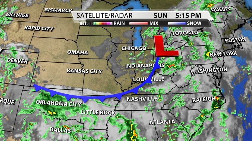
Another round of storms passed through our communities Sunday afternoon, pushed ahead of this cold front. As the front clears our area overnight, it will bring some different weather to this forecast.
We all know July was hot and dry, but the end of the month certainly made up for that lack of rainfall. Early in the month, July was shaping up to be one of the warmest Julys on record.
Since it's SO HOT this weekend, we thought it would be fun to look ahead at when our area normally sees the first snow of the season.
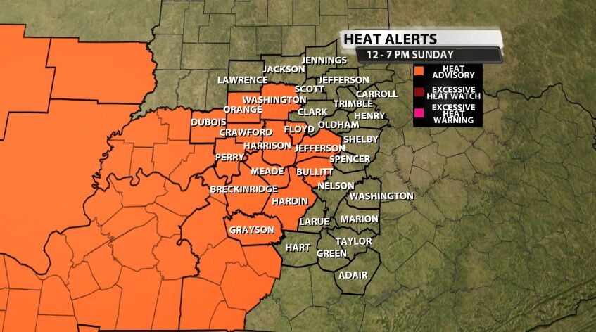
A new Heat Advisory has been issued from Noon til 7 PM (Eastern) Sunday for areas highlighted below in orange. A Heat Advisory means the temperature and humidity will be high enough as to be hazardous to your health.

Even though we are expecting some communities to see highs in the 90s again Thursday, that is our "break in the heat" for this week. Heat surges again Friday and we are likely to feel some of the hottest days of the year this weekend. This post will focus on an early heads up for that increased heat.

June and July have brought some pretty hot days across our area, and we have plenty more 90-degree days coming up in the forecast. The question we are getting asked a lot lately is how unusual is this heat?

KAIRE (Kentuckiana Air Education) has issued an Air Quality Alert for Saturday in Louisville and parts of southern Indiana.

Wednesday brought another day of heat alerts for our area, and Thursday looks like it's going to be just about as hot.