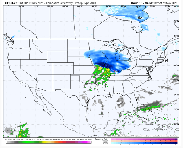
We've been talking about the arrival of today's winter system for a long time now, but there was a lot of disagreement among different weather models about when the wintry mix would arrive and how much snow might fall across Kentuckiana. Let's take a look at one in particular: the GFS model.

GFS model forecast for 1 PM EST Saturday, Nov. 29th, 2025
You likely watched us show scenarios of the incoming storm system with AdvanceTrak over the last week. The GFS and NAM models in particular were quite aggressive with their outputs of snowfall, often suggesting we could see snow falling before noon with multiple inches of snow possible for many of the counties that we cover in Southern Indiana. Some model runs even suggested places south of I-64 in KY could get an inch or more of snow!
But we didn't use the GFS or NAM models on air much if at all this week leading up to the storm. Why? Because we had a hunch they would deceive people watching at home by painting a confusing picture.

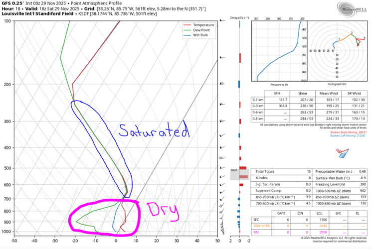
GFS sounding for 1 PM EST Saturday, Nov. 29th, 2025
The sounding above shows the anticipated airmass in play Saturday afternoon. The area circled in blue depicts a large portion of the atmospheric column the is saturated. But the middle and lower levels of the atmosphere (750mb and lower) clearly show a dry pocket of air (circled in fuchsia). This means any snow that falls through this column of air would turn into water vapor very quickly. This can happen by either evaporation or sublimation.
Sublimation is the conversion between the solid and the gaseous phases of matter, with no intermediate liquid stage. For those of us interested in the water cycle, sublimation is most often used to describe the process of snow and ice changing into water vapor in the air without first melting into water. The opposite of sublimation is "deposition", where water vapor changes directly into ice—such as snowflakes and frost.
Sublimation occurs more readily when certain weather conditions are present, such as low relative humidity and dry winds. Sublimation also occurs more at higher altitudes, where the air pressure is less than at lower altitudes. Energy, such as strong sunlight, is also needed; however, it can happen on cloudy days when the other ingredients are present in abundance.

That satellite and radar image above gives a good representation of what we were experiencing across Kentuckiana at the same time that the GFS and NAM models suggested we would be getting hammered with snow. The reality is that it was snowing at the time, but the snow was not reaching the ground. Instead, it was hitting dry air, evaporating/sublimating, and eventually ended up moistening the air column enough for a wintry mix (mainly rain for most of us) to actually fall to the ground later in the evening.

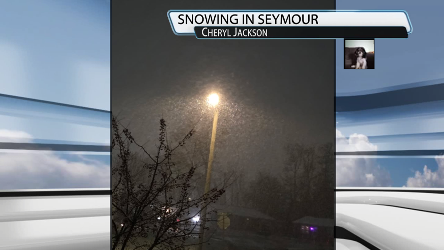
Where the air was conducive to snowfall, we received a coating of snow this evening. Check out Cheryl Jackson's picture of snow falling in Seymour, IN! This was a location that we said could end up getting a coating of snow. But don't expect snow to stick around long! Above-freezing temperatures are expected tonight, and a transition to rain will happen soon if it hasn't already in your area.


