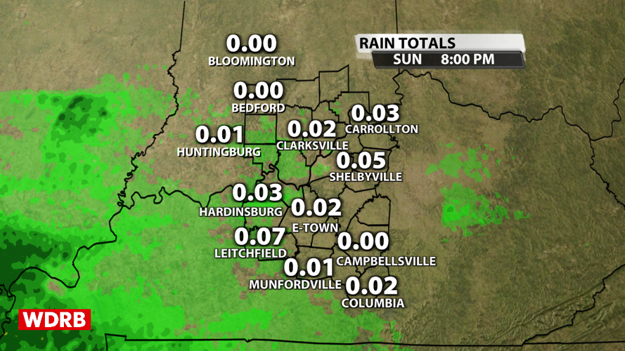


We had widespread rain today, but it didn't amount to much. Most folks only topped out with a few hundredths of an inch to maybe a tenth of an inch just as expected.

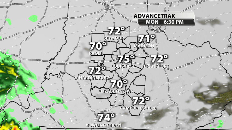
Memorial Day is looking drier and drier as each new round of data comes in. There's still a chance for rain around sunset for some of us, but most are dry while the sun is up. Temperatures will top out in the middle 70s. Rain will roll across the region on Monday night.

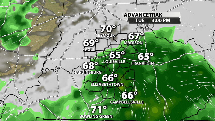
Tuesday is full of showers and maybe even a few storms. Severe weather is not anticipated. Rainfall totals will stack up pretty good on Tuesday with and inch or more possible in some spots.

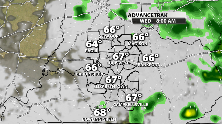
Rain should come to an end early on Wednesday morning. Some models point to a few rain chances after Wednesday, but we'll keep those chances on the low side for now with too much uncertainty in the long-term forecast.

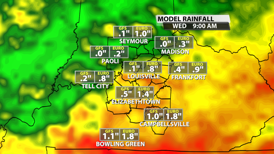
As mentioned before, the heaviest rain will fall Monday night through Tuesday night. Over the next 3 days, we could end up receiving and inch or more in quite a few spots, but some places will get through the next few days with significantly less specifically in Indiana.

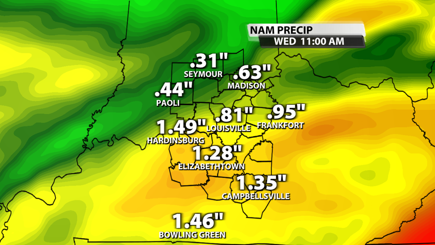
The NAM model is much more bullish with the heavy rainfall totals, but it's still a realistic scenario considering the precipitable water values will be around 1.7 to 1.8 inches at times.

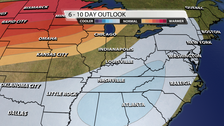
This week is expected to be another cooler than average week. It's unlikely that we have a single day top out in the 80s. The cool trend probably lasts into next week according to the CPC's latest 6-10 day temperature trend analysis, but we'll likely be flirting with 80s after this next weekend.


