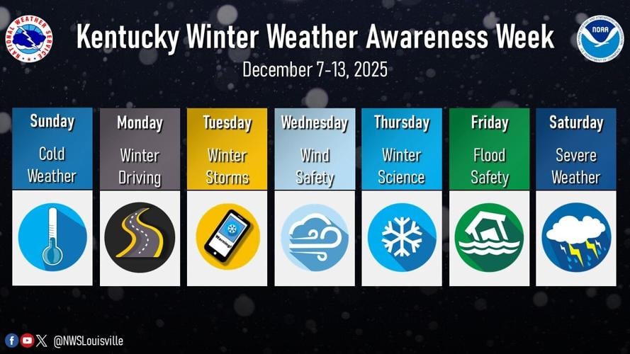


December 7-13, 2025 is Winter Weather Awareness Week in Kentucky. The winter season can bring many different hazards and impacts to the region. Winter Weather Awareness week is your reminder that you need to be Weather Ready for all types of hazards, such as winter storms, snow squalls, ice storms, heavy rain and flooding, high winds, and even severe weather. All week long, the National Weather Service office in Louisville, KY will be sharing information on how to prepare for winter, which will be viewable on our social media platforms (Facebook and X). Please Share/Retweet to share this knowledge with others.
Winter Weather Headlines Issued by NWS Louisville
Winter Weather Advisory: For impactful snow accumulations up to 4 inches, or a combination of impactful snow, sleet, or freezing rain expected to occur in the next 2 to 3 days.
Winter Storm Watch: Any combination of snow, sleet, or freezing rain averaging 4 inches or more expected to occur in the next 2 to 3 days.
Winter Storm Warning: Any combination of snow, sleet, or freezing rain averaging 4 inches or more expected to occur in the next 24 to 48 hours.
Ice Storm Warning: A freezing rain event is expected in the next 24 to 48 hours that will produce ice accumulations of 1/4 of an inch or more.
Blizzard Warning: A combination of sustained winds or frequent wind gusts of at least 35 mph and visibilities of less than 1/4 of a mile due to snow and/or blowing snow for at least three straight hours. This is expected to occur in the next 24 to 48 hours.
Snow Squall Warning: Intense bursts of snow with gusty winds causing whiteout conditions.
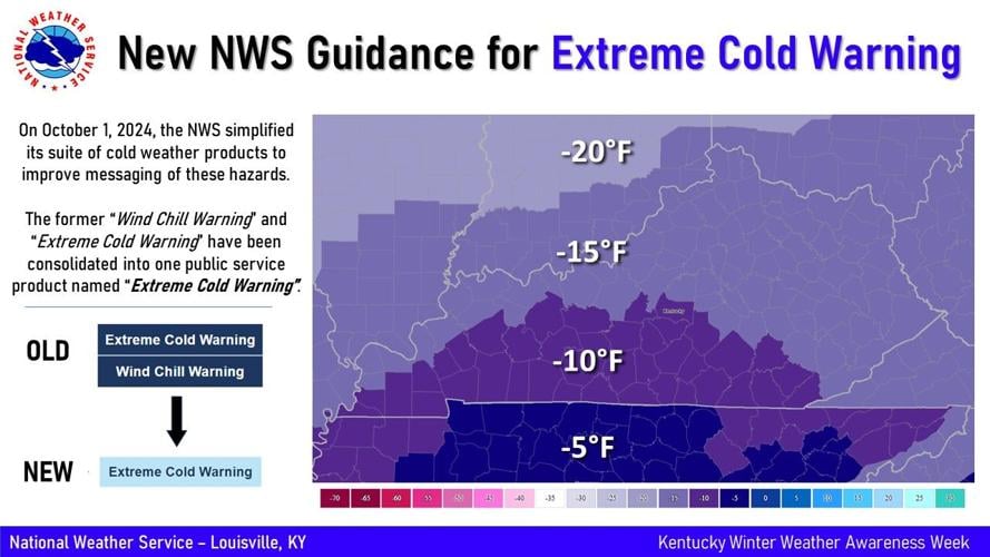
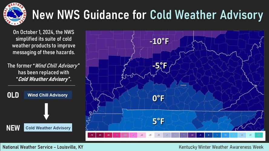
The NWS also puts out advisories and warnings for cold temperatures. The following maps show how cold temperatures must be for the NWS to issue a Cold Weather Advisory or Extreme Cold Warning.


