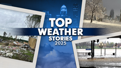
LOUISVILLE, Ky. (WDRB) -- 2025 has been full of all kinds of extreme weather events in the Louisville area from tornadoes, to record flooding and record snowfall. Living in this area means we get a little bit of everything.
From all those events, we've narrowed down a list of the top five weather events of the year year, most of which you probably remember or were perhaps even impacted by.
1. Winter Storm — January
Between Jan. 5-6, Louisville was hit with 10.5 inches of snow, with some areas getting an additional 1/2-inch of ice. Of that total, 9 inches fell Jan. 5 alone, making it the third-snowiest calendar day ever in January and the 11th-snowiest calendar day all time in Louisville. It was the snowiest single calendar day since Feb. 4, 1998.
Since there was ice accumulation under the snow, nearly 100,000 people were without power by the next morning. Jefferson County Public Schools and many other school districts in the area were out of school for the entire week.
2. EF3 Tornado — April
Late at night on April 2, an EF3 tornado roared through Jeffersontown, initially forming along Watterson Trail and Rivanna Drive. It continued on the ground for just under 10 miles, through the industrial park in Jeffersontown and finally dissipating along long Run Road and Pope Dale Road.
While it only lasted for 10 minutes, it generated a large swath of damage across the eastern side of Louisville. The tornado peaked with 145 mph winds and tore apart multiple buildings and businesses.
The EF3 rating made it the highest rated tornado in Louisville since May 1996. Despite hitting a highly populated area, nobody was injured or killed. That same outbreak spawned four more tornadoes around our area: an EF2 in Washington County, Indiana, an EF1 in New Albany and an EF1 in both Nelson and Taylor counties.
3. Ohio River Flooding — April
Starting the same day as that tornado and lasting for a few more days, between 6 inches and 1 foot of rain fell across the Louisville area. In Louisville, about 8 inches fell, including three consecutive days of 2 inches for the first time in recorded history.
The persistent rainfall led to widespread flooding, with numerous rivers reaching moderate of high flood stage. Rolling Fork, near Boston, Kentucky, saw its fourth-highest river level on record. And the Ohio River flooded numerous roads along its banks and littered Waterfront Park with debris.
As a result, Thunder Over Louisville was canceled for the first time.
4. Hail Storm — March
On March 15, a severe hail storm hit many areas in the community when a strong line of storms rolled in just before sunrise. There were multiple reports of hail up to 2" inches in diameter, including Jeffersonville and New Albany, Indiana.
The hail stones did a lot of damage around the area that Saturday morning, including shattering windows and denting cars.
In addition to the hail, a 110 mph EF1 tornado was confirmed from the same storm system in Orleans, Indiana. It remained on the ground for more than 11 miles.
5. Flooding — February
Widespread heavy rain brought flooding across Kentucky over the weekend of Feb. 15-16. The Weather Prediction Center issued a rare High Risk for Excessive Rainfall for much of southern Kentucky, where several counties saw between 4 and 6 inches of rain within 48 hours.
The Rolling Fork near Boston, Kentucky, crested at its 12th-highest point on record, Rough River near Dundee saw their sixth-largest crest on record, and the Green River at Munfordville saw its 10th-largest crest on record.
Copyright 2025 WDRB Media. All Rights Reserved.


