


LOUISVILLE, Ky. (WDRB) -- Kentucky Gov. Andy Beshear told reporters Saturday morning that at least 70 people died after tornadoes ripped through the commonwealth overnight.
As that death toll continues to rise, Beshear says it could exceed 100.
"This will be, I believe, the deadliest tornado system ever to run through Kentucky," Beshear said, adding that, "The damage is even worse now that we have first light."
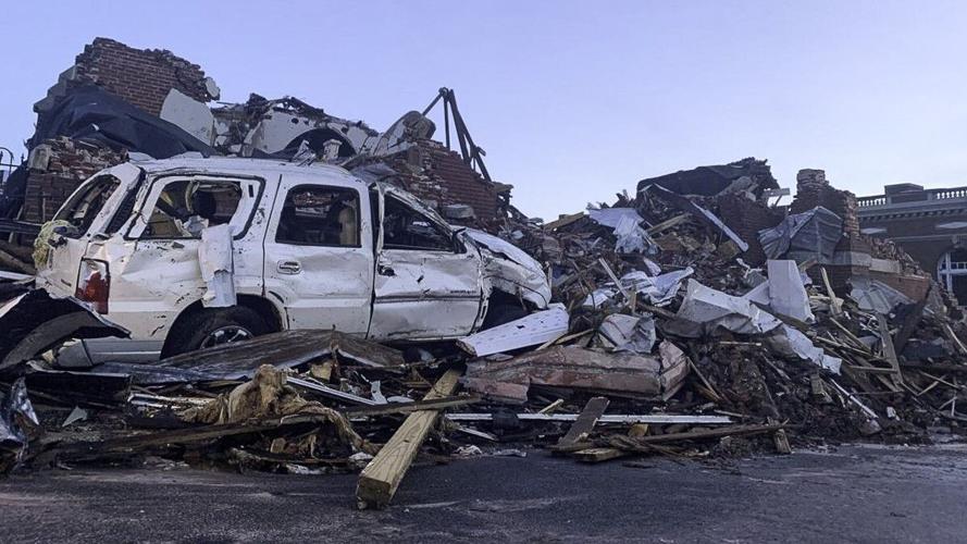
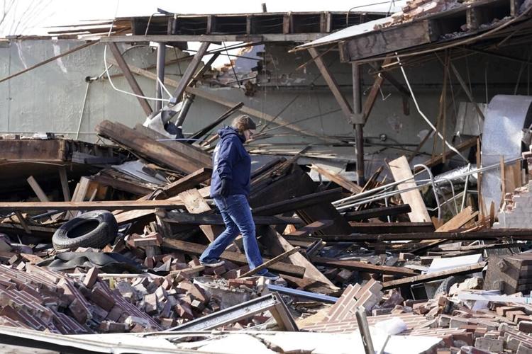
"We have deaths in multiple -- possibly many -- counties," Beshear said earlier in the day, adding that the hardest hit county appears to be Graves, where the city of Mayfield was devastated. "A roof collapse at a candle factory has resulted in mass casualties." Beshear said about 110 people were working in a candle factory that was hit by a tornado, and the death toll "is in the dozens."
Mayfield Fire Chief Jeremy Creason thanked 11 counties that had sent ambulance crews to Mayfield to help.
"We had to at times crawl over casualties to get to live victims and get them out and mark those as we work our way through the rubble," Creason said.
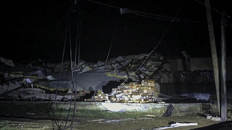
He said the fire department battled four structure fires overnight, and although it was difficult to put them out, crews were able to extinguish all of them.
He said one of the department's fire stations was in the direct path of a tornado and is now inoperable. He added that fire crews had to extricate their own fire and EMS apparatus in order to respond to runs.
The police station as also destroyed, Creason said, adding that the police department is borrowing cars.
Grayson County Judge Executive Jesse Perry's voice cracked as he told reporters, "At this time, what we need from everyone, is we need your prayers. We need your help."
Beshear declared a state of emergency about midnight in multiple Kentucky counties. He has also activated the Kentucky National Guard and Kentucky State Police to assist. So far 181 soldiers and airmen have already been mobilized, including search, extraction and debris clearing crews, with more to come. Beshear two tractor-trailers filled with water are headed to western Kentucky.
"This has been one of the toughest nights in Kentucky history, and some areas have been hit in ways that are hard to put in words," Beshear said. He said he believes this event is "the single most severe, certainly tornado event in our history, and I believe likely our most deadly."
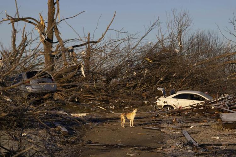
A dog stands in the street surrounded by the aftermath of a tornado in Dawson Springs, Ky., Sunday, Dec. 12, 2021. A monstrous tornado, carving a track that could rival the longest on record, ripped across the middle of the U.S. on Friday. (AP Photo/Michael Clubb)
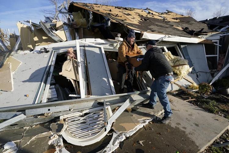
Father and son, Kenny Sanford, right, and Colby Sanford, carry out a dresser from Colby's grandmother's tornado-damaged home in Mayfield, Ky., on Saturday, Dec. 11, 2021. Tornadoes and severe weather caused catastrophic damage across several states late Friday, killing multiple people overnight. (AP Photo/Mark Humphrey)
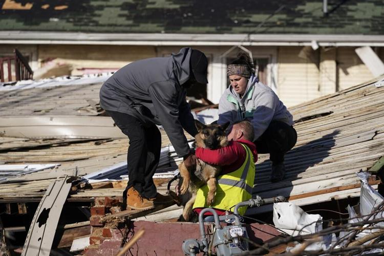
Dog owner Derrick Starks, left, Chris Buchanan, center and Niki Thompson, right, both from neighboring counties, attempt to rescue Cheyenne from a tornado-damaged home in Mayfield, Ky., on Saturday, Dec. 11, 2021. Tornadoes and severe weather caused catastrophic damage across multiple states late Friday, killing dozens of people overnight. (AP Photo/Mark Humphrey)
Local firefighters, EMS and first responders check for survivors trapped in homes and vehicles in the neighborhood off Creekwood Avenue in Bowling Green, Ky., early Saturday, Dec. 11, 2021. Tornadoes and severe weather caused catastrophic damage across multiple states late Friday, killing several people overnight. (Grace Ramey/Daily News via AP)
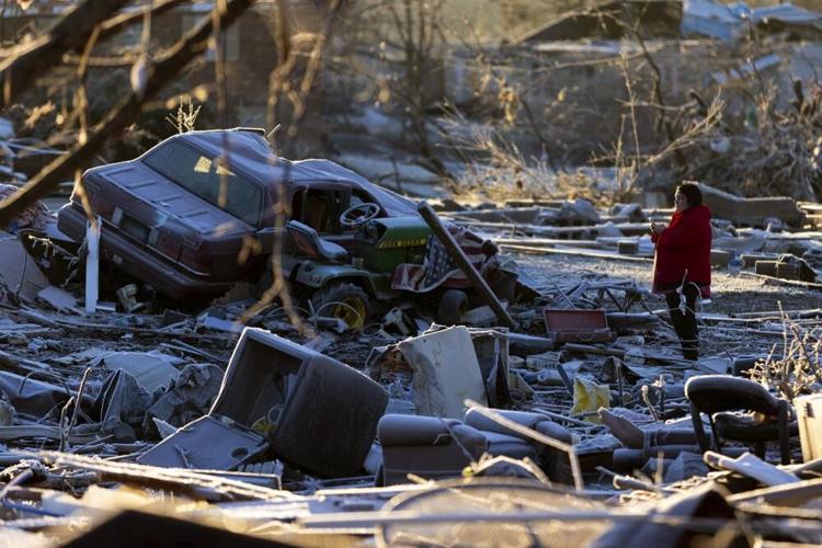
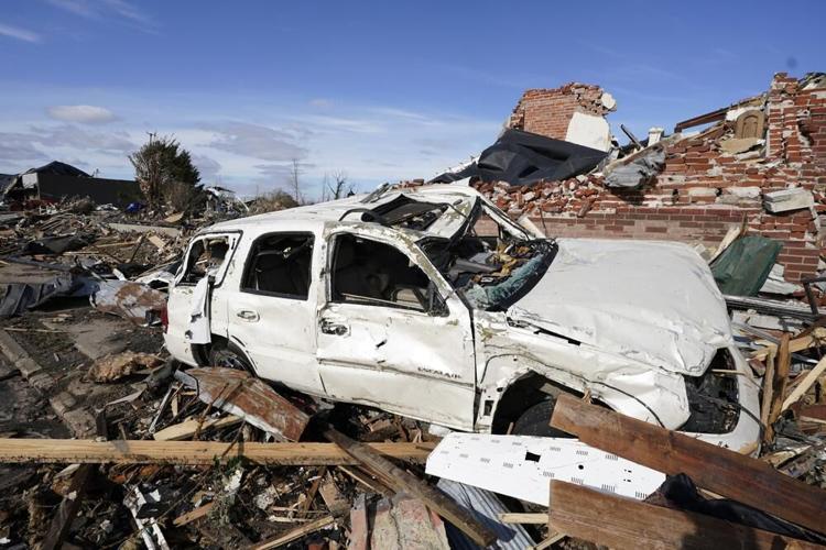
A car sits among the remains of a destroyed house after a tornado in Dawson Springs, Ky., Sunday, Dec. 12, 2021. A monstrous tornado, carving a track that could rival the longest on record, ripped across the middle of the U.S. on Friday. (AP Photo/Michael Clubb)
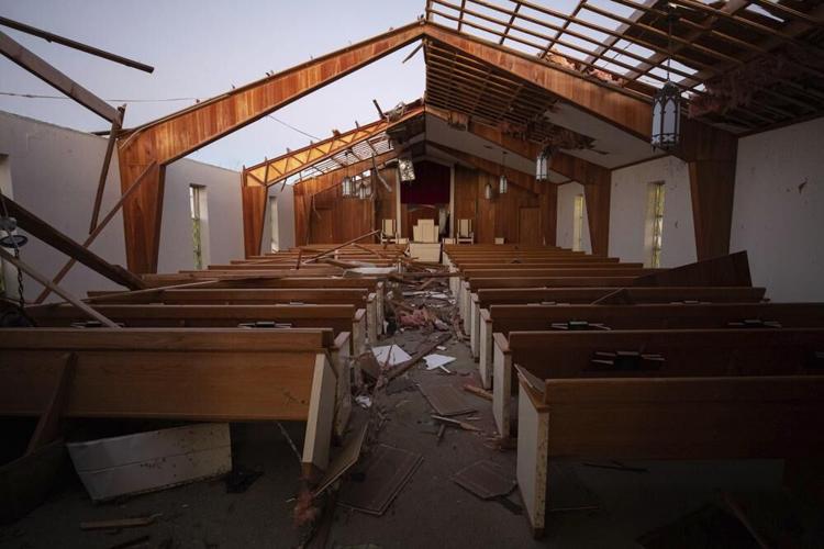
The remains of Dawson Springs Primitive Baptist Church after a tornado in Dawson Springs, Ky., Sunday, Dec. 12, 2021. A monstrous tornado, carving a track that could rival the longest on record, ripped across the middle of the U.S. on Friday. (AP Photo/Michael Clubb)
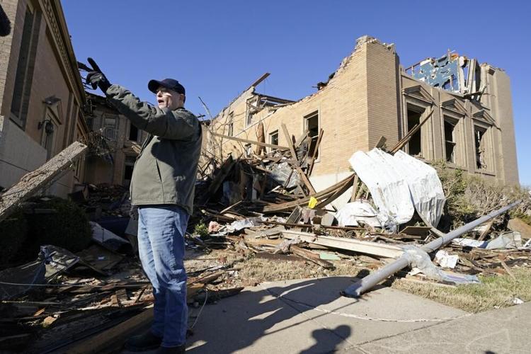
Dr. Milton West, senior minister of First Christian Church, talks about the damage done to the church and the plans for recovery after an outdoor service was held Sunday, Dec. 12, 2021, in Mayfield, Ky. Tornadoes and severe weather caused catastrophic damage across several states Friday, killing multiple people. (AP Photo/Mark Humphrey)
A woman searches for valuables amidst the remnants of a home on Saturday, Dec.11, 2021, on Highway F in Defiance, Mo. Tornadoes and severe weather caused catastrophic damage across multiple states late Friday. (Christian Gooden/St. Louis Post-Dispatch via AP)
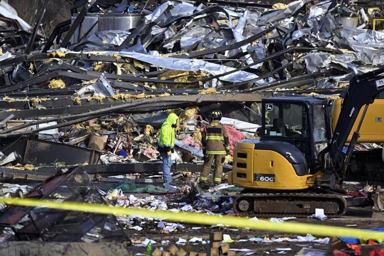
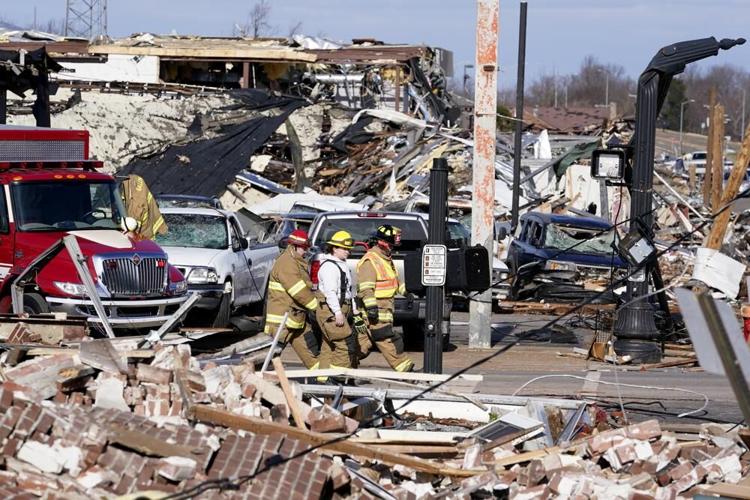
Emergency response workers dig through the rubble of the Mayfield Consumer Products candle factory in Mayfield, Ky., Saturday, Dec. 11, 2021. Tornadoes and severe weather caused catastrophic damage across multiple states late Friday, killing several people overnight. (AP Photo/Timothy D. Easley)
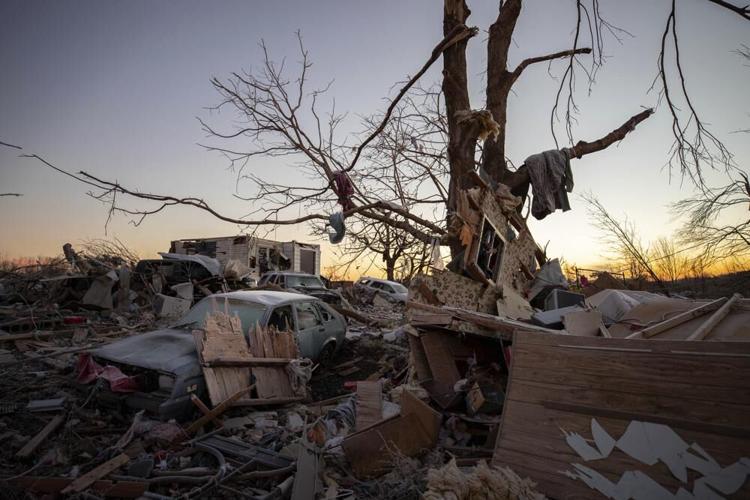
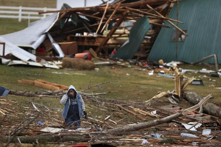
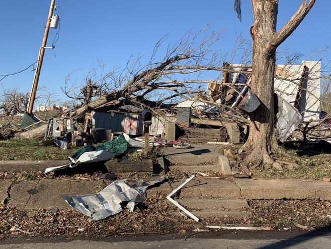
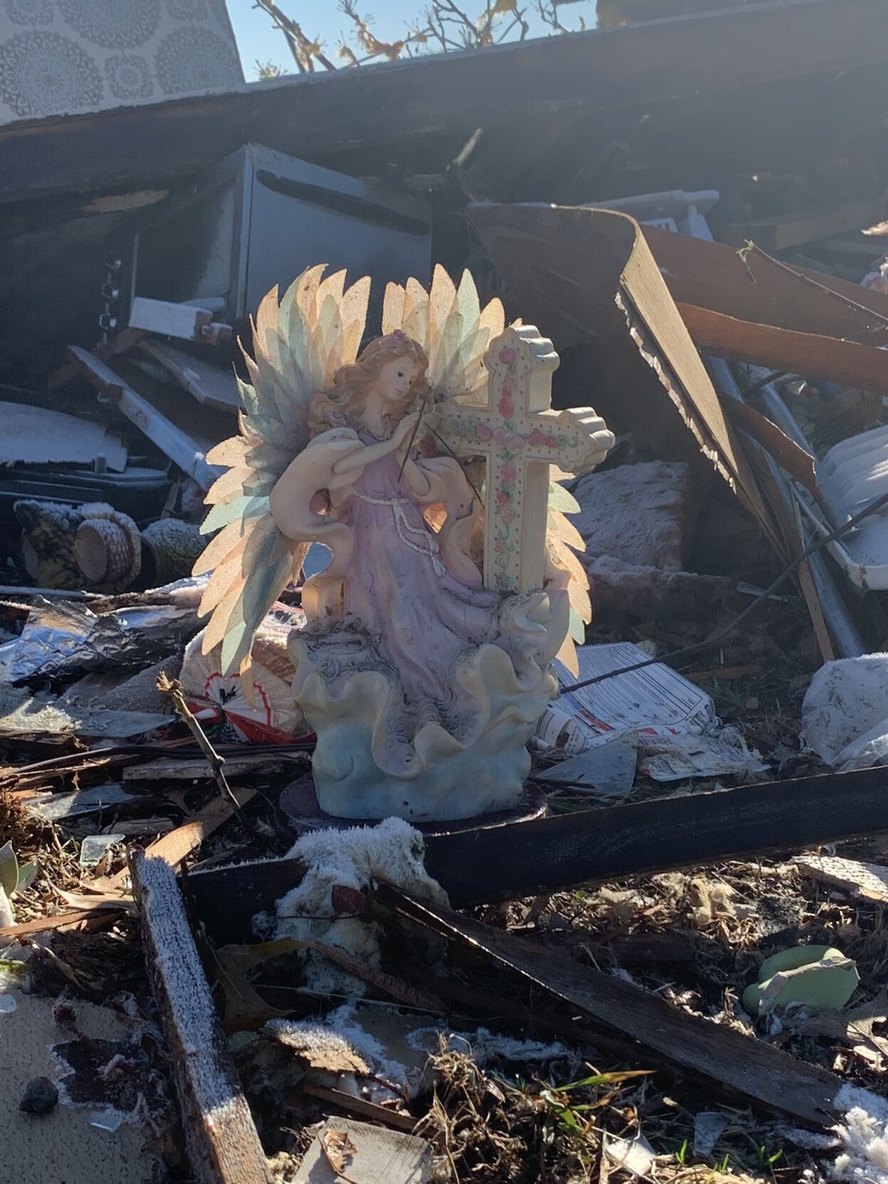
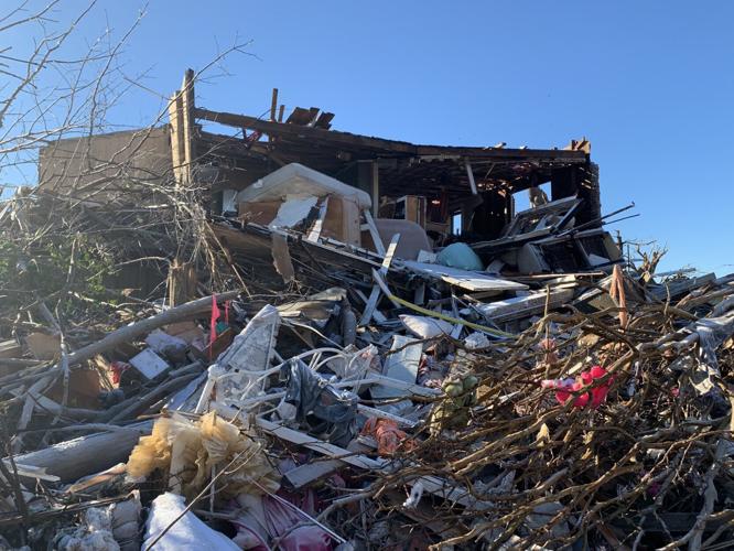
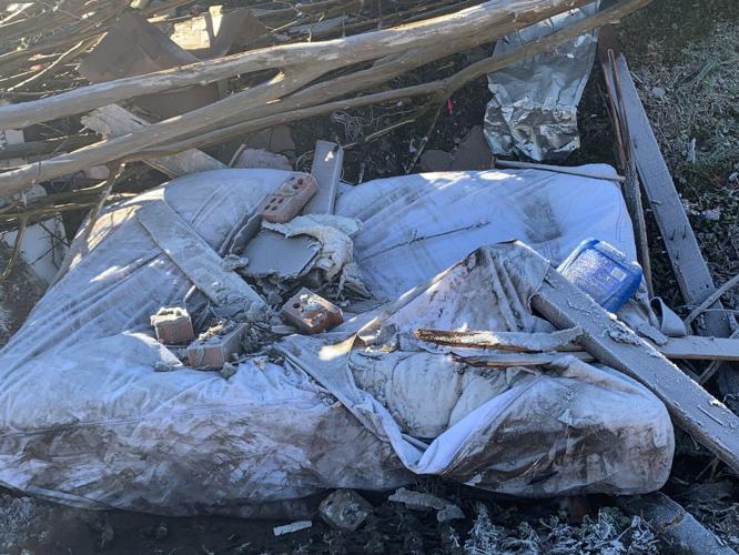
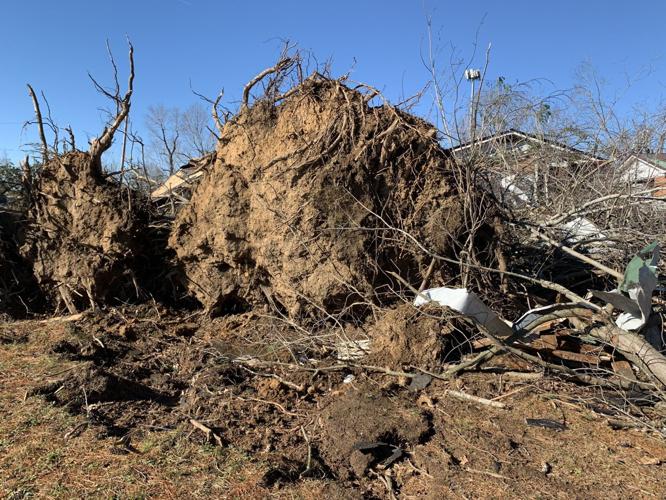
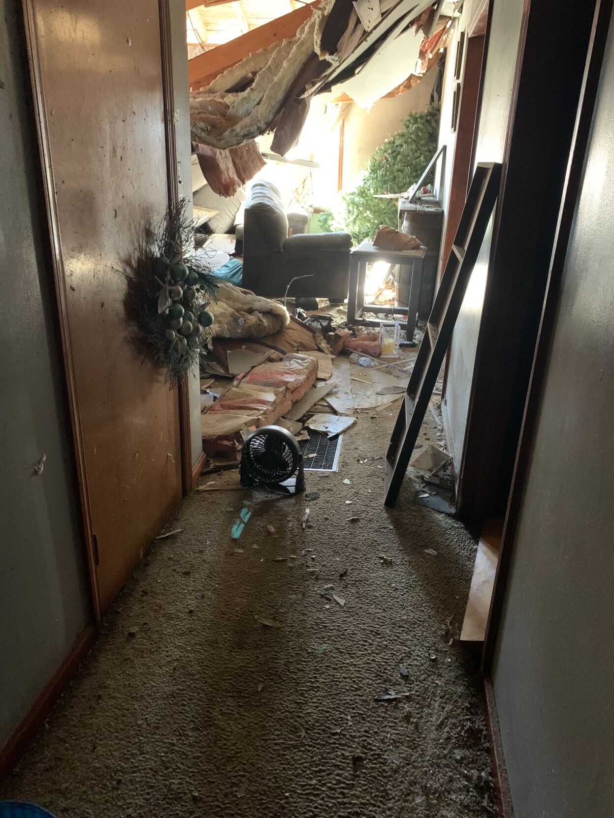
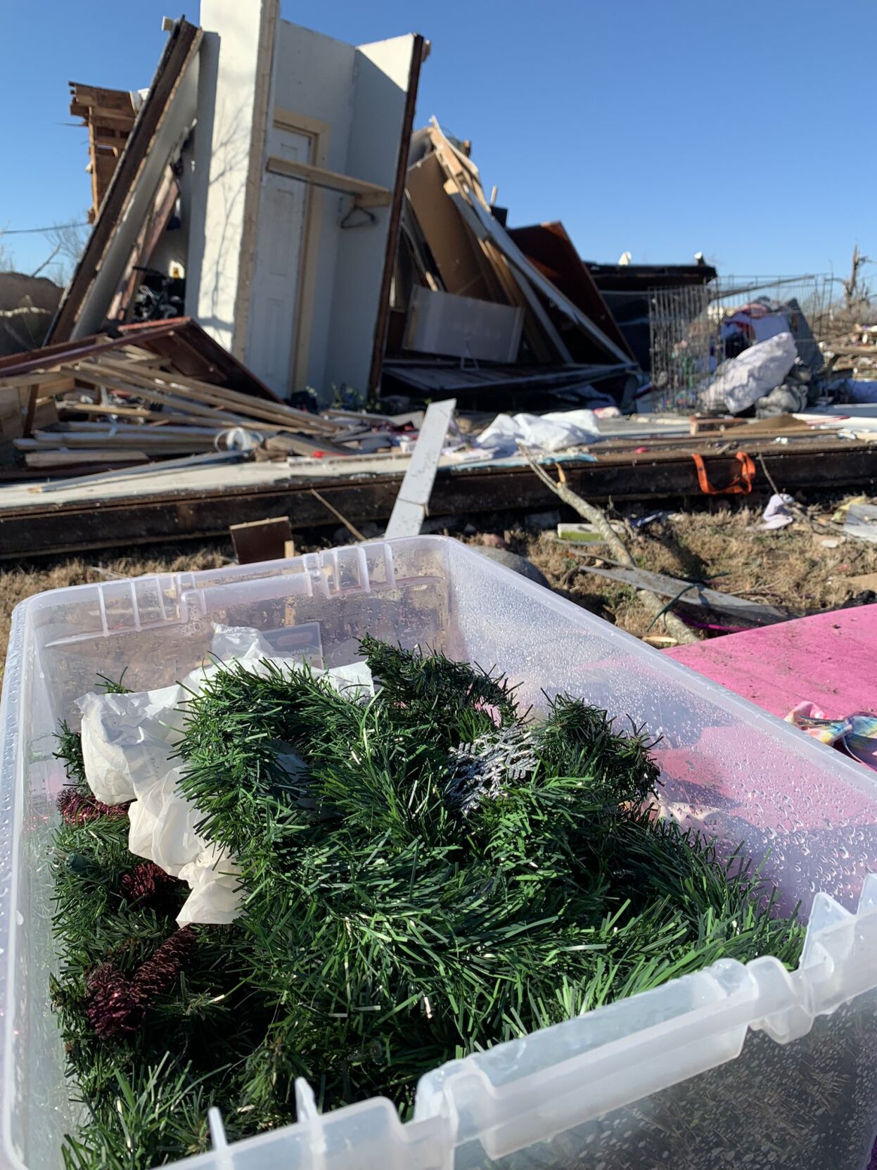
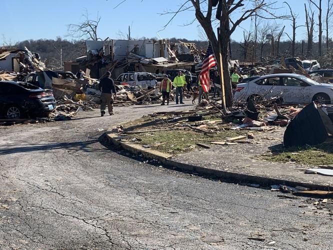
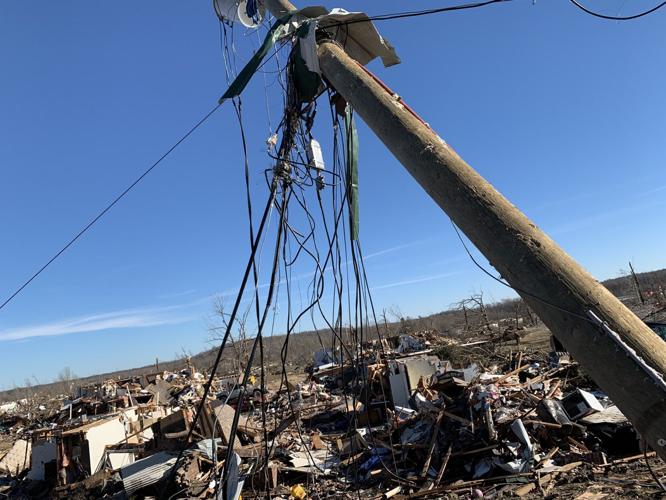
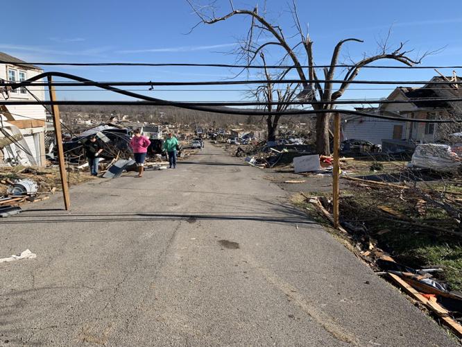
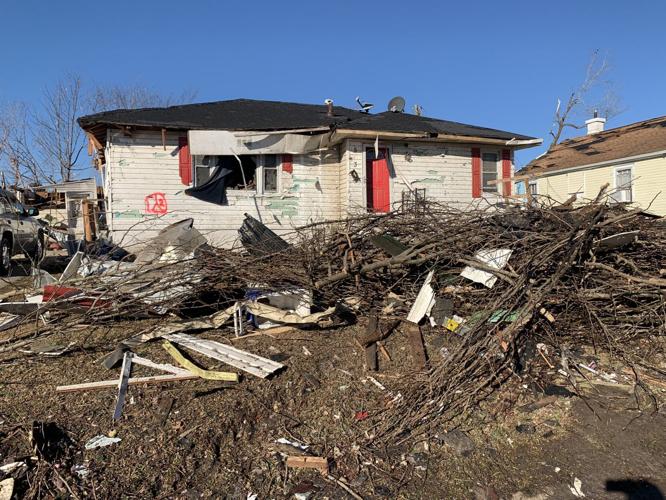
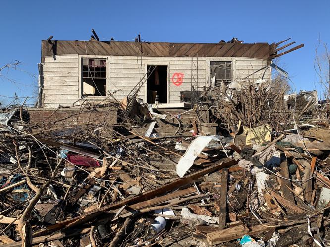
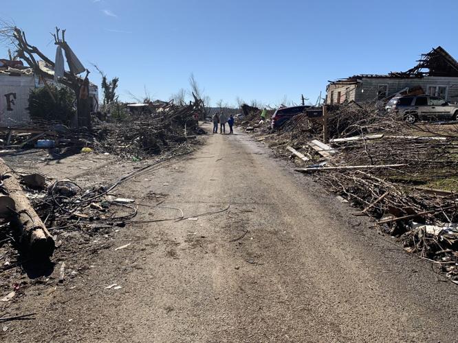
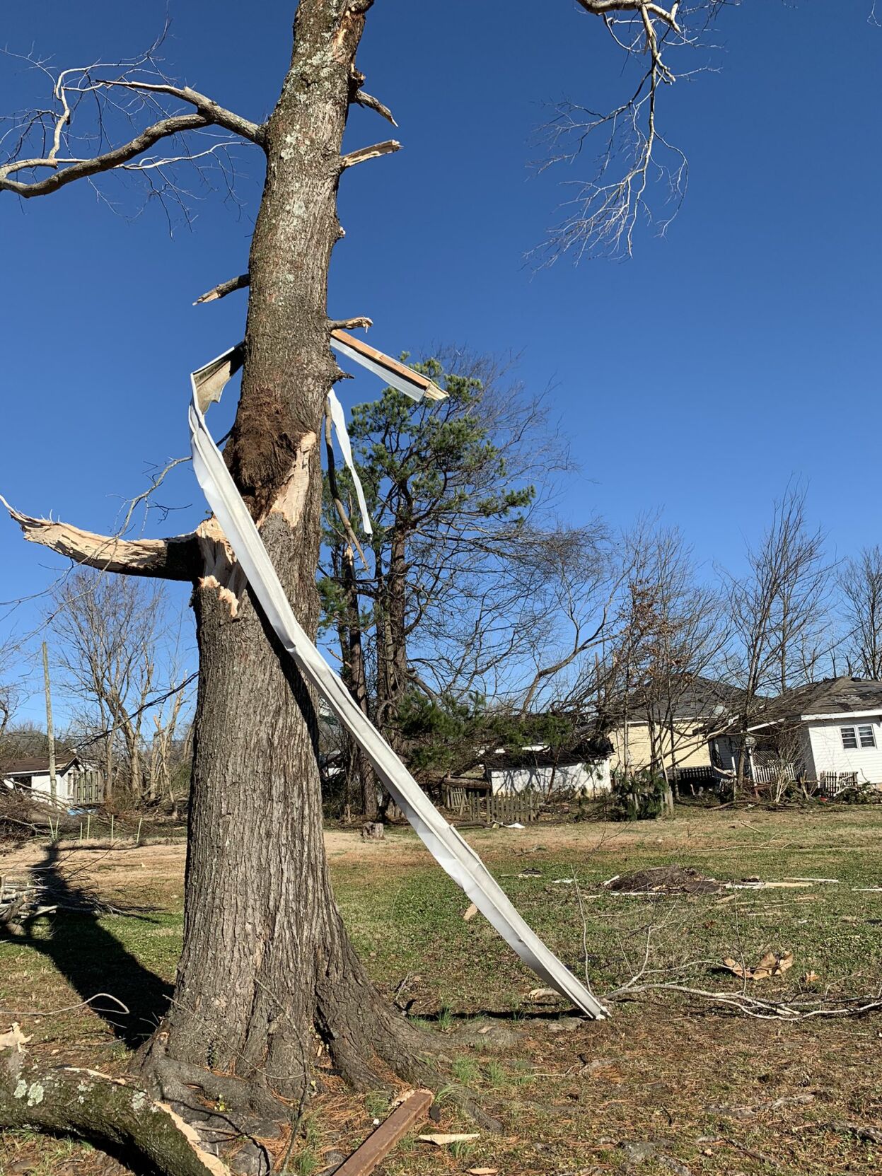
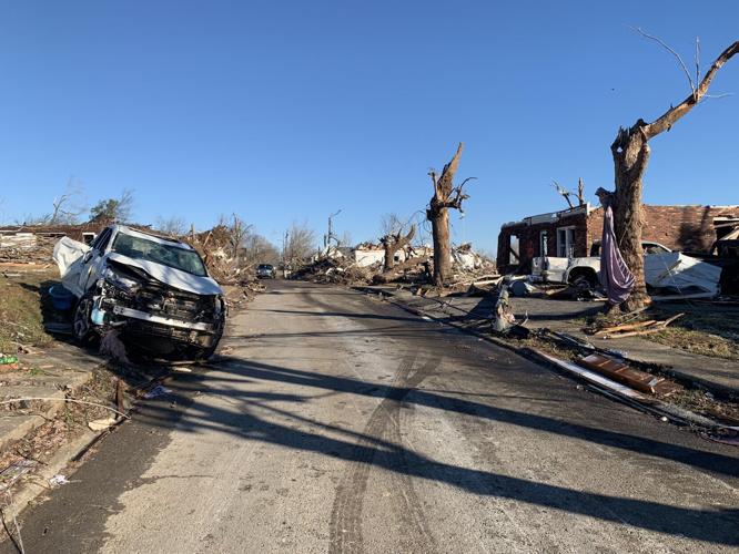
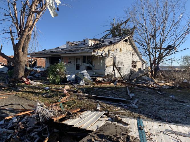
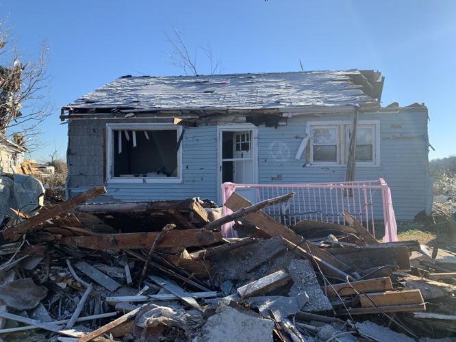
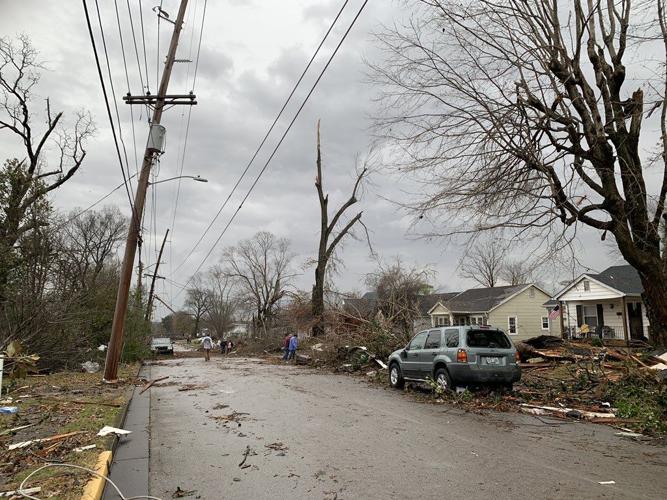
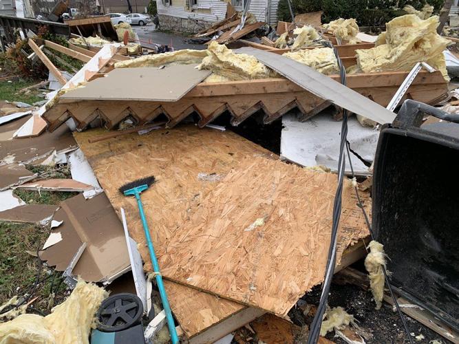
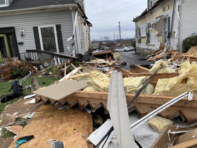
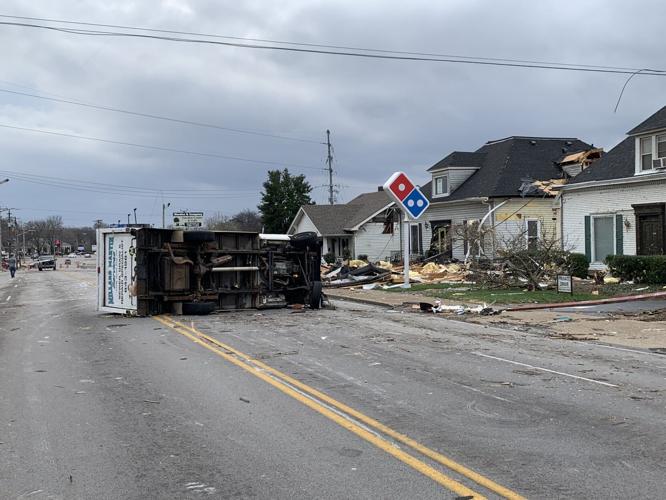
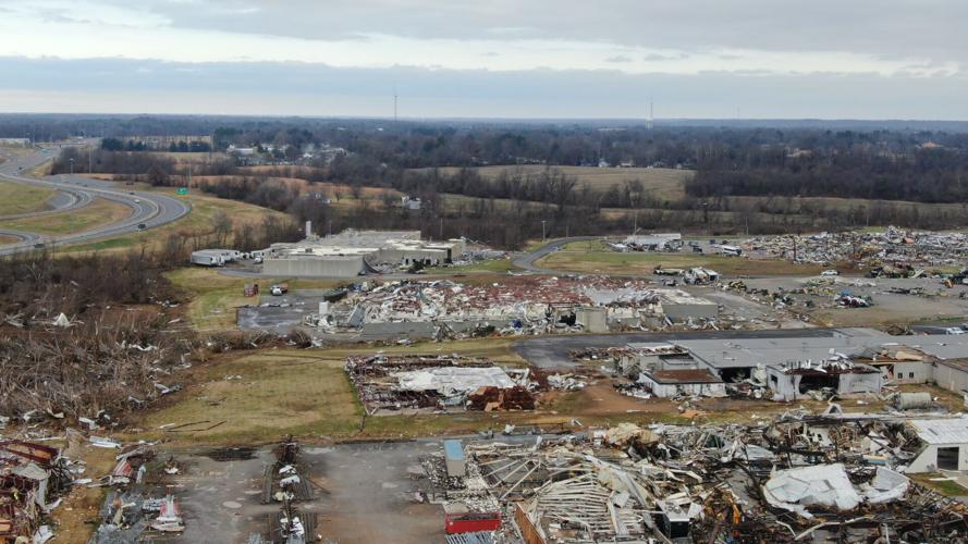
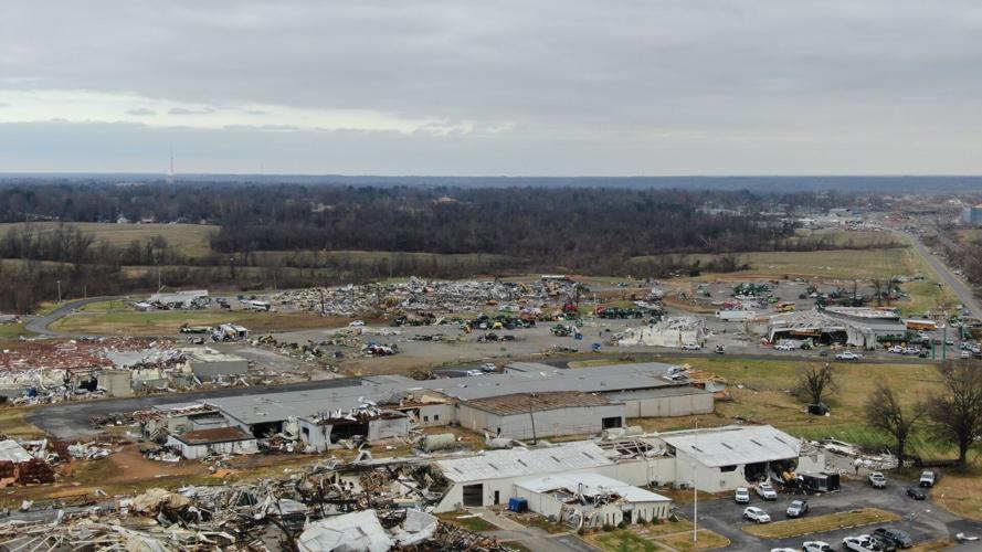
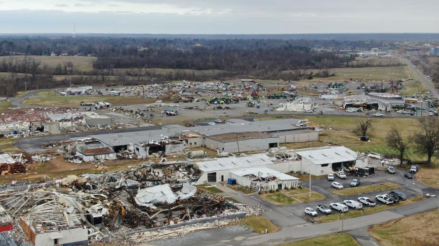
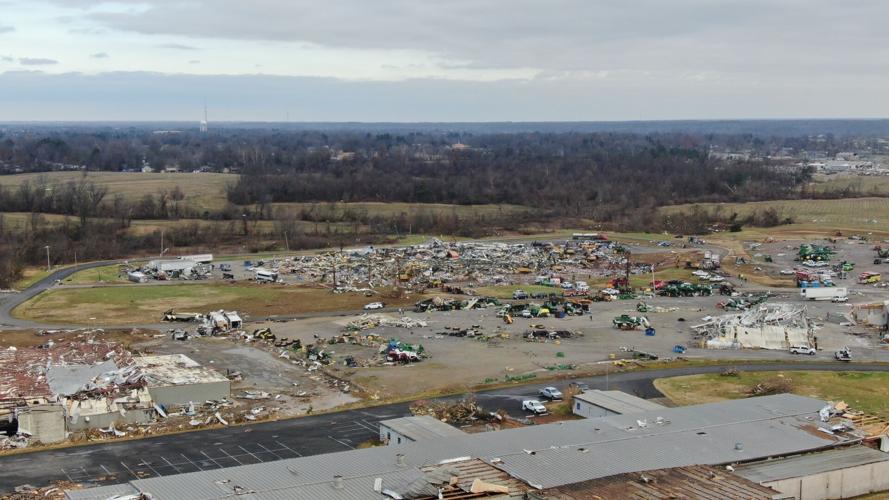
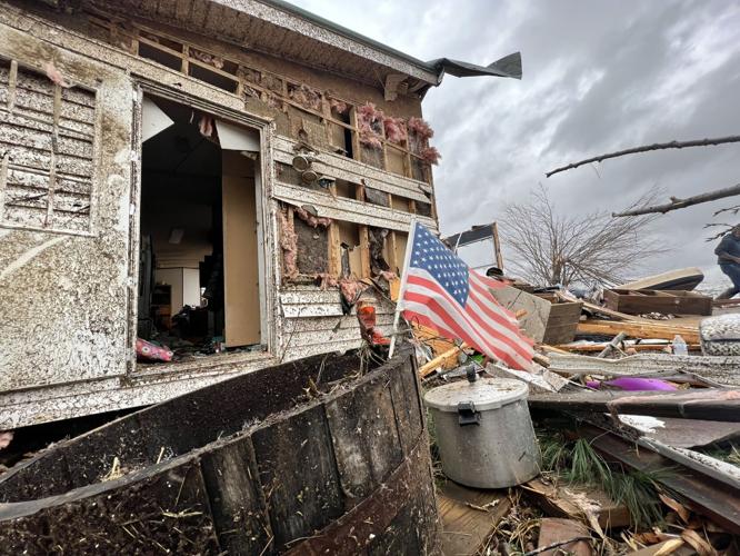
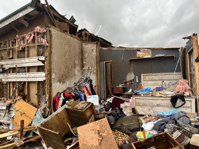
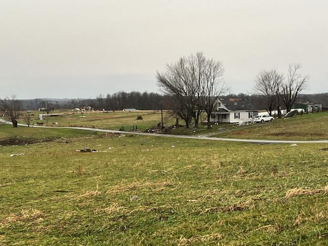
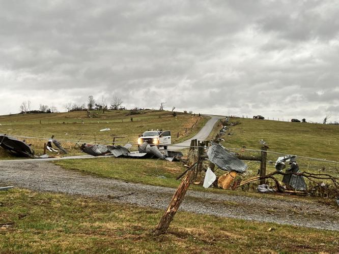
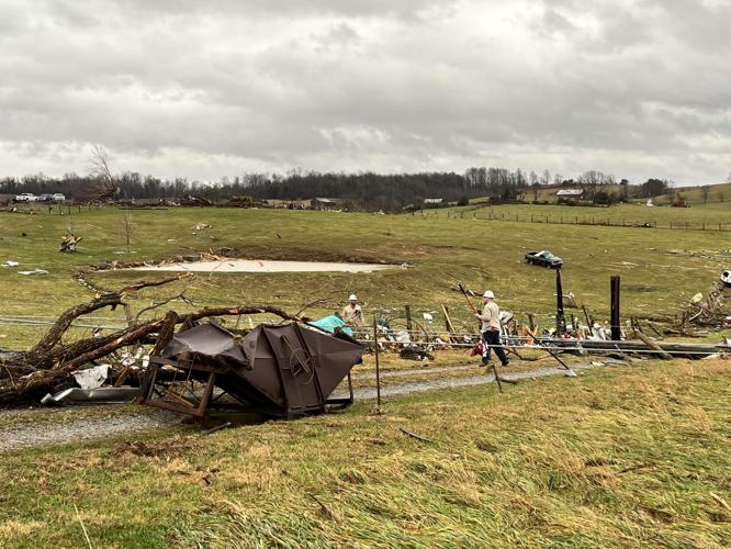
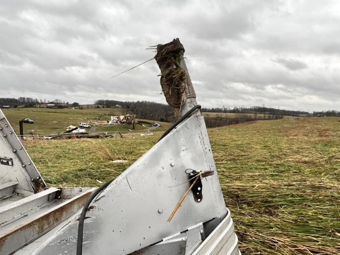
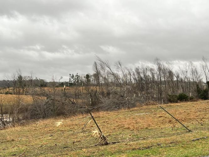
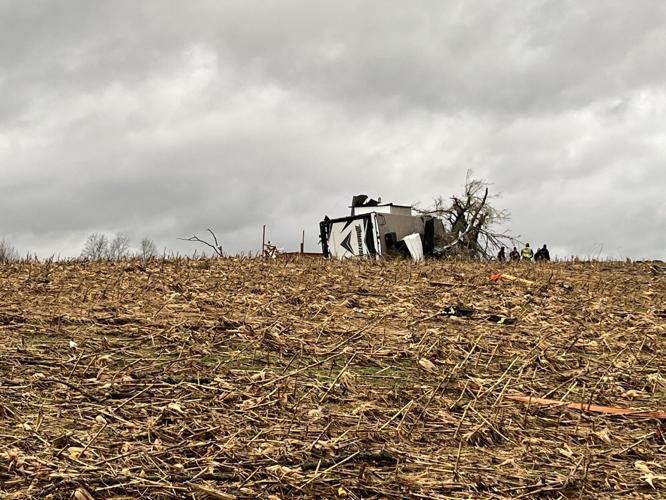
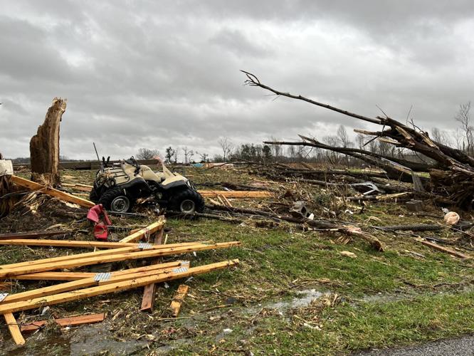
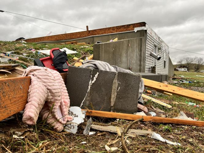
IMAGES: Damage in western Kentucky after Dec. 10-11, 2021 tornadoes
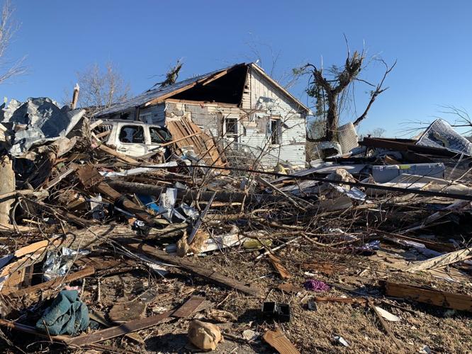
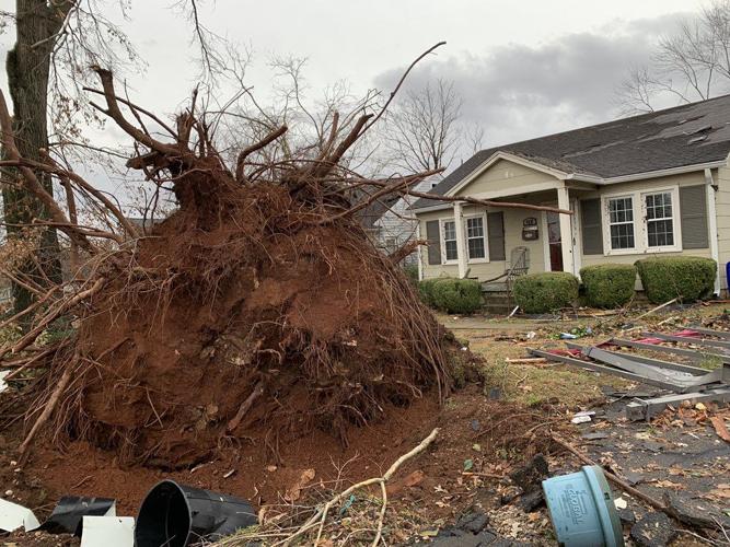
Aftermath of damage caused by tornadoes in Dawson Springs, KY.
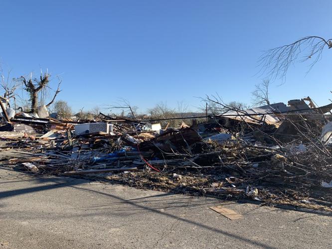
Aftermath of damage caused by tornadoes in Dawson Springs, KY.
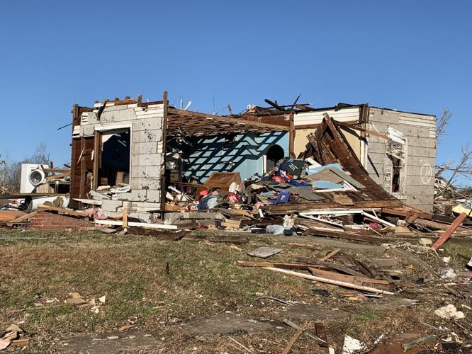
Aftermath of damage caused by tornadoes in Dawson Springs, KY.
Aftermath of damage caused by tornadoes in Dawson Springs, KY.
Aftermath of damage caused by tornadoes in Dawson Springs, KY.
Aftermath of damage caused by tornadoes in Dawson Springs, KY.
Aftermath of damage caused by tornadoes in Dawson Springs, KY.
Aftermath of damage caused by tornadoes in Dawson Springs, KY.
Aftermath of damage caused by tornadoes in Dawson Springs, KY.
Aftermath of damage caused by tornadoes in Dawson Springs, KY.
Aftermath of damage caused by tornadoes in Dawson Springs, KY.
Aftermath of damage caused by tornadoes in Dawson Springs, KY.
Aftermath of damage caused by tornadoes in Dawson Springs, KY.
Aftermath of damage caused by tornadoes in Dawson Springs, KY.
Aftermath of damage caused by tornadoes in Dawson Springs, KY.
Aftermath of damage caused by tornadoes in Dawson Springs, KY.
Aftermath of damage caused by tornadoes in Dawson Springs, KY.
Aftermath of damage caused by tornadoes in Dawson Springs, KY.
Aftermath of damage caused by tornadoes in Dawson Springs, KY.
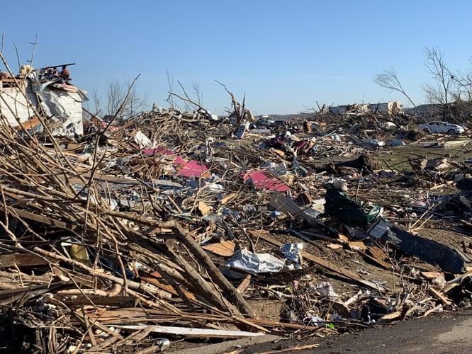
Aftermath of damage caused by tornadoes in Dawson Springs, KY.
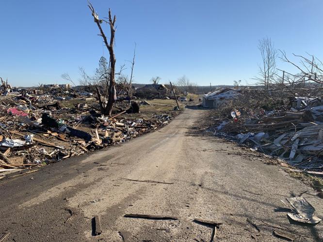
Aftermath of damage caused by tornadoes in Dawson Springs, KY.
Aftermath of damage caused by tornadoes in Dawson Springs, KY.
Aftermath of damage caused by tornadoes in Dawson Springs, KY.
Aftermath of damage caused by tornadoes in Dawson Springs, KY.
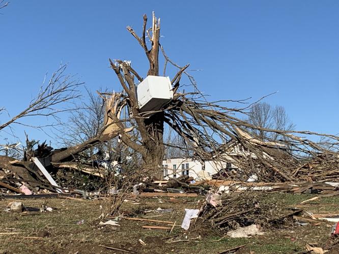
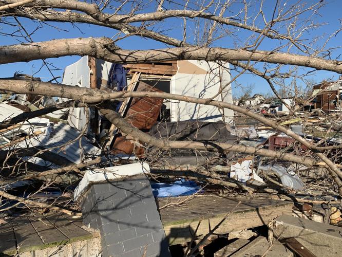
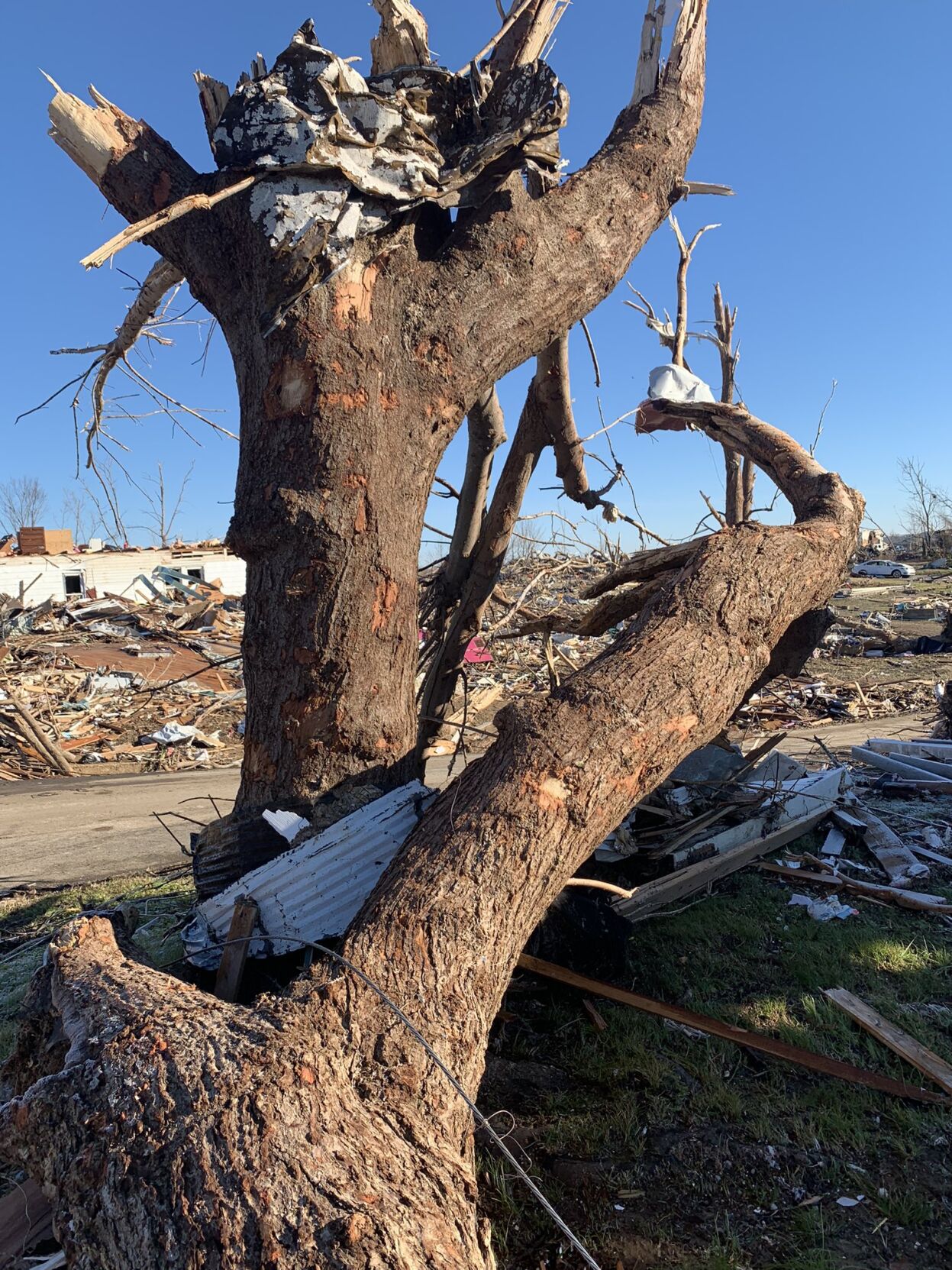
A refrigerator wedged in a tree in Dawson Springs, Ky. on Dec. 12.
Aftermath of damage caused by tornadoes in Dawson Springs, KY.
Aftermath of damage caused by tornadoes in Dawson Springs, KY.
Aftermath of damage caused by tornadoes in Dawson Springs, KY.
Aftermath of damage caused by tornadoes in Dawson Springs, KY.
Aftermath of damage caused by tornadoes in Dawson Springs, KY.
Damage in western Kentucky after Dec. 10-11, 2021 tornadoes
Damage in western Kentucky after Dec. 10-11, 2021 tornadoes
Damage in western Kentucky after Dec. 10-11, 2021 tornadoes
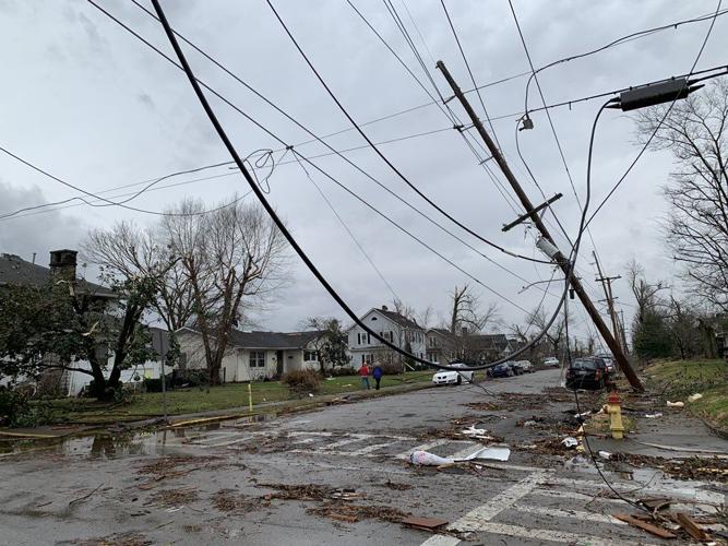
Aftermath of damage caused by tornadoes in Bowling Green, KY.
Aftermath of damage caused by tornadoes in Bowling Green, KY.
Aftermath of damage caused by tornadoes in Bowling Green, KY.
Aftermath of damage caused by tornadoes in Bowling Green, KY.
Aftermath of damage caused by tornadoes in Bowling Green, KY.
Aftermath of damage caused by tornadoes in Bowling Green, KY.
Aftermath of damage caused by tornadoes in Bowling Green, KY.
Aftermath of damage caused by tornadoes in Bowling Green, KY.
Aftermath of damage caused by tornadoes in Bowling Green, KY.

Aftermath of damage caused by tornadoes in Bowling Green, KY.
Aftermath of damage caused by tornadoes in Bowling Green, KY.
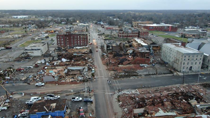
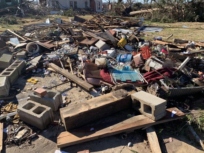
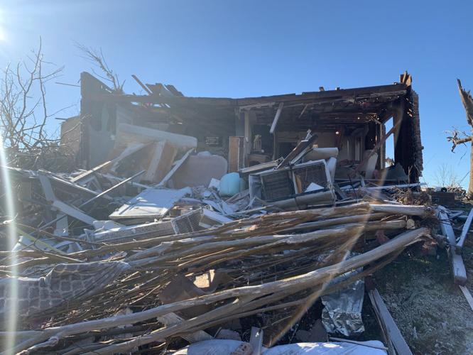
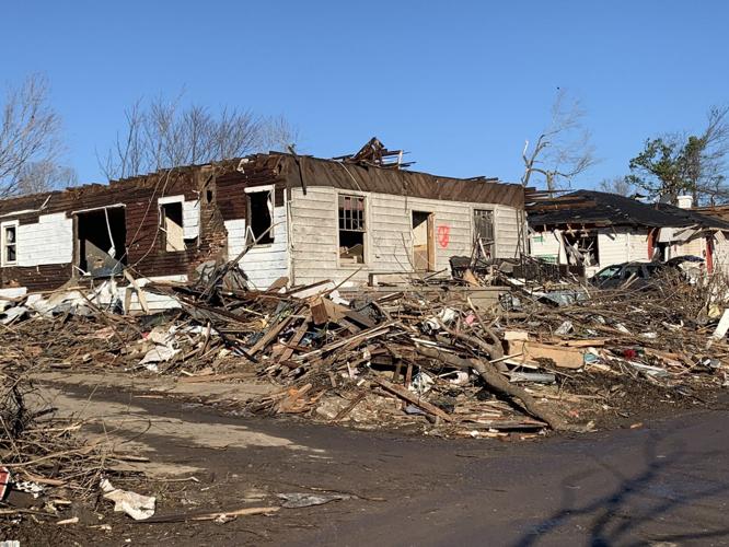
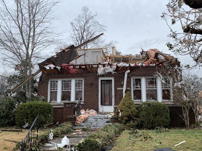
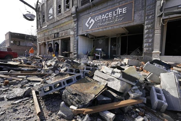
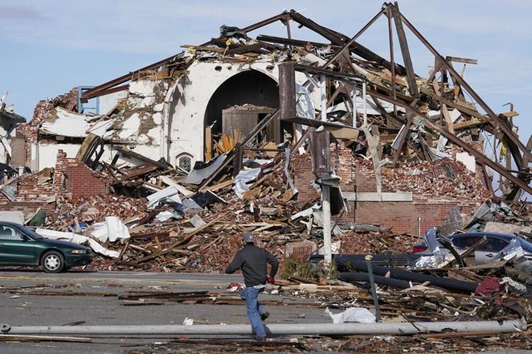
The aftermath damage from tornadoes in Mayfield, KY.
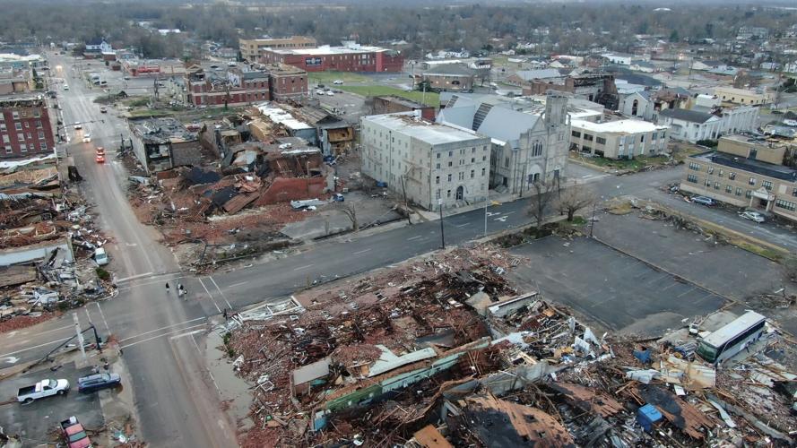
The aftermath damage from tornadoes in Mayfield, KY.
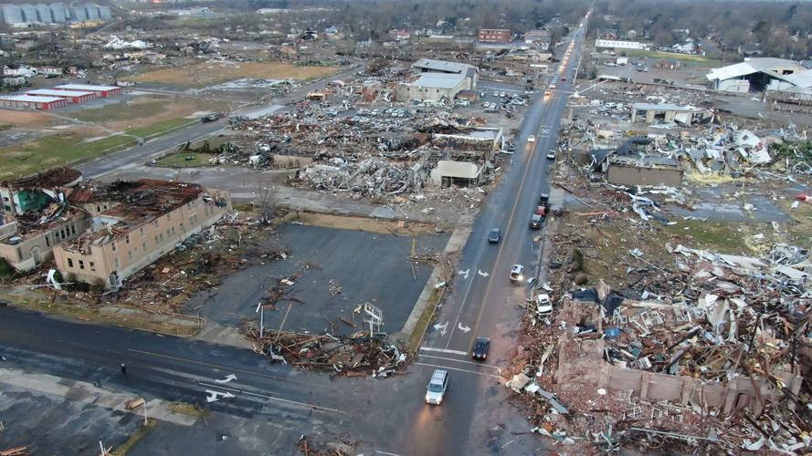
The aftermath damage from tornadoes in Mayfield, KY.
The aftermath damage from tornadoes in Mayfield, KY.
The aftermath damage from tornadoes in Mayfield, KY.
The aftermath damage from tornadoes in Mayfield, KY.
The aftermath damage from tornadoes in Mayfield, KY.
The aftermath damage from tornadoes in Mayfield, KY.
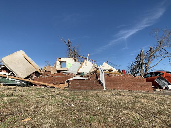
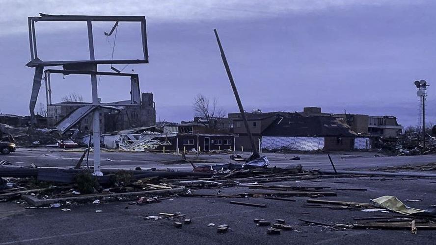
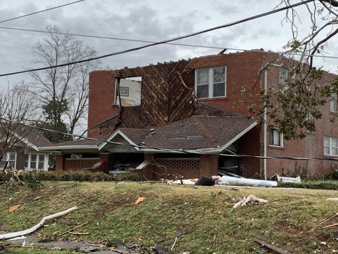
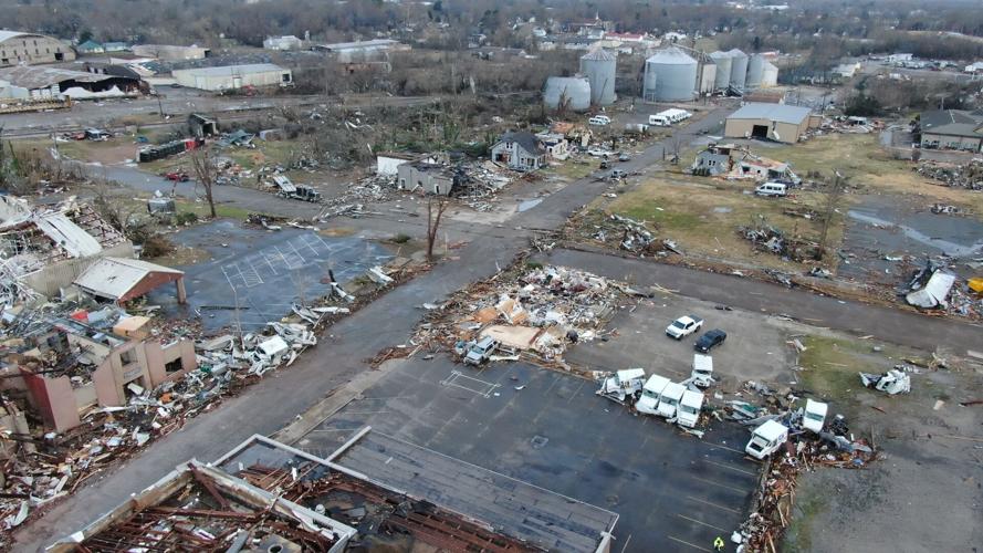
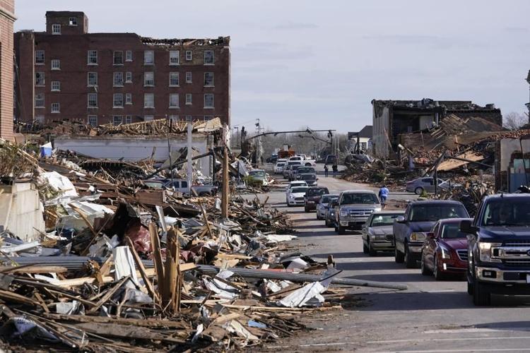
Damage in western Kentucky after Dec. 10-11, 2021 tornadoes
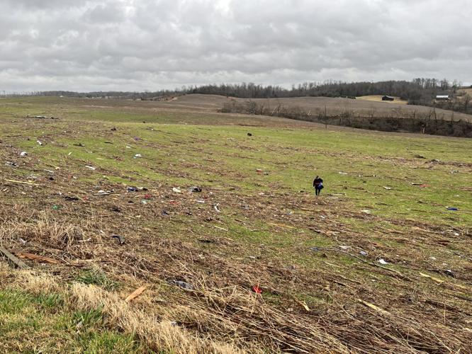
Damage in western Kentucky after Dec. 10-11, 2021 tornadoes
Damage in western Kentucky after Dec. 10-11, 2021 tornadoes
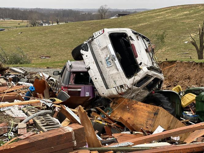
Damage in western Kentucky after Dec. 10-11, 2021 tornadoes
Damage in western Kentucky after Dec. 10-11, 2021 tornadoes
Damage in western Kentucky after Dec. 10-11, 2021 tornadoes
Damage in western Kentucky after Dec. 10-11, 2021 tornadoes
Damage in western Kentucky after Dec. 10-11, 2021 tornadoes
Damage in western Kentucky after Dec. 10-11, 2021 tornadoes
Damage in western Kentucky after Dec. 10-11, 2021 tornadoes
Damage in western Kentucky after Dec. 10-11, 2021 tornadoes
Damage in western Kentucky after Dec. 10-11, 2021 tornadoes
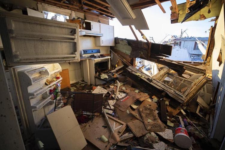
The remains of a house's kitchen after a tornado in Dawson Springs, Ky., Sunday, Dec. 12, 2021. A monstrous tornado, carving a track that could rival the longest on record, ripped across the middle of the U.S. on Friday. (AP Photo/Michael Clubb)
A dog stands in the street surrounded by the aftermath of a tornado in Dawson Springs, Ky., Sunday, Dec. 12, 2021. A monstrous tornado, carving a track that could rival the longest on record, ripped across the middle of the U.S. on Friday. (AP Photo/Michael Clubb)
Dena Ausdorn stands at the remains of her home after a tornado in Dawson Springs, Ky., Sunday, Dec. 12, 2021. Ausdorn has lived there for 28 years and lost two of her dogs with another left paralyzed after the tornado. (AP Photo/Michael Clubb)
Father and son, Kenny Sanford, right, and Colby Sanford, carry out a dresser from Colby's grandmother's tornado-damaged home in Mayfield, Ky., on Saturday, Dec. 11, 2021. Tornadoes and severe weather caused catastrophic damage across several states late Friday, killing multiple people overnight. (AP Photo/Mark Humphrey)
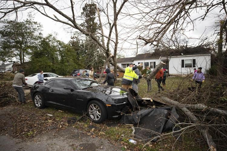
Members of the community work to clear debris off of a car after a tornado off in Bowling Green, Ky., Saturday, Dec. 11, 2021. (AP Photo/Michael Clubb)
Dog owner Derrick Starks, left, Chris Buchanan, center and Niki Thompson, right, both from neighboring counties, attempt to rescue Cheyenne from a tornado-damaged home in Mayfield, Ky., on Saturday, Dec. 11, 2021. Tornadoes and severe weather caused catastrophic damage across multiple states late Friday, killing dozens of people overnight. (AP Photo/Mark Humphrey)
Local firefighters, EMS and first responders check for survivors trapped in homes and vehicles in the neighborhood off Creekwood Avenue in Bowling Green, Ky., early Saturday, Dec. 11, 2021. Tornadoes and severe weather caused catastrophic damage across multiple states late Friday, killing several people overnight. (Grace Ramey/Daily News via AP)
A car sits among the remains of a destroyed house after a tornado in Dawson Springs, Ky., Sunday, Dec. 12, 2021. A monstrous tornado, carving a track that could rival the longest on record, ripped across the middle of the U.S. on Friday. (AP Photo/Michael Clubb)
The remains of Dawson Springs Primitive Baptist Church after a tornado in Dawson Springs, Ky., Sunday, Dec. 12, 2021. A monstrous tornado, carving a track that could rival the longest on record, ripped across the middle of the U.S. on Friday. (AP Photo/Michael Clubb)
Dr. Milton West, senior minister of First Christian Church, talks about the damage done to the church and the plans for recovery after an outdoor service was held Sunday, Dec. 12, 2021, in Mayfield, Ky. Tornadoes and severe weather caused catastrophic damage across several states Friday, killing multiple people. (AP Photo/Mark Humphrey)
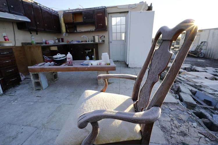
Early morning frost covers a chair sitting in a destroyed home Sunday, Dec. 12, 2021, in Mayfield, Ky. Tornadoes and severe weather caused catastrophic damage across several states Friday, killing multiple people overnight. (AP Photo/Mark Humphrey)
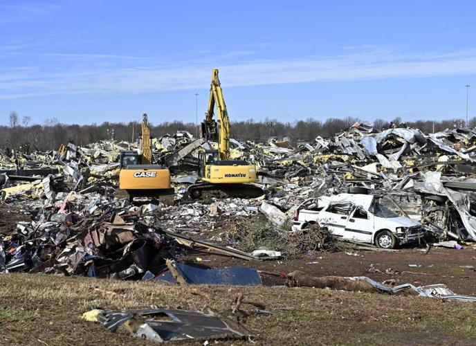
Emergency response workers dig through the rubble of the Mayfield Consumer Products candle factory in Mayfield, Ky., Saturday, Dec. 11, 2021. (AP Photo/Timothy D. Easley)
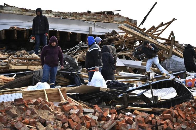
A family digs through the remains of their apartment in Mayfield, Ky., Saturday, Dec. 11, 2021. Tornadoes and severe weather caused catastrophic damage across multiple states late Friday, killing several people overnight. (AP Photo/Timothy D. Easley)
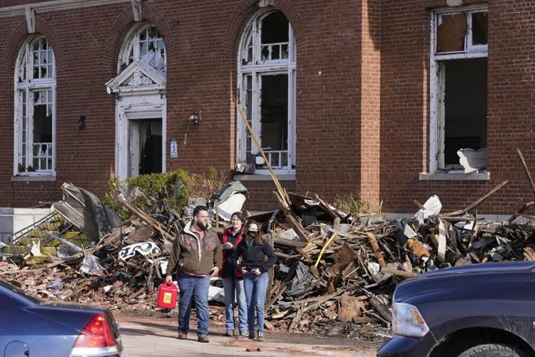
People survey damage from a tornado is seen in Mayfield, Ky., on Saturday, Dec. 11, 2021. Tornadoes and severe weather caused catastrophic damage across multiple states late Friday, killing several people overnight. (AP Photo/Mark Humphrey)
People survey damage from a tornado is seen in Mayfield, Ky., on Saturday, Dec. 11, 2021. Tornadoes and severe weather caused catastrophic damage across multiple states late Friday, killing several people overnight. (AP Photo/Mark Humphrey)
A woman searches for valuables amidst the remnants of a home on Saturday, Dec.11, 2021, on Highway F in Defiance, Mo. Tornadoes and severe weather caused catastrophic damage across multiple states late Friday. (Christian Gooden/St. Louis Post-Dispatch via AP)
Damage from a tornado is seen in downtown Mayfield, Ky. on Saturday, Dec. 11, 2021. Tornadoes and severe weather caused catastrophic damage across multiple states late Friday, killing several people overnight. (AP Photo/Mark Humphrey)
People survey damage from a tornado is seen in Mayfield, Ky., on Saturday, Dec. 11, 2021. Tornadoes and severe weather caused catastrophic damage across multiple states late Friday, killing several people overnight. (AP Photo/Mark Humphrey)
Authorities survey damage from a tornado is seen in Mayfield, Ky., on Saturday, Dec. 11, 2021. Tornadoes and severe weather caused catastrophic damage across multiple states late Friday, killing several people overnight. (AP Photo/Mark Humphrey)
People survey damage from a tornado is seen in Mayfield, Ky., on Saturday, Dec. 11, 2021. Tornadoes and severe weather caused catastrophic damage across multiple states late Friday, killing several people overnight. (AP Photo/Mark Humphrey)
People survey damage from a tornado is seen in Mayfield, Ky., on Saturday, Dec. 11, 2021. Tornadoes and severe weather caused catastrophic damage across multiple states late Friday, killing several people overnight. (AP Photo/Mark Humphrey)
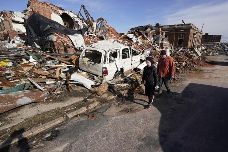
People survey damage from a tornado is seen in Mayfield, Ky., on Saturday, Dec. 11, 2021. Tornadoes and severe weather caused catastrophic damage across multiple states late Friday, killing several people overnight. (AP Photo/Mark Humphrey)
Emergency response workers dig through the rubble of the Mayfield Consumer Products candle factory in Mayfield, Ky., Saturday, Dec. 11, 2021. Tornadoes and severe weather caused catastrophic damage across multiple states late Friday, killing several people overnight. (AP Photo/Timothy D. Easley)
He said he has been in contact with federal authorities and expects a federal disaster declaration to be declared by Saturday afternoon.
Counties with likely damage and debris include: Fulton, Hickman, Graves, Marshall, Lyon, Caldwell, Hopkins, Ohio, Breckinridge, Bullitt, Spencer, Shelby, Christian, Logan, Warren, Edmonson, Taylor and Marion.
Kentucky Emergency Management Director Michael Dossett said "this tornado event may surpass the 1974 super outbreak as one of the most deadly in Kentucky's history."
Dossett said rescues and search efforts were ongoing, even before the storms were over.
Dossett said the "track for the tornado is over 200 miles, just in Kentucky, and it may eclipse the 1925 record tri-state track for the longest tornado." He said the tornado originated in Arkansas, then moving through Missouri, Tennessee and Kentucky. "It is a significant, massive disaster event."
"This is going to be some of the worst tornado damage we've seen in a long time," Beshear said in a Twitter video. He also said he will personally visit the areas affected as soon as it is safe to travel.
Tornado warnings were declared in multiple locations, and there were several confirmed tornadoes overnight including one about 2 a.m. seven miles west of Taylorsville, Kentucky. Beshear said at least four tornadoes touched down in the state, and that Dawson Springs was also hit hard.
In southwest Kentucky, "twin tornadoes" were reported about 2:20 a.m. near Bowling Green. Warnings were also declared at about the same time in Hart, Edmonson, Barren, Metcalfe, Warren, Butler Counties.
Western Kentucky University in Bowling Green says emergency crews were assessing significant storm damage there but no injuries were immediately reported.
Emergency crews are assessing significant storm damage in the Bowling Green area. WKU is in contact with all residential staff, and no injuries are reported on campus at this time.
— Western Kentucky University (@wku) December 11, 2021
A likely tornado with an estimated 102 mph winds was spotted on radar by WDRB meteorologists just after 3 a.m. near Hardyville, Kentucky, as the storm tracked toward Green County.
Severe weather and tornadoes in the overnight hours are extremely dangerous because many people are asleep, and tornadoes shrouded in darkness and heavy rain are nearly impossible to see.
Kentucky State Police Post 1 in Mayfield released a statement about 12:30 a.m. Saturday that said it was responding to a severe tornado event across multiple counties in western Kentucky. The release said there is significant damage reported. Several buildings collapsed in Mayfield, said Sarah Burgess, a trooper with the Kentucky State Police. Burgess said authorities worked to clear trees and power lines from roads in order to begin assessing damage.
Photos posted to social media from Mayfield showed uprooted trees, a courthouse steeple sheered off and business windows blown out in the storms.
"I have a lot of history here, four or five generations deep," First Christian Church of Mayfield Preacher Milton West said. "It's hard to see my community like this, but it's going to get better...absolutely certain of that."
Related Stories:
- 'The Lord took care of us' | Taylor County man says he's thankful to be alive after night of tornadoes
McConnell on tornado damage: 'We'll help these great folks rebuild'
How to help victims impacted by the tornadoes in western Kentucky
Copyright 2021 WDRB Media. All Rights Reserved.


