LOUISVILLE, Ky. (WDRB) -- Severe storms Monday morning left behind serious damage as they rolled through Tompkinsville, Kentucky.
Photos from Monroe County, which is close to the Kentucky-Tennessee border, show trees down and parts of houses sheered off by the wind.
The National Weather Service (NWS) in Louisville said it was sending a survey crew to the county "due to all the damage reports from Tompkinsville that seem to be consistent with a tornado."
Survey crew is on their way down to Monroe County due to all the damage reports from Tompkinsville that seem to be consistent with a tornado this morning. #KYwx pic.twitter.com/sIFHLJlkSI
— NWS Louisville (@NWSLouisville) May 3, 2021
At last check, no serious injuries were reported.
Severe storms leave behind serious damage in southern Kentucky
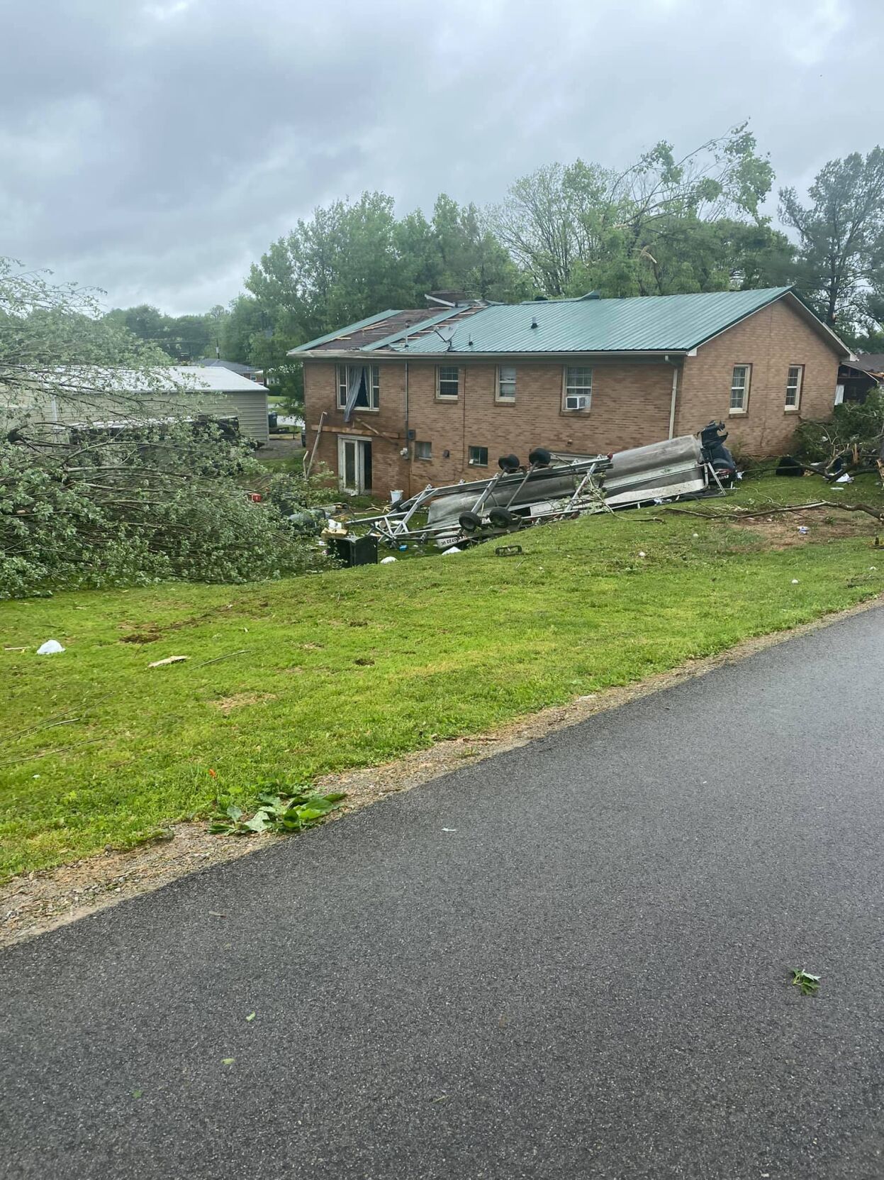
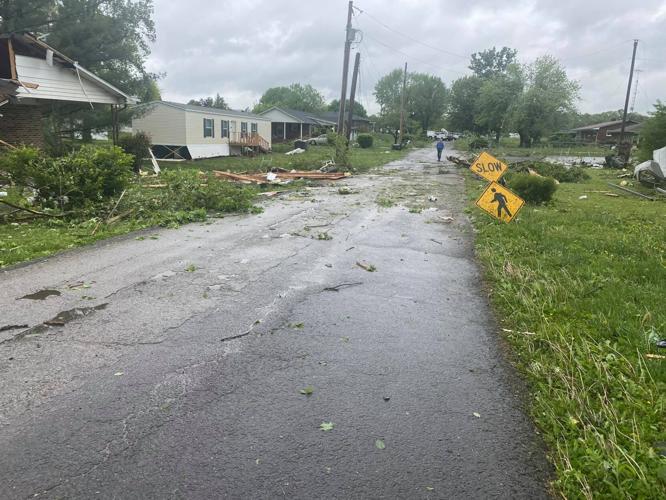
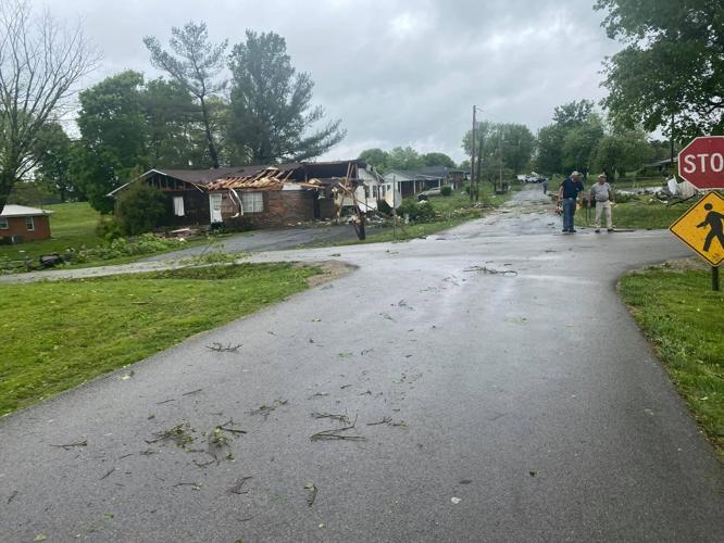
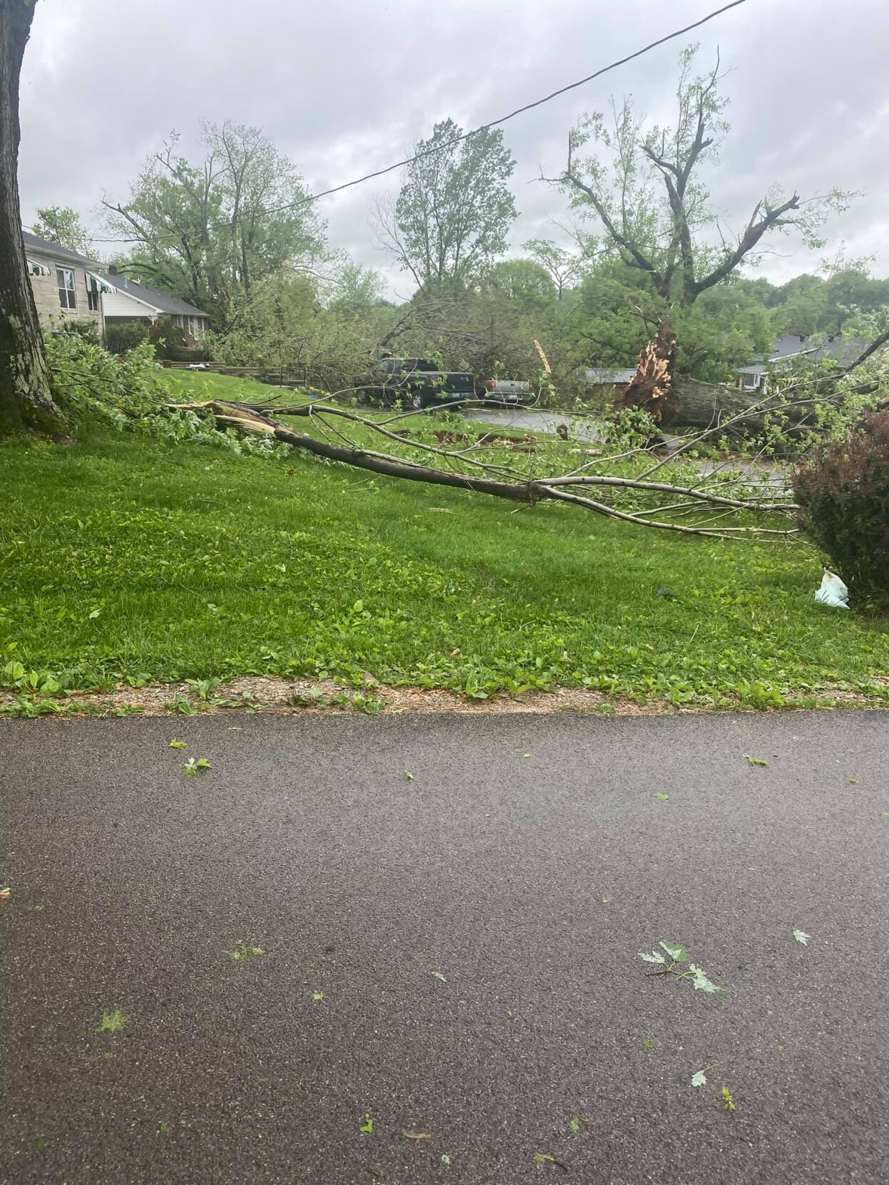
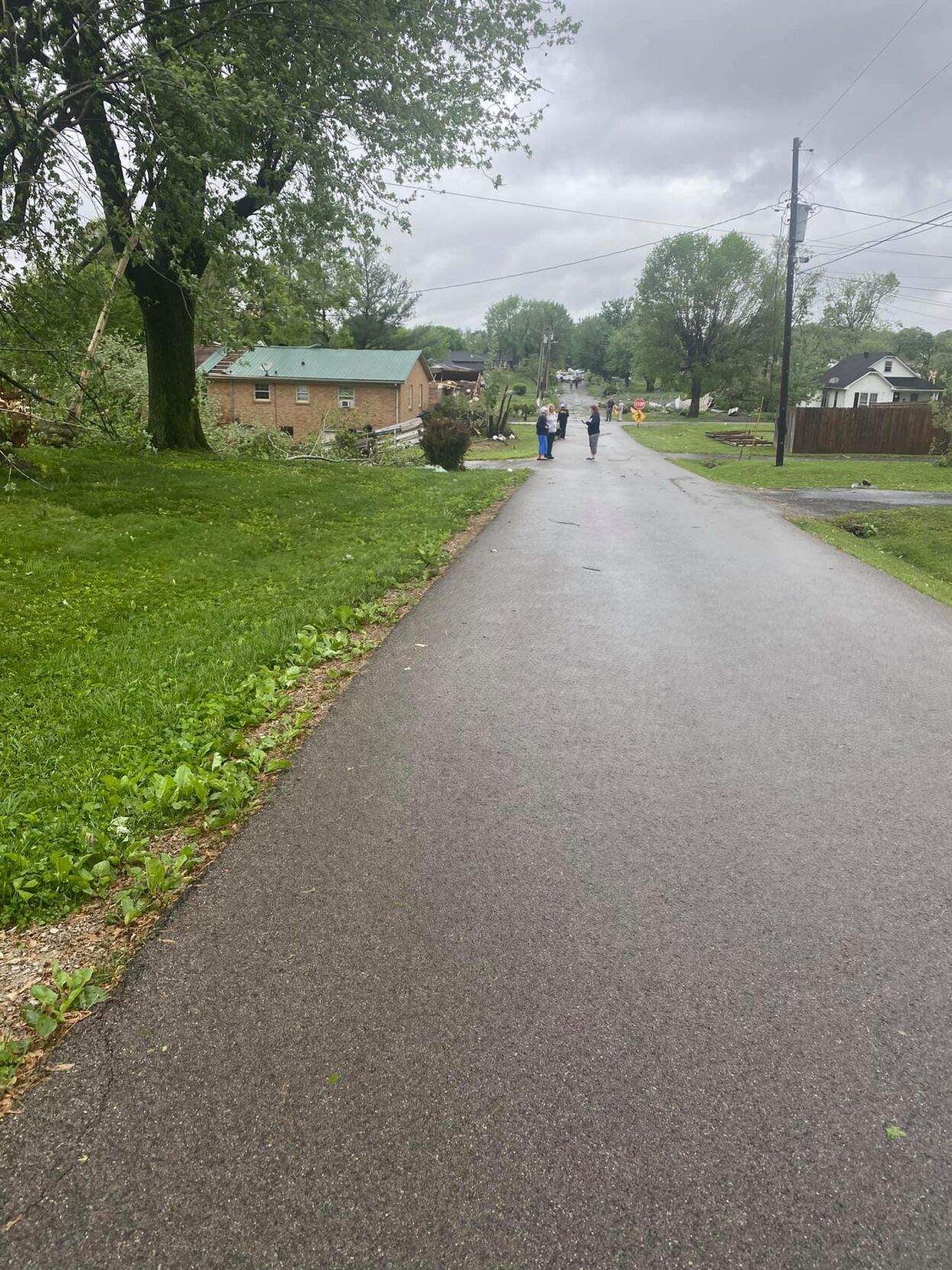
Severe storms Monday, May 3, 2021, left behind serious damage as they rolled through Tompkinsville, Ky. (Photo courtesy of Jason Sutton)
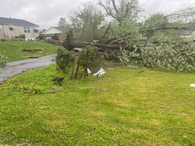
Severe storms Monday, May 3, 2021, left behind serious damage as they rolled through Tompkinsville, Ky. (Photo courtesy of Jason Sutton)
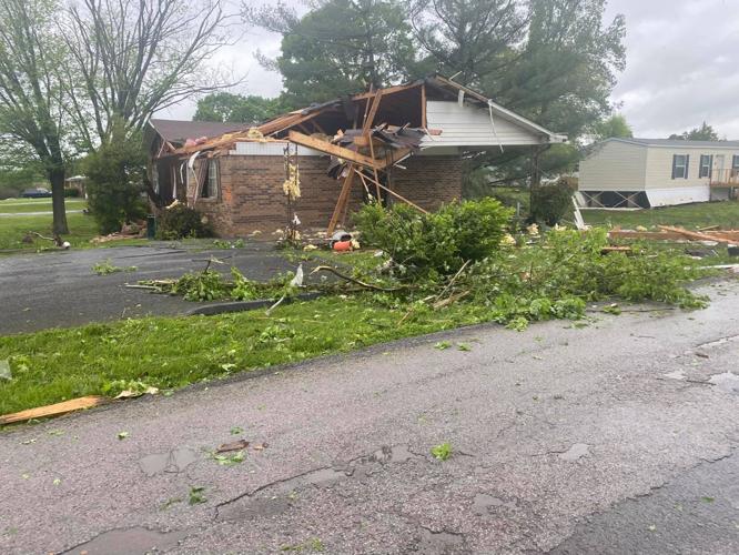
Severe storms Monday, May 3, 2021, left behind serious damage as they rolled through Tompkinsville, Ky. (Photo courtesy of Jason Sutton)
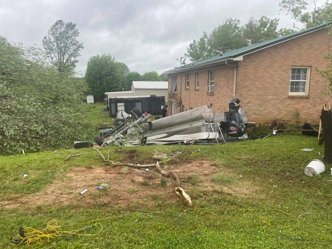
Severe storms Monday, May 3, 2021, left behind serious damage as they rolled through Tompkinsville, Ky. (Photo courtesy of Jason Sutton)
Severe storms Monday, May 3, 2021, left behind serious damage as they rolled through Tompkinsville, Ky. (Photo courtesy of Jason Sutton)
Severe storms Monday, May 3, 2021, left behind serious damage as they rolled through Tompkinsville, Ky. (Photo courtesy of Jason Sutton)
Severe storms Monday, May 3, 2021, left behind serious damage as they rolled through Tompkinsville, Ky. (Photo courtesy of Jason Sutton)
Severe storms Monday, May 3, 2021, left behind serious damage as they rolled through Tompkinsville, Ky. (Photo courtesy of Jason Sutton)
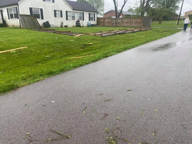
Severe storms Monday, May 3, 2021, left behind serious damage as they rolled through Tompkinsville, Ky. (Photo courtesy of Jason Sutton)
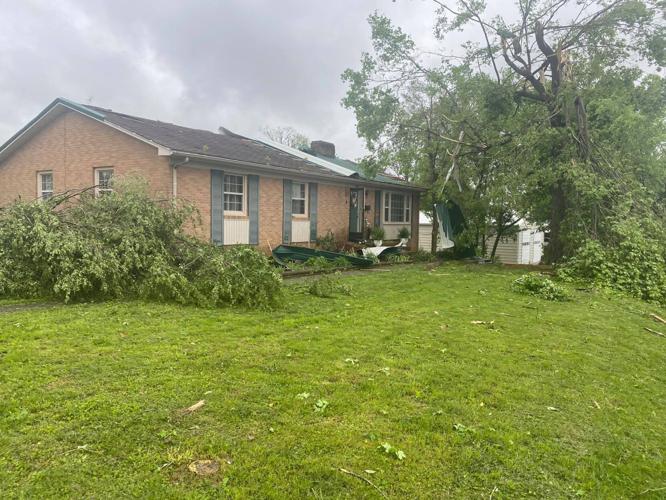
Severe storms Monday, May 3, 2021, left behind serious damage as they rolled through Tompkinsville, Ky. (Photo courtesy of Jason Sutton)
"Strong to severe storms are possible" late Monday night into Tuesday morning for Louisville, its surrounding counties and much of Kentucky, according to NWS Louisville.
"The main threats will be large hail and damaging winds," NWS Louisville said in a tweet Monday afternoon. "Localized flash flooding and a brief tornado are also possible."
Strong to severe storms are possible late tonight into Tuesday morning and then again Tuesday afternoon and evening. The main threats will be large hail and damaging winds. Localized flash flooding and a brief tornado are also possible. pic.twitter.com/bEPQk5WqMk
— NWS Louisville (@NWSLouisville) May 3, 2021
To stay up to date on the latest severe weather, visit the WDRB Weather page or download the WDRB Weather app.
Related Stories:
Copyright 2021 WDRB Media. All Rights Reserved.