
The tropics, in both the Atlantic and Pacific Oceans, are currently active. There are two hurricanes tracking west toward Hawaii in the Pacific Ocean.

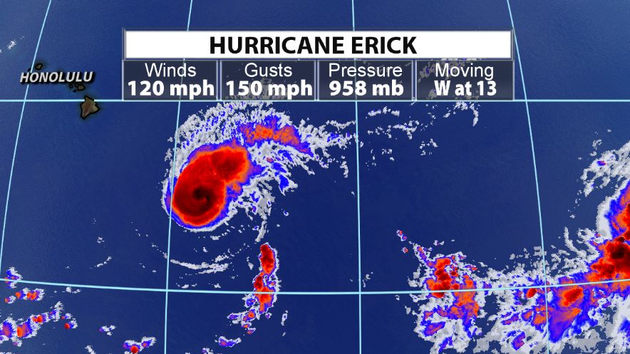
Hurricane Erick is a major hurricane, but expected to weaken by the end of the week. The National Hurricane Center's track has Erick sliding south of Hawaii late Thursday/early Friday.
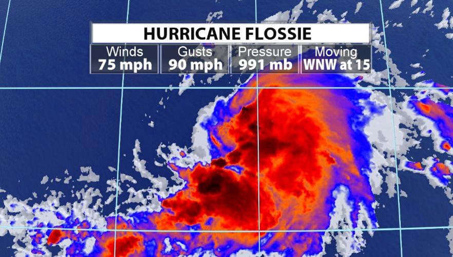
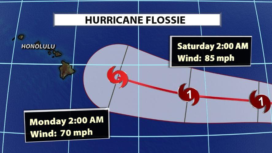
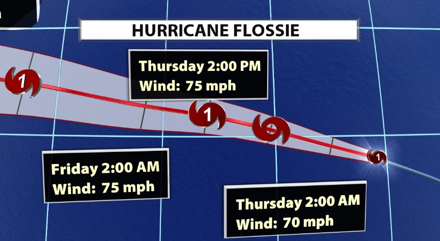
The second storm, Hurricane Flossie, is likely to stay a category one storm, but will weaken to a tropical storm by early next week as it moves toward Hawaii. Both of these storms are expected to bring high surf and heavy rain to the island.


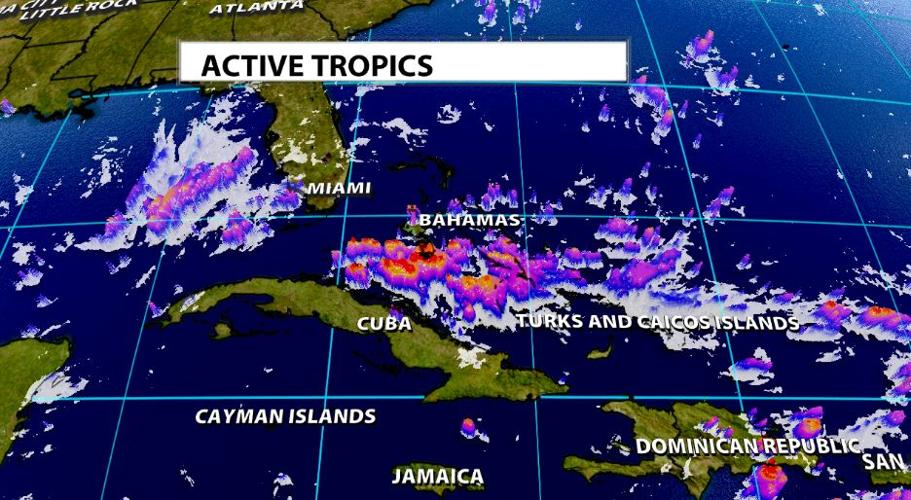
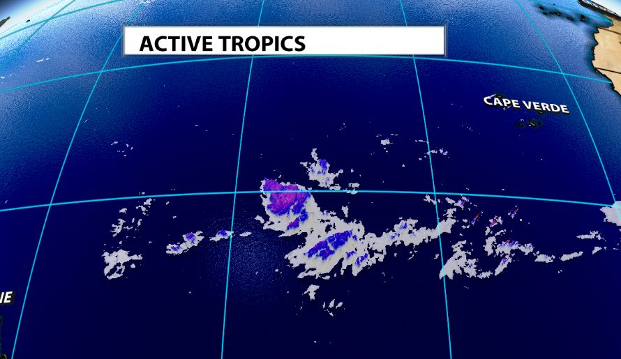
In the Atlantic Ocean, there are no hurricanes or tropical storms, but there are some tropical disturbances worth keeping an eye on during the next few days/week. The first is located near Hispaniola (Haiti and the Dominican Republic). This area of disturbed weather is expected to move northwestward to northward in the next few days, producing heavy rainfall in the Greater Antilles, Bahamas and Florida. There is only a small chance this could form into a tropical depression. Conditions could become more conductive for development over the weekend while the system accelerates NE. Stayed tuned.

Another tropical disturbance is also moving through the far eastern Atlantic. This also has a chance to develop this weekend or next week. This is a broad area of shower and thunderstorm activity. Little to no development of the wave is expected for the next few days while it moves westward across the eastern and central tropical Atlantic Ocean at about 15 mph. Environmental conditions are forecast to become more conducive for development over the weekend and a tropical depression could form by early next week several hundred miles east of the Lesser Antilles.


