

Happy weekend! After morning cloud cover and fog, we're clearing out for more sunshine for the rest of Saturday afternoon! We'll stay dry for the rest of the day and temperatures will end up in the mid 70s for most of us!
Sunday
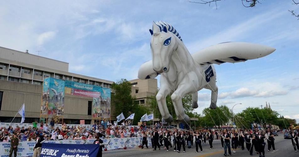
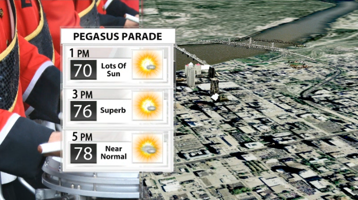
SUNday looks great and will live up to the first half of its name! The Pegasus Parade through downtown Louisville will start at 3 p.m.! Luckily for us this year, the weather is almost perfect for this time of year. We'll likely be in the mid 70s by the time the parade starts with lots of sunshine. The parade is set to end around 5 p.m., in which we will have warmed up into the upper 70s by then!
Monday Storms
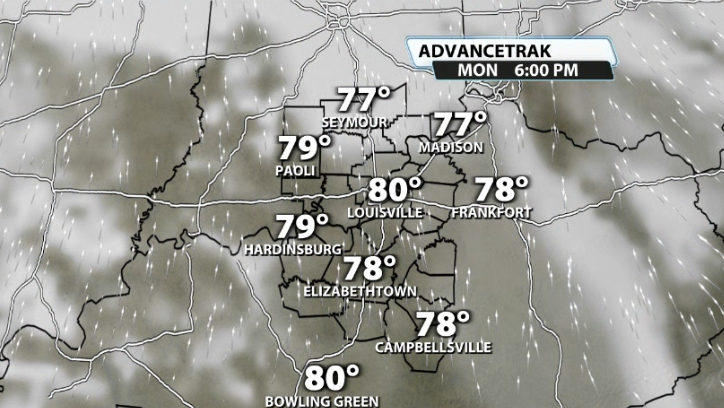
The daytime for Monday will likely be dry. If you have outdoor plans during the daytime, you're good to go. It'll be windy and temperatures will quickly climb into the low-mid 80s during the day. It will be a little muggy, which will help feed storms late in the day.
Storms don't arrive until after sunset. Data (for now) has storms approaching our western communities by around 10 p.m.-12 a.m.. Our western communities west of I-65 will have the highest chance of seeing severe weather.
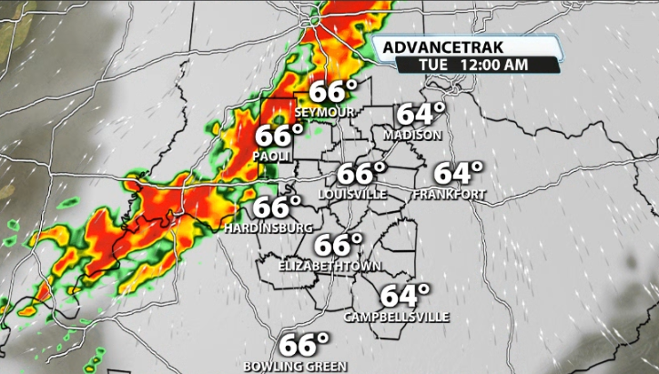
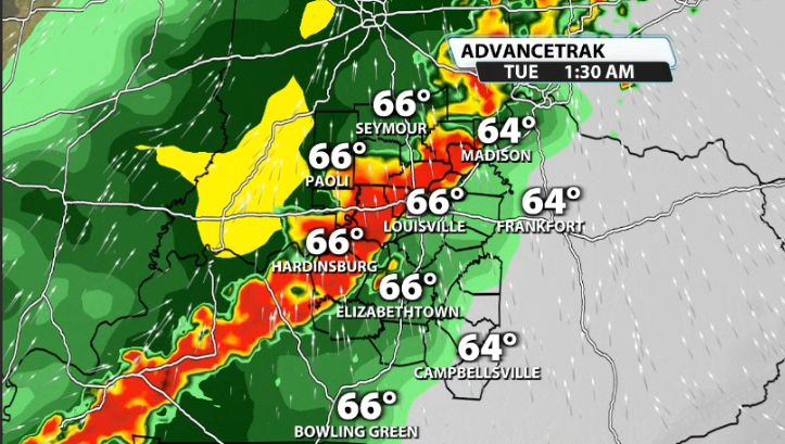
The lines approaches Louisville between around 12 a.m.-3 a.m., weakening slowly from west to east, but will still likely pack a punch once it arrives in the metro.
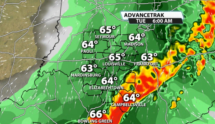
It should exit our area completely by around 6 a.m. at the latest. The further east that the line goes, the weaker it should become.
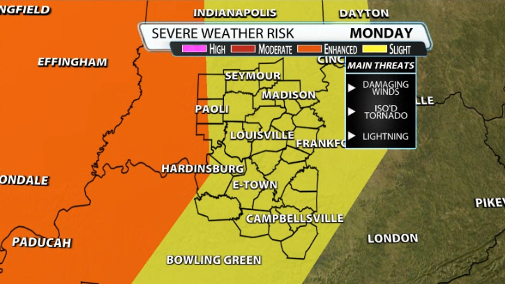
Here's the latest from the SPC...Louisville and most of our area are under the Slight (2/5) risk for severe storms, while the extreme western sliver of our viewing area is included in the higher risk, Enhanced (3/5). Damaging winds will be the biggest threat followed by an isolated tornado risk in the line as it sweeps across our area,


