
A little rain returned to parts of Southern Indiana today, and even more is expected this week. We definitely need the rain considering the drought conditions we have seen across much of Kentucky. Let's talk about the timing and how much rain will fall.

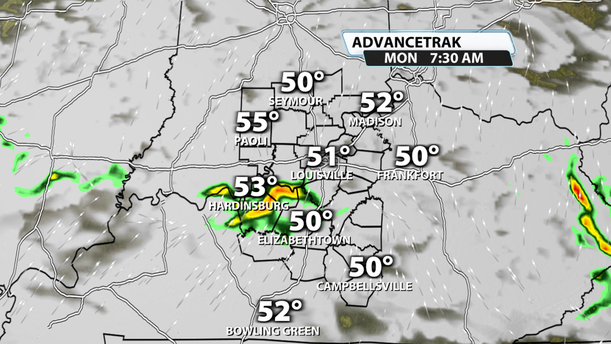
Showers with some rumbles of thunder are likely across the region tonight. Rainfall amounts will probably stay under a tenth of an inch for a majority of Kentuckiana, but a few spots might pick up a couple tenths of an inch if you include what falls early Monday morning. Rain could impact the morning commute for some. Much of Monday afternoon and evening will be bone dry, but we'll leave a 10-20% chance for rain at that point.

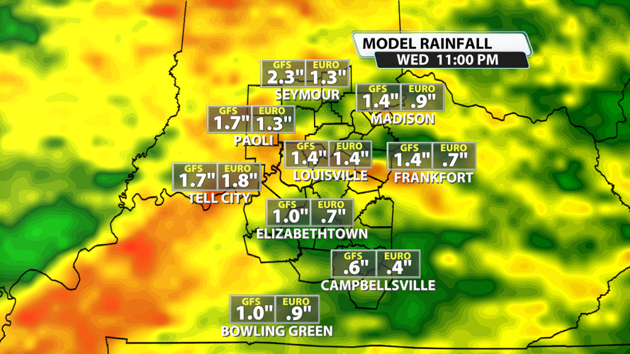
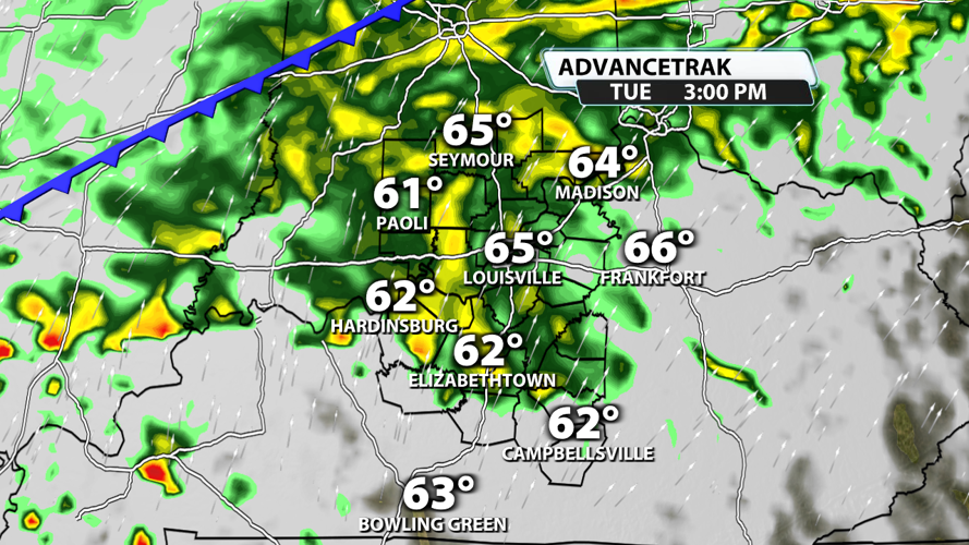
Showers and storms become much more widespread on Tuesday. Rain is possible early in the day, but it's much more likely during the evening and overnight hours. Heavy rain will be possible at times. Most places will receive 0.5" to 1.5" of rain!

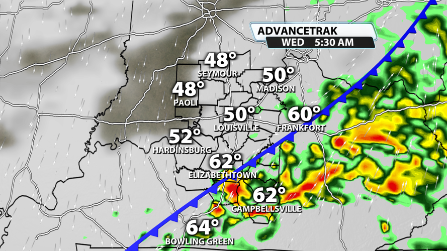
A few showers or storms may linger into Wednesday, but much of the day is expected to be dry. Beyond Wednesday, rain chances fall to almost zero.

Once all is said and done, many places will have received an inch of rain. There's a chance that some spots double that.

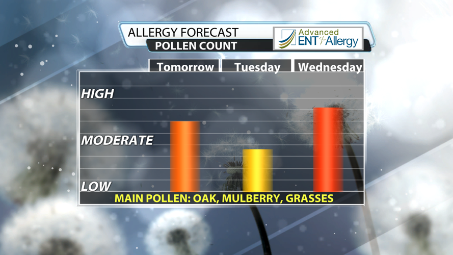
It won't just be rain falling early next week. Pollen levels will drop as well! With Tuesday's heavier and more consistent rain, pollen levels could drop to the low range in some places.


