We just wrapped up a phone call with the National Weather Service about the snow moving into our area right. Here is a recap of what we talked about and NWS Louisville's thoughts about what will happen:
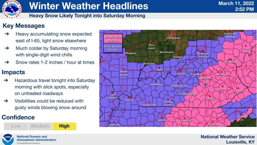
There's not a lot of change to the information because NWS confidence remains high in the forecast.

The Winter Storm Warning (shaded above in pink) is where higher snow amounts are expected and more travel impacts Saturday morning.

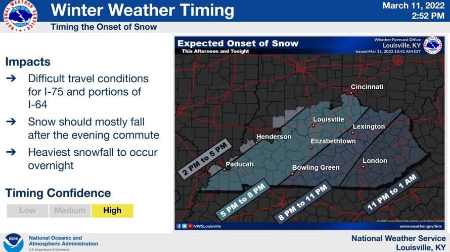
The greatest impacts and heaviest snow are likely overnight and closer to I-75. Parts of I-64 east of I-65 may also become difficult to travel on overnight and Saturday morning.


Marc Weinberg and Rick DeLuca will have updates for you tonight on WDRB News, tracking the snow as it arrives and showing you where snow is likely to cause the most issues.


