Top Story
The AWIPS system is used to display weather and water information, and send critical weather warnings and updates.
The AWIPS system is used to display weather and water information, and send critical weather warnings and updates.

The National Weather Service has finished their assessment of the tornado that touched down around the Ohio River Thursday afternoon. The final path is longer than initially stated
Last year we shared this story with you about Climavision, a weather data company who got their start in NuLu. Now this local company is sharing their data with the National Mesonet Program, through which the National Weather Service can use it.
We just finished a conference call with the National Weather Service to their local partners to discuss more about the threat of severe storms tonight. Here's a summary of what we talked about in that call:
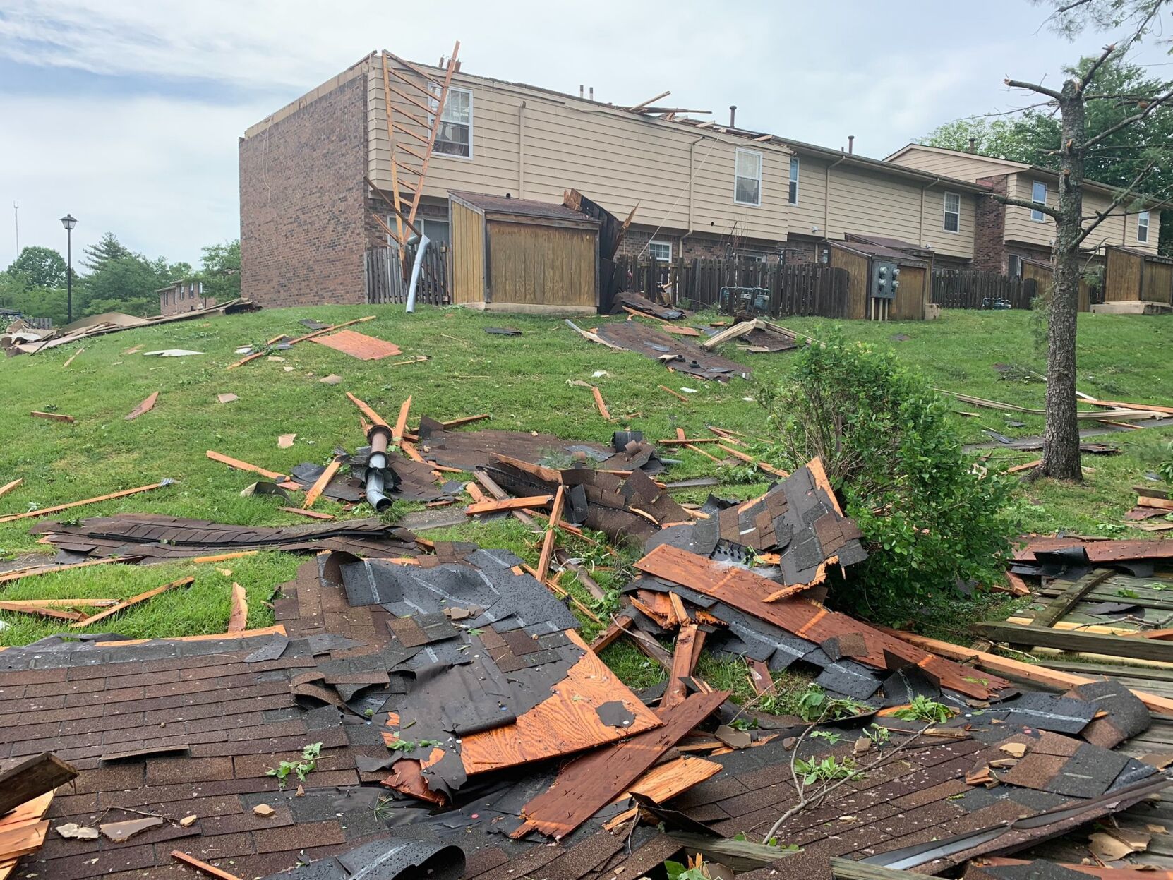
An EF-1 tornado touched down in Floyd County, near Edwardsville, and crossed the Ohio River into Jefferson County, the NWS said Tuesday.
The NWS said tornadoes touched down in Newburg, PRP and in Meade County.
Want to help us during active weather? The National Weather Service office in Louisville is hosting Skywarn training sessions this week!
The National Weather Service office in Louisville hosted a conference call for their partners to discuss the threat of severe storms, damaging wind, and flooding that moves into our area Friday. Below is a summary of what we talked about
Wednesday afternoon the National Weather Service office in Louisville hosted a conference call for the groups that work with them during active weather. Here is a summary of their thoughts about the threat of severe storms Thursday and what we discussed on the call:

The National Weather Service office in Louisville has used drones on some of their wind and tornado damage surveys before, but they recently expanded that use to include hydrology surveys.