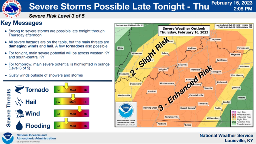
Wednesday afternoon the National Weather Service office in Louisville hosted a conference call for the groups that work with them during active weather. Here is a summary of their thoughts about the threat of severe storms Thursday and what we discussed on the call:

One of the first thoughts that opened the meeting was that nothing good comes from temperatures in the 70s and dew points in the 60s during February. A warm front will cross through the area overnight opening us up to storms starting around midnight. A surface low will be moving from the Southern Plains up toward southwest Indiana - a track that usually causes problems in our area, according to the NWS forecaster.

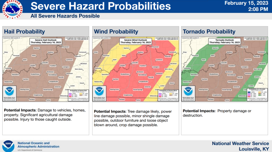
All threats will be on the table in this setup - strong wind, isolated tornadoes, and large hail are all possible at different points in this set up. You can read more about the different rounds and what threats are possible in each in this blog Bryce wrote earlier today. It's also worth noting there will be strong surface winds even outside of storms which will help support storms coming likely as a mix of bowing segments and super cells.
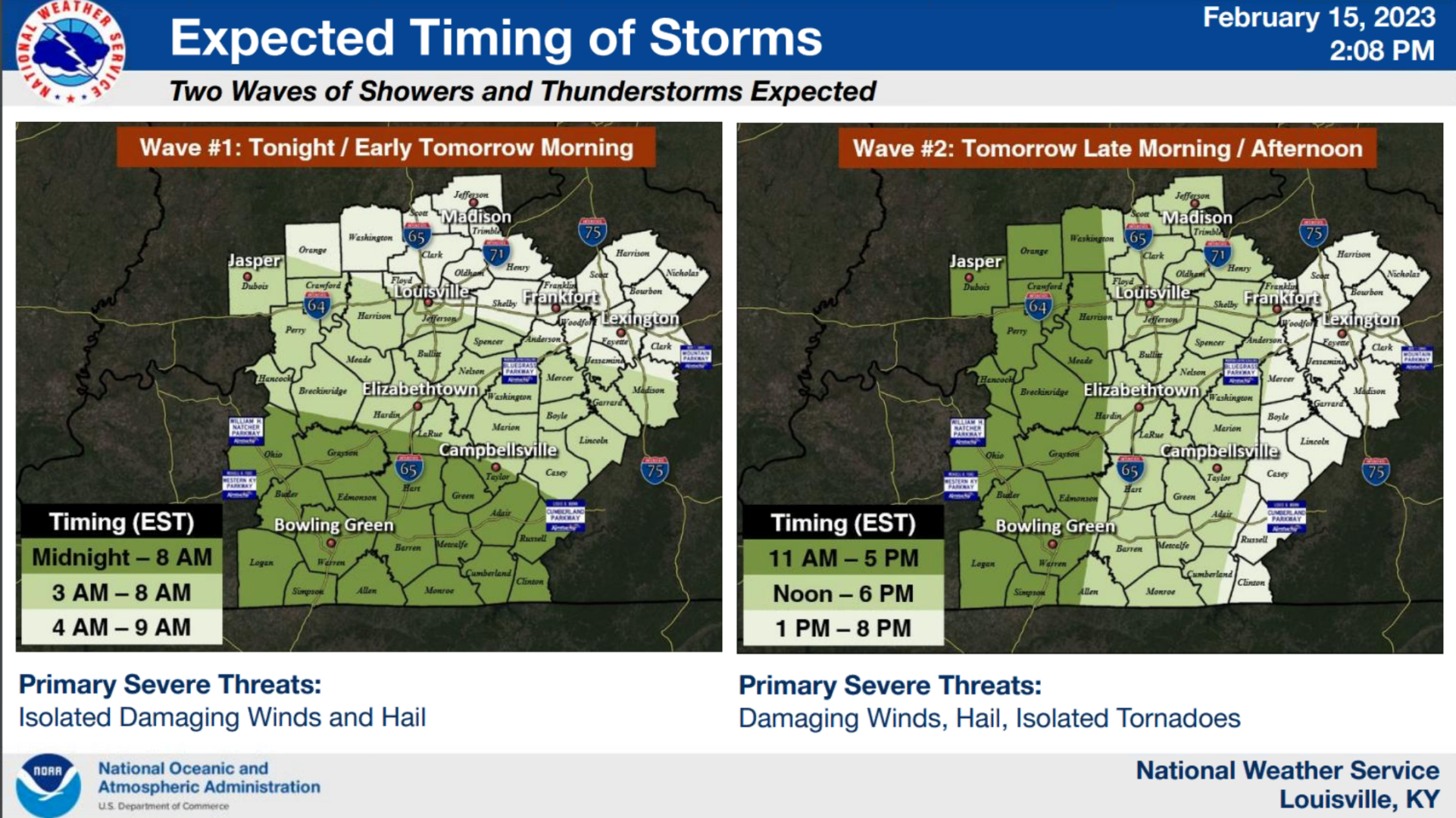
The storms will come in a two main rounds, shown above. The early round of storms will have more elevated energy bringing wind and hail as the main threats. The second main round has more surface-based storm energy putting isolated tornadoes and damaging wind on the table.

If you have any questions about what to expect from these strong thunderstorms Wednesday night through Thursday, you can find any of our meteorologists on social media.


