

We've got a beautiful weekend ahead of us! Today comes with low humidity and temperatures in the upper 70s near 80! Sunday, during the daytime, will be even warmer, and in the mid-upper 80s with a nice breeze!
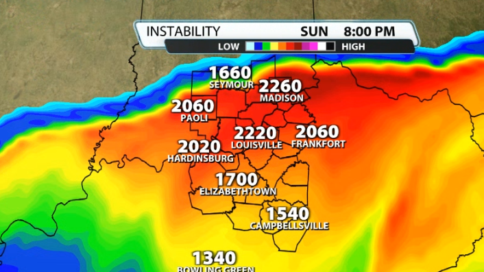
The warmer air tomorrow will build up some instability, or storm energy/CAPE that a cold front will try to eat up on after sunset.
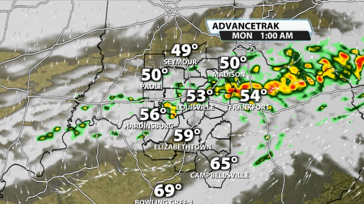
After around 8-9PM Sunday night, the cold front approaches our Indiana counties. It'll begin to move southward closer to the river around 11PM-12AM.
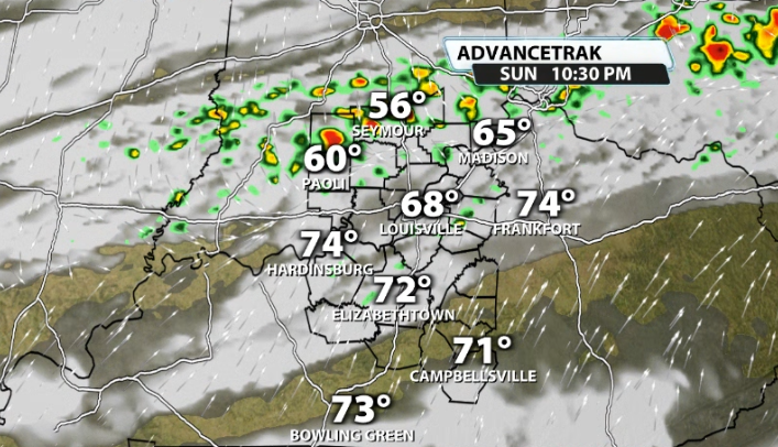
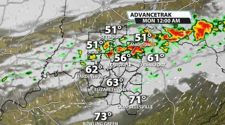
By the time the front moves south of the river, the storms are running out of steam because of the time of night. With temperatures cooling, that line should start to weaken as it moves into our Kentucky counties through the middle of the night
Severe Factors
There will be a few factors working in favor of strong storms on Sunday night, but there's also some limiting factors that could help prevent many of them.
CAPE
CAPE, or storm energy, will be prevalent in our area Sunday because of how warm we're going to be on Sunday afternoon. The highest amount of instability will be available during the peak heating of the day, but the front won't be here quite yet at that time. Still, once the front gets here, the storms will still have some to work with to make them pop.
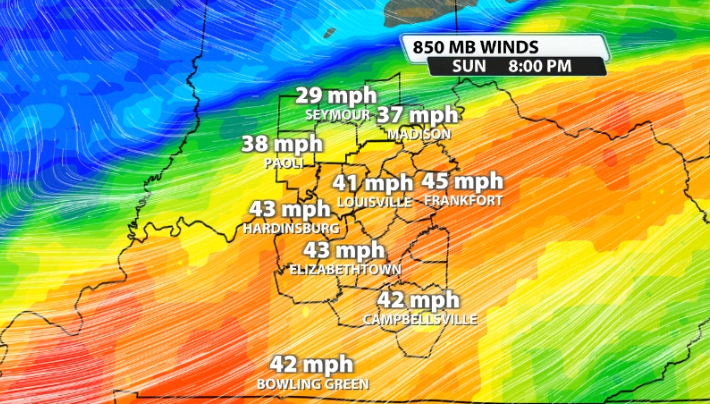
The wind energy is not crazy like it was last Sunday, but it should still be sufficient enough to help support stronger storms as well. We look for 40mph winds or stronger about a mile above the ground (like you're seeing on this map), so it meets criteria.
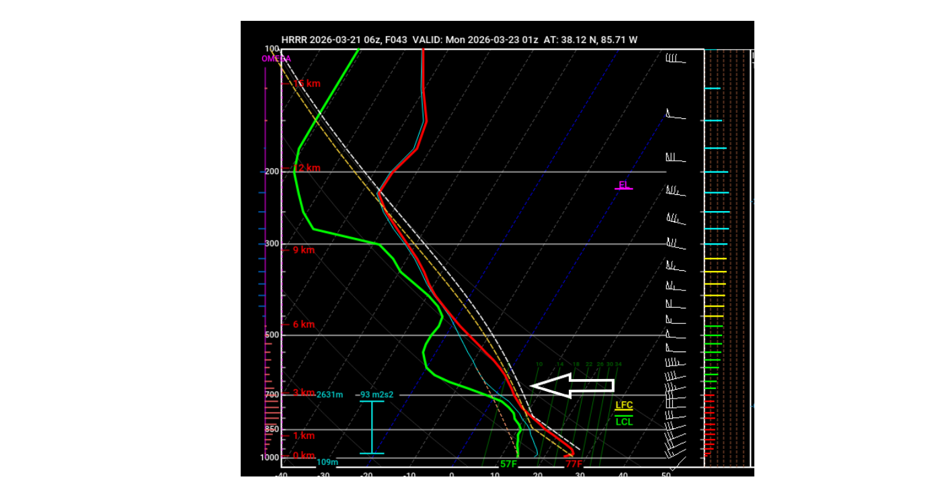
So, what's the limiting factor? Data continues to show a "cap" or a "capping inversion" in the atmosphere Sunday afternoon and evening.
What is a "cap"? A cap is a layer of warm, stable air located thousands of feet above the ground that acts like a lid on the atmosphere. The cap is an important ingredient in most severe thunderstorm episodes, as it serves to separate warm, moist air below and cooler, drier air above.
With the cap in place, air below it can continue to warm and/or moisten, thus increasing the amount of potential instability. Or, air above it can cool, which also increases potential instability. But without a cap, either process (warming/moistening at low levels or cooling aloft) results in a faster release of available instability - often before instability levels become large enough to support severe weather development.
We can see the capping inversion on a skew-t graph for our atmosphere in Louisville around 9PM still on Sunday night.

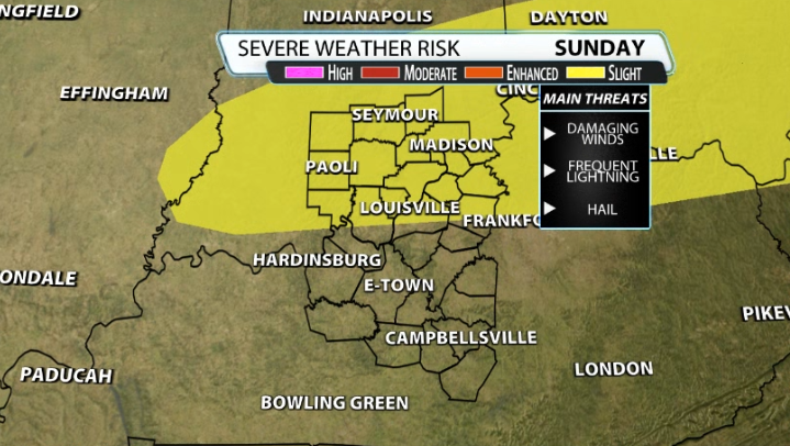
This is why we have a low-end severe risk for Sunday night. The SPC currently has a level 2/5 slight risk for parts of our area, mainly in Indiana.


