

Today is a GREAT day for those that love Spring temperatures. Record warmth across the area today as we climb into the mid 70s!
As we have been saying all week though, Spring-like temperatures in February usually don't come without Spring-like storms. In this case, storms that roll in on Thursday do come with a strong to severe threat.
Overnight tonight, a warm front lifts through the area, and will continue to keep temperatures mild overnight tonight. Rain and storms begin to roll in behind the front in the middle of the night.
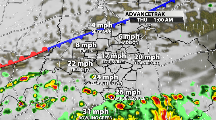
The storms that roll in overnight don't come with a huge severe threat, since the timing that they are moving in won't allow for a ton of storm energy, or instability here at the surface. Still, this will come with heavy rainfall, strong wind gusts at times, and the chance for a couple rogue warnings within them.
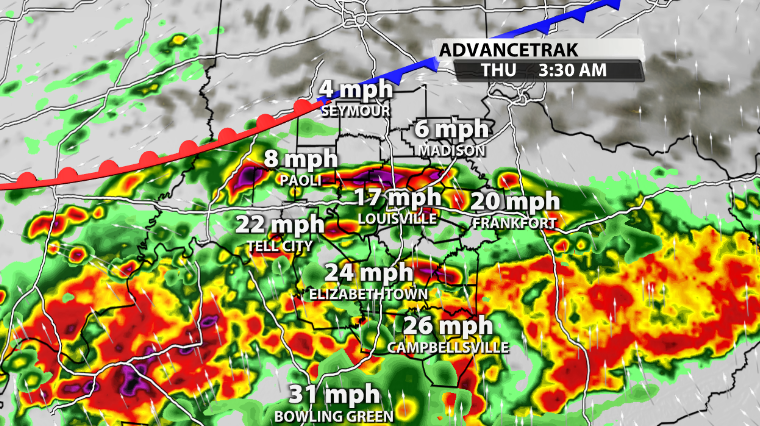
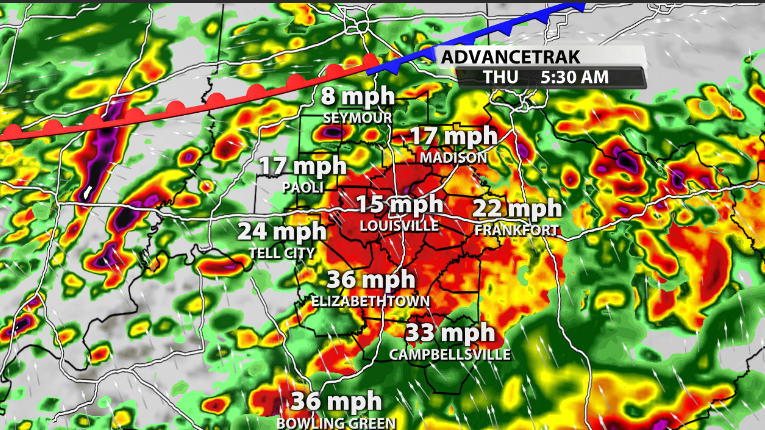
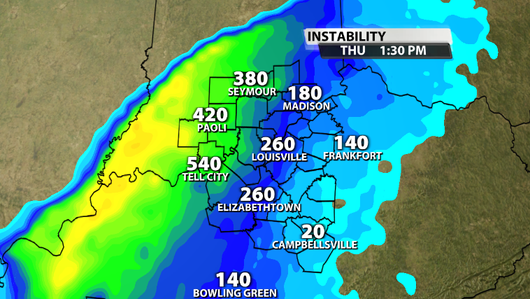
The chance for severe storms climbs further as we head longer into the morning and into the early afternoon especially. Model data is now in a good agreement of a second wave of storms rolling through the area, along a strong cold front. This would be moving through at a more favorable time during the day as temperatures warm up a little more. If we end up seeing some dry time between waves, our atmosphere would become more unstable and more suitable for stronger storm development.
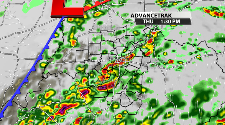
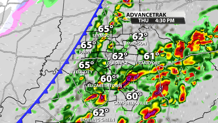
The good thing about this system, is that the greatest threat for storms to turn severe will be when most of us are awake and during the daytime. The front will slide through late afternoon and take the stronger storm threat along with it off to our East.
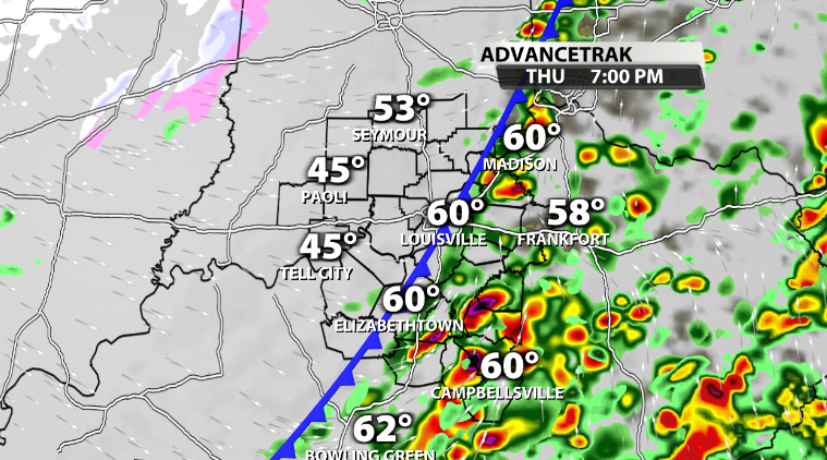
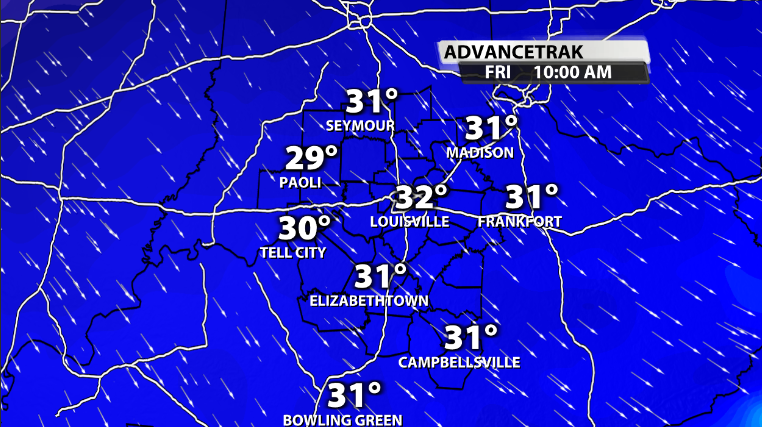
Temperatures behind this front will crash pretty quickly. We will end up dropping all the way back below freezing for much of the area by the time we wake up on Friday morning.
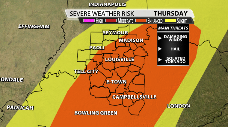
Now, back to that severe aspect. The Storm Prediction Center has most of our area under an Enhanced (3/5) risk for severe storms tomorrow. The biggest reason behind this beside increasing confidence, is the fact that we could have some pretty strong wind gusts embedded in the stronger storms that move across our area. This would make way for multiple severe thunderstorm warnings that could be issued.
So, damaging wind gusts will be the main threat tomorrow by far, followed by the possibility for large hail in the stronger storms with stronger updrafts, and we can't rule out the possibility for tornadoes in our area, although that would be less likely than the other two main impacts.
In order to get severe weather we need multiple things, but especially 3 key factors. We need ample low level moisture, storm energy, otherwise known as instability or CAPE, and we need wind shear (wind energy.)
All three will be present in some shape or form as the system moves in tomorrow.
Dewpoints during the late morning and early afternoon from latest model data have the chance to surge into the 60s. That would be a decent amount of moisture for storms to feed off of. This time of year though with southerly wind, that's not usually too hard to come by. Instead, its usually harder to get Storm energy, or instability. We should have enough surface CAPE, or storm energy, to keep storms going and allow them to get stronger through part of the daytime tomorrow, especially if we end up having any dry time.
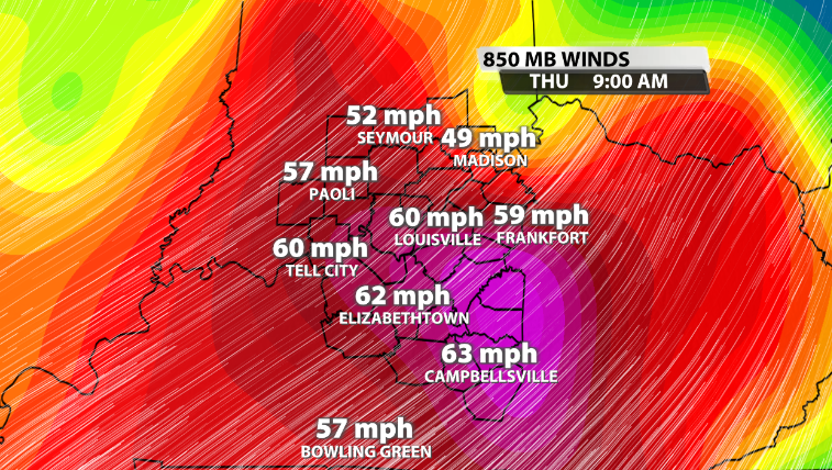
Wind energy will be plentiful with this set-up tomorrow as well. Winds at the 850mb level in the atmosphere (around 1 mile above our heads give or take) will be around 60-70mph. We usually look for around 40+ to help tilt storms as they climb higher in the atmosphere, thus allowing for updrafts and downdrafts to be separated in thunderstorms. This allows for storms to last longer and not collapse on themselves as quickly.
Again, the most impact tomorrow will be damaging wind gusts inside the strong storms, followed by the potential for large hail and the smaller chance of seeing a spin-up tornado around our area. Have a way to receive warnings just in case one is issued for your area at some point on Thursday.