The National Weather Service office in Louisville hosted a conference call for their partners to discuss the threat of severe storms, damaging wind, and flooding that moves into our area Friday. Below is a summary of what we talked about:

This "weather event" will come in two main rounds:
Round 1 comes with the warm front, mainly 4-9 AM according to NWS, bringing mainly heavy rain. Round 2 from the cold front brings the strongest storms, generally Noon to 4 PM according to NWS.

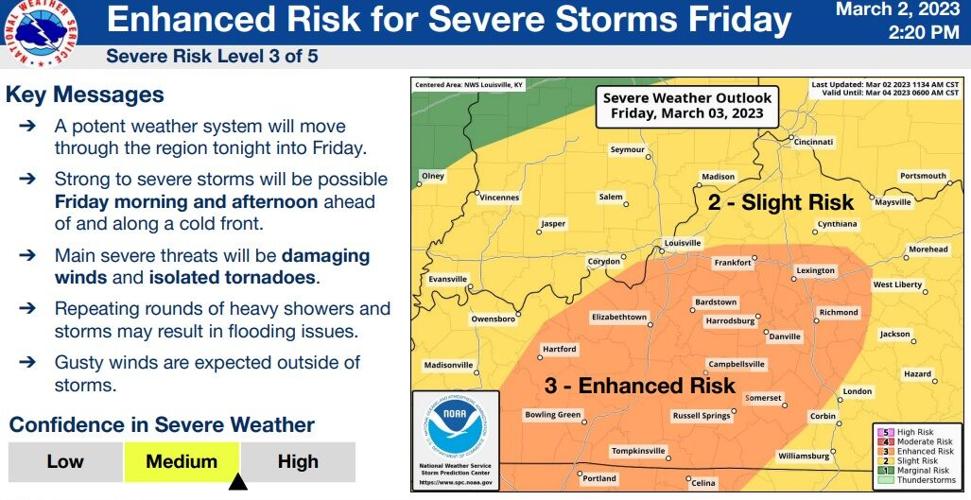
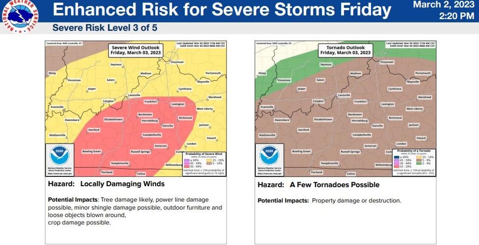
Tornadoes and rotating storms look most likely along and south of a line from Glasgow through Campbellsville, and up toward Lexington. The tornado threat is driven by turning of the wind at different levels in the atmosphere, not by instability or "storm energy." If the sun comes out, that would increase the storm energy and increase the threats beyond what is discussed here. Confidence in tornadoes in the area mentioned above is increasing.

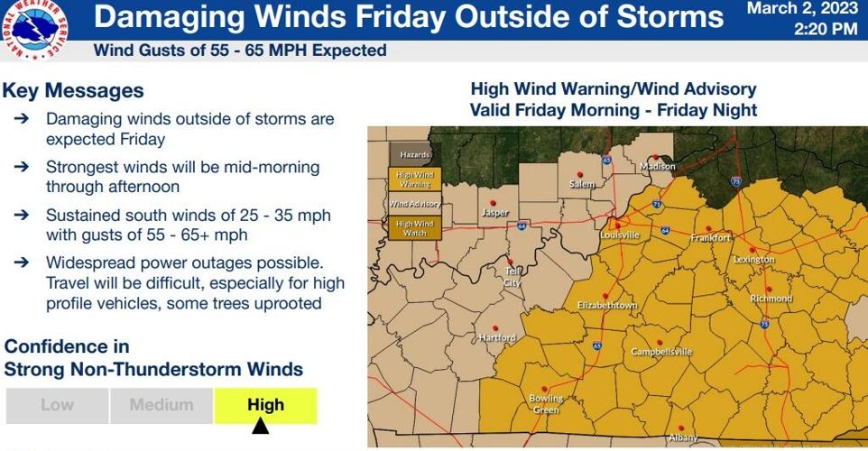
John Gordon, who leads this NWS office and led this call, said "this is one of the deepest lows I've seen here in a long time." A deep low provides power and increases the wind threat. That's a large part of why the confidence in the wind part of this forecast is so high. Gusts 60-70 mph look very possible which would cause widespread power outages. Gordon went on to say, "I've been here 17 years; this is the first time we've put out a High Wind Warning this far in advance," and he is very confident the strength of wind they are warning about will happen. The wind will stay strong after dark, too.

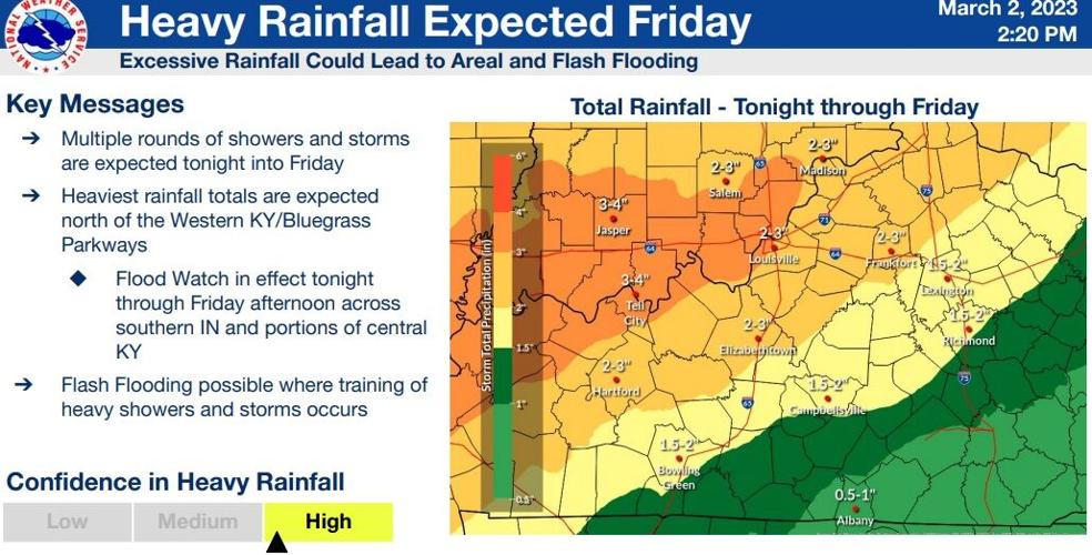
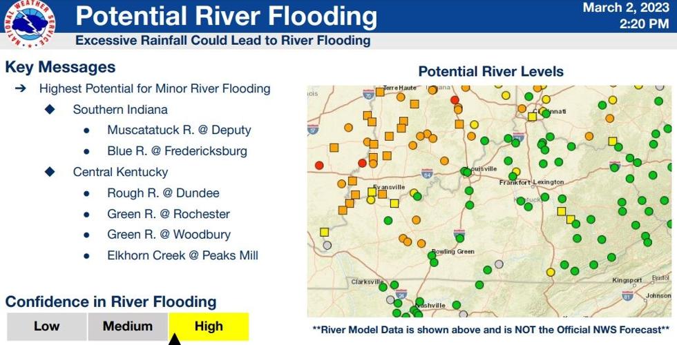
The heaviest rain will fall through southern Indiana, so that's also where minor river flooding is most likely. There will be less rain in Kentucky but there is flood potential in spots that typically flood.

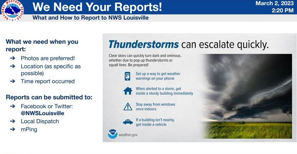
Finally NWS urged everyone to submit reports to them. This helps them improve the warnings they are sending out and the messaging they are sharing with us in the moment.

We will be discussing the timing and threats in detail all night on WDRB News and posting more updates here on our Weather Blog. You can also connect with any of our Meteorologists on social media to ask questions and see the updates they are posting.


