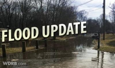

Last night a thunderstorm parked itself over downtown Louisville and dropped a lot of rain which led to flash flooding. We experienced some of that here at WDRB, but Thursday's flash flooding pales in comparison to what we've seen here before.
Pounding rain and howling wind. This got bad fast. We had to get the cars out of the lot. #FlashFlooding @WDRBNews pic.twitter.com/d0ZwjGwbr1
— Gilbert Corsey (@gcorsey) August 27, 2021
Looking Back: Flash Flood of August 4, 2009...
Record-breaking heavy rains fell in Jefferson County, Kentucky, as well as Floyd and Clark Counties in Indiana as strong thunderstorms regenerated over the area. Rainfall amounts up to 6 inches fell between 7am and 10am EDT, especially in central Louisville. Five inches of rain fell in 90 minutes from 7:45am to 9:15am, and rainfall rates up to an astounding 8.80 inches per hour were reported.
There were no fatalities or injuries. A woman and two children were trapped and then rescued in New Albany. Ten kittens and a dog at the metro animal services shelter in Louisville drowned when the building flooded.
Third and Magnolia Streets in Louisville. Image Credit: NWS / Mike Howard
In Louisville, nearly 200 people were rescued by emergency workers from the tops of cars and houses. About 50 people were rescued by boat from a University of Louisville administrative office building. Two children were pulled from a swollen creek when neighbors saw them get swept away as they walked too close to the stream. Water was reported up to several feet deep in parts of Louisville. Cars were submerged in a downtown parking lot. Major flooding affected Churchill Downs and surrounding neighborhoods. Interstates 65 and 264 were closed. Floodwaters poured into homes and engulfed Louisville's main public library downtown, several area hospitals, horse barns at Churchill Downs, and the University of Louisville campus. Thousands of books were destroyed at the Louisville downtown library, with a million dollars in damage.
Louisville flooding. Image Credit: NWS
Other water rescues were also reported in New Albany as well as in Sellersburg. Massive flooding occurred in New Albany, where cars were set afloat. Up to three feet of water was on the streets of Jeffersonville, stalling vehicles. Water entered homes and businesses in Lanesville.
University of Louisville. Image Credit: NWS / Mike Howard
Officially at Standiford International Airport (SDF), 4.53 inches of rain fell, which broke the old record for highest rainfall in a single day in August (set back in 1879). Three inches of that rain fell in just one hour.
Dozens of flood warnings and statements were issued by the Louisville office of the National Weather Service. The average time between the issuance of a flood warning and the beginning of flooding was 63 minutes. The weather office received e-mails from the public thanking the meteorologists for issuing the flood products in a timely manner to give people ample warning of the unfolding disaster.
Elkin and Thirteenth Streets in New Albany. Image Credit: NWS / Randy Lescault
Below is a rainfall map constructed on the day of the flood. Note the amazing bullseye of torrential rainfall centered right over downtown Louisville and New Albany.
Image Credit: NWS
You can click here to see the list of rainfall reports from the National Weather Service during this event.