
We saw our fair share of extremely hot weather last week with multiple record-tying or record-breaking high temperatures. We carried those 90s into September, but the heat was short-lived. Louisville hit 92 degrees on Sunday, September 1st. Yesterday, we only topped out at 84 degrees. Some places across Kentuckiana didn't even get out of the 70s!

This is the type of weather that makes you think Fall is on the way, and you might just be right. But there have been plenty of instances of 90s and even 100s returning to the region in past Septembers, so we won't declare Summer finished just yet. Let's see what's ahead.

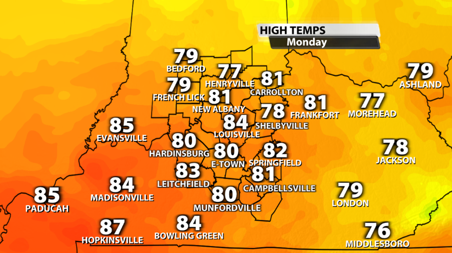
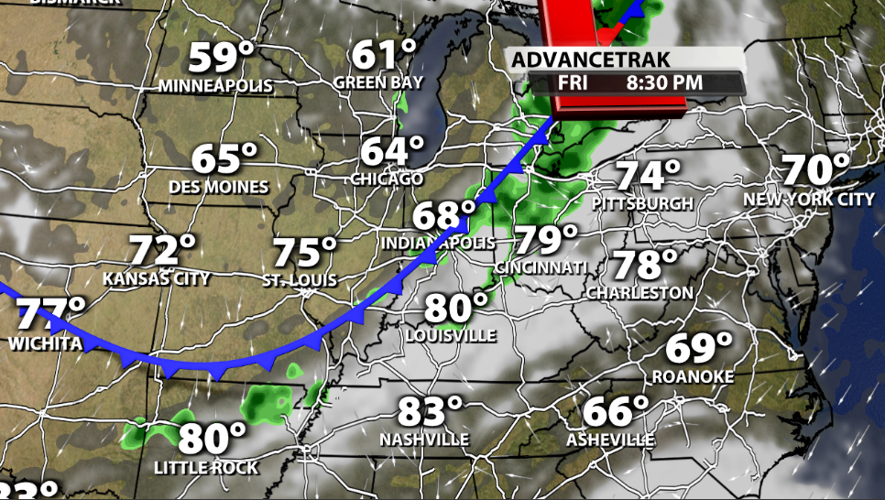
We had some cool temperatures this morning with 50s all across Kentuckiana. Now we start warming up. Highs will be in the middle to upper 80s most of this week, but don't fret. That's almost exactly where we should be during the first week of September. Another cold front will likely swing through as we head into the weekend. There will be a round of rain preceding it and cooler temperatures rolling in behind it.

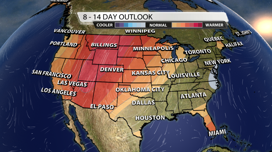
That cold front should bring us well-below average temperatures. But that extreme cool down may not last long. The Climate Prediction Center give us "Equal Chances" for above or below average temperatures next week. At this point, I do think temperatures could touch 90 a couple of times during the second week of September. But this is unlikely to last long, and it's more likely that we hold on to 80s for highs.
If you are wondering about historical weather data for Labor Day, here's a look at some of the extremes that Louisville has experienced on the holiday.
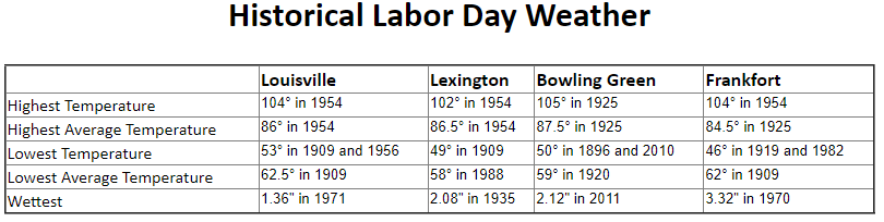
Image credit to NWS Louisville


