
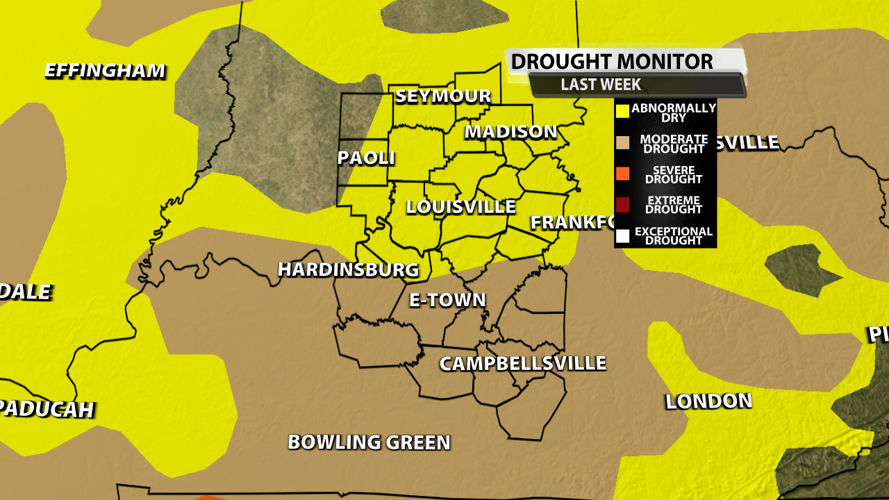


Last week, moderate drought swallowed up much of central Kentucky including areas like Elizabethtown, Leitchfield, Bardstown, Munfordville and Hardinsburg. The abnormally dry or transient drought expanded into Louisville along with much of Southern Indiana.

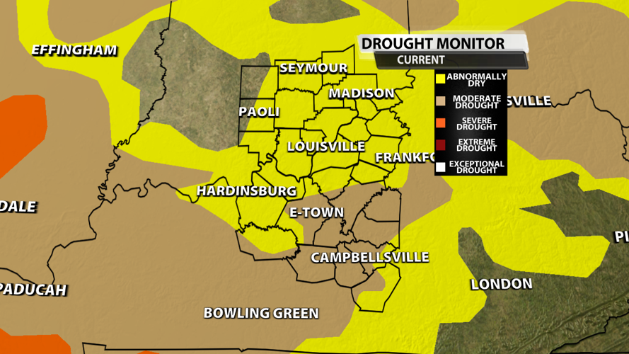
This week, many locations like Hardinsburg and Leithchfield were removed from moderate drought due to the rain around September 4th. Abnormally dry conditions were also reduced across portions of eastern KY. However, severe drought was introduced in southwestern Kentucky. That is a sign of what's to come.

Drought conditions are likely to worsen as above normal temperatures and little to no rainfall are expected in the near future. Both the GFS and EURO computer models show no measurbable rain over the next 7 days. There is a slim chance for a couple storms Sunday, but most won't get a drop.

Burn bans are expanding and Rapid Onset Drought is occurring in our area. Unfortunately, it looks more and more likely that late summer drought will impact all of our area. This is not good for agriculture or your lawn.

Image Credit: NOAA
A lot of time, late summer drought occurs when we see a quiet tropical season. Sound familiar? We rely on moisture from tropical systems getting captured by storms and spread across and that's simply not happening. Trust me, I'm glad we aren't tracking major hurricanes, but it just means drought for us in the Ohio Valley.


