
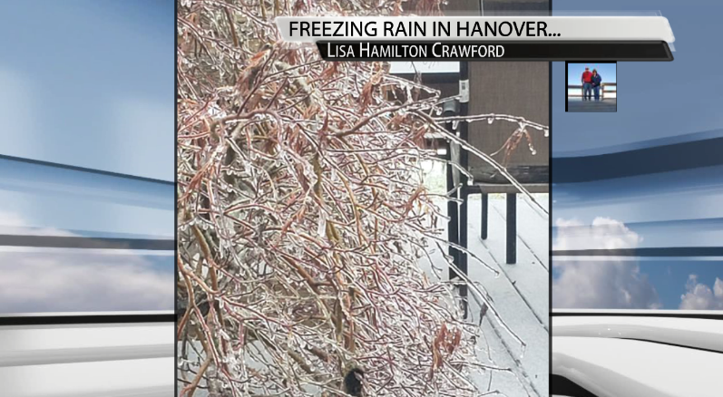
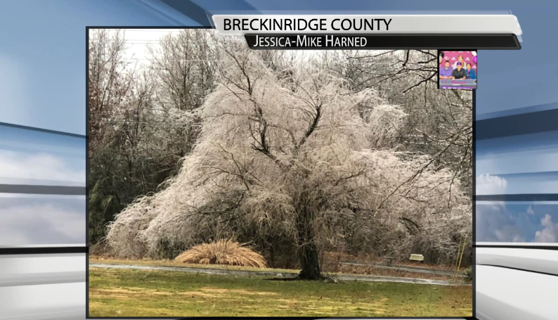
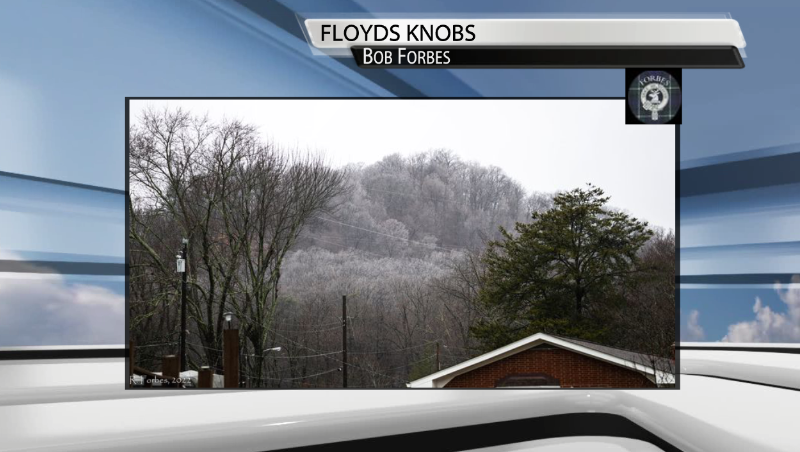
Southern Indiana has already been impacted by this winter storm this morning and into the afternoon hours. Multiple locations just across the river have already seen 0.25" of ice accumulation and more across our viewing area in Indiana.
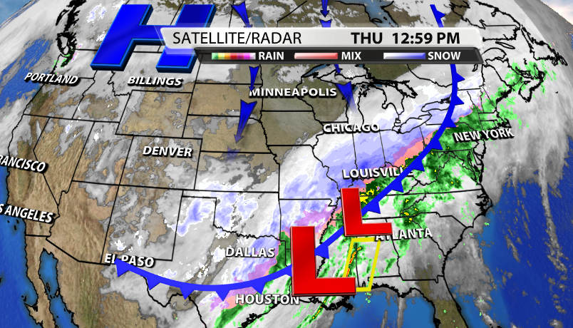
This winter storm is a huge one as well. From the Northeast down to Southeast Texas it is affected a very large portion of the United States. The cold front passing through our area overnight brings in colder temperatures coming in from the North throughout the rest of the afternoon.
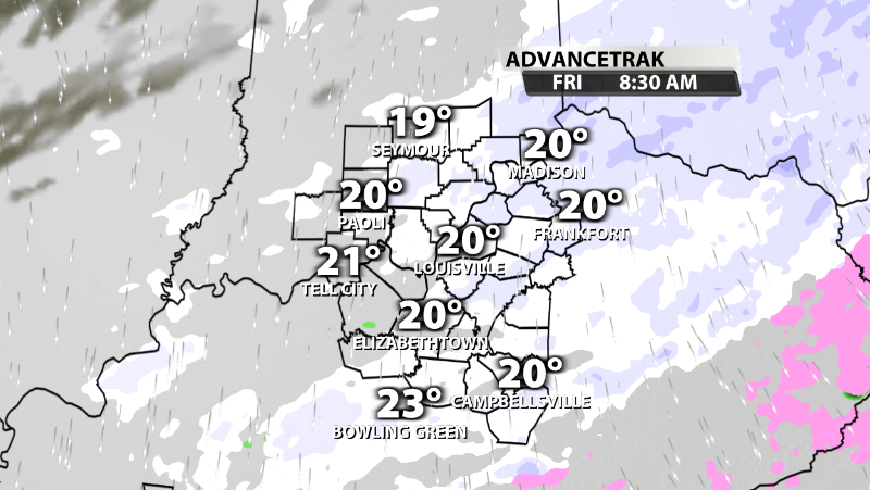
Timing
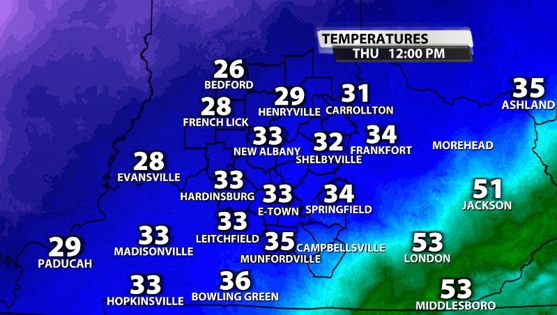
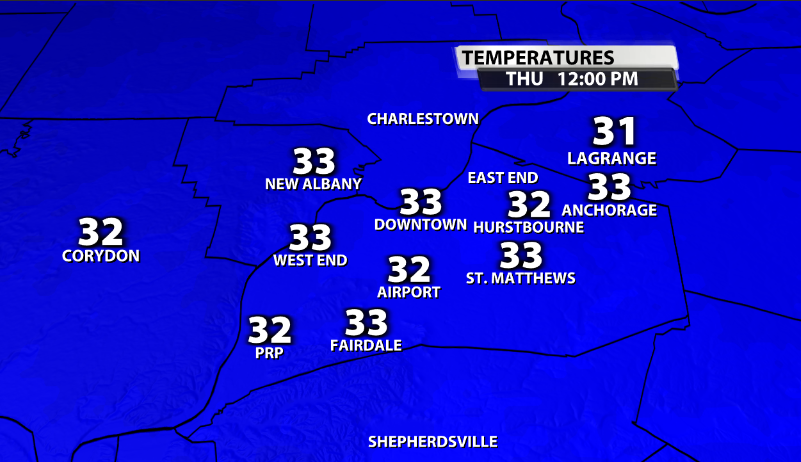
A big reason why Louisville was left out from the morning ice accumulations unlike Southern Indiana is due to literally 1 or 2 degrees. What helps part of this is the urban heat island that Louisville has as well. As you can see here, temperatures this morning are just one degree or so above freezing in the metro, while they are below in Southern Indiana, where the ice accumulation has mainly been so far.
Louisville will continue to see the transition from rain to freezing rain & sleet through the rest of the early and mid-afternoon hours as temperatures continue to slowly fall from North to South.
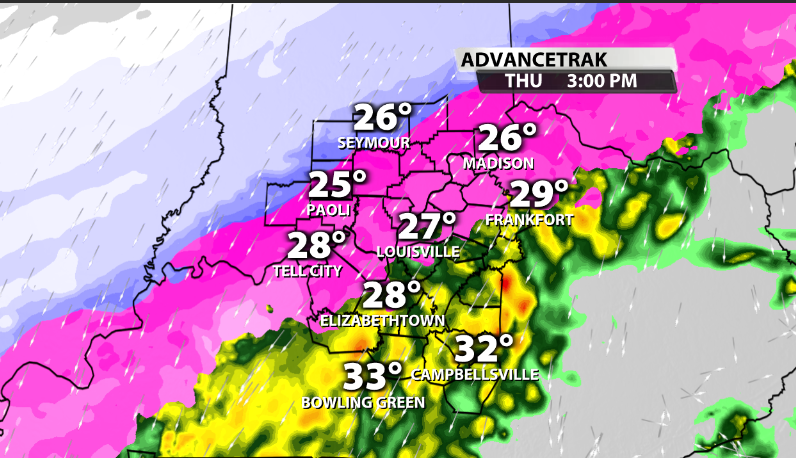
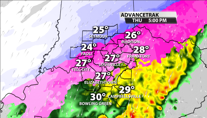
Sleet will eventually start falling instead of freezing rain heading into the latter portion of the afternoon and early evening as this system continues to push through our area.
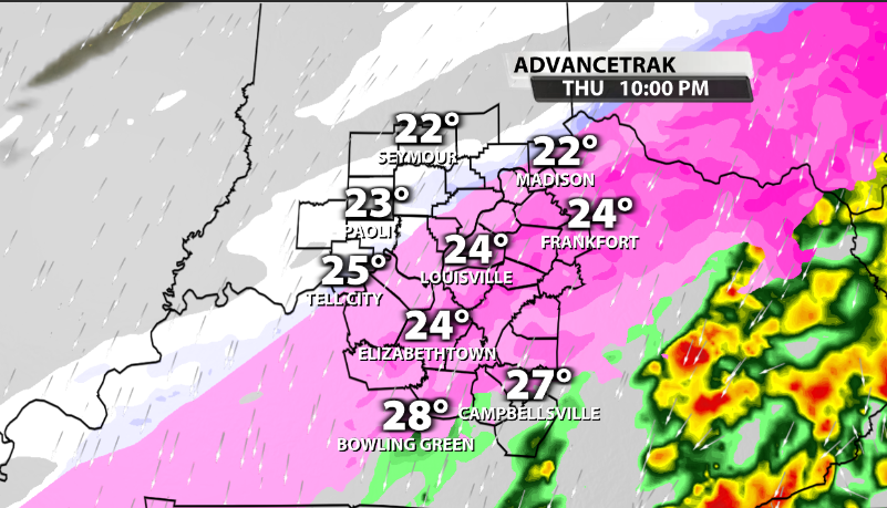
Overnight tonight, as the atmosphere entirely becomes below freezing, snow on the backside of the moisture plume will start falling during the early morning hours and likely during the morning commute on Friday.

Totals
Obviously ice and snow/sleet totals have been updated and adjusted since Louisville's temperature held on to just above freezing for so long, and that affects totals to the South as well since the front hung just North of our area.
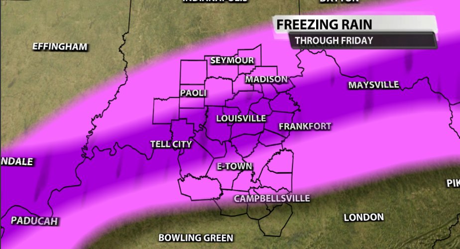
For Freezing rain accumulations...
Light Pink: This includes areas like Paoli, Madison, and down toward E-Town and Greensville, should expect up to .20" of ice.
Purple: The purple area which includes all of our Southern Indiana communities along the river, Louisville Metro, and down to Shelbyville, can see .20 to .50" of ice accumulation. The upper half of that range will likely occur in our Southern Indiana communities who have already seen some accumulation from this morning.

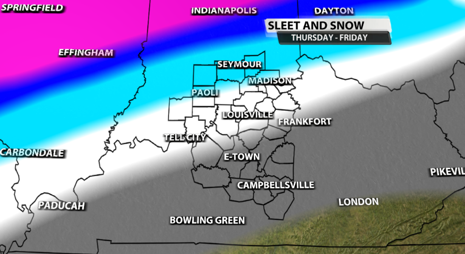
When it comes to snow and sleet on top of the ice, here's the latest update:
In our viewing area,
Light blue: This includes areas like Seymour, Madison, Jasper, and Paoli, can expect 3-6" of sleet/snow.
White: This includes Metro Louisville, Jeffersonville, Charlestown, and Lagrange, can expect up to 2" of sleet/snow.
Grey: This includes E-Town, Bardstown, and Campbellsville, can expect under 1" of sleet/snow.


