
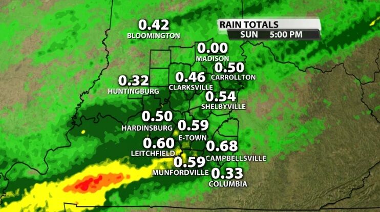
The off and on rain was more on than off Sunday. We saw more rain than dry times, especially as we get farther into the evening. The rain totals below represent how much rain fell between 12 AM and 5 PM Sunday. Rain is still falling so these totals will rise before the end of the day.
The same cold front we've been talking about for days is still stretched across our region which is why the rain is still here.
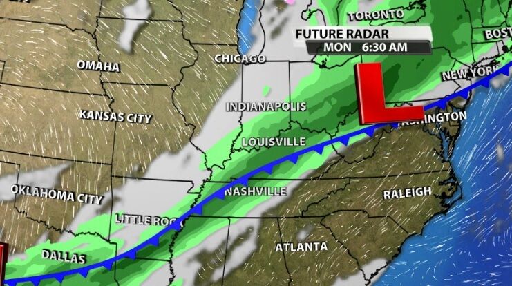
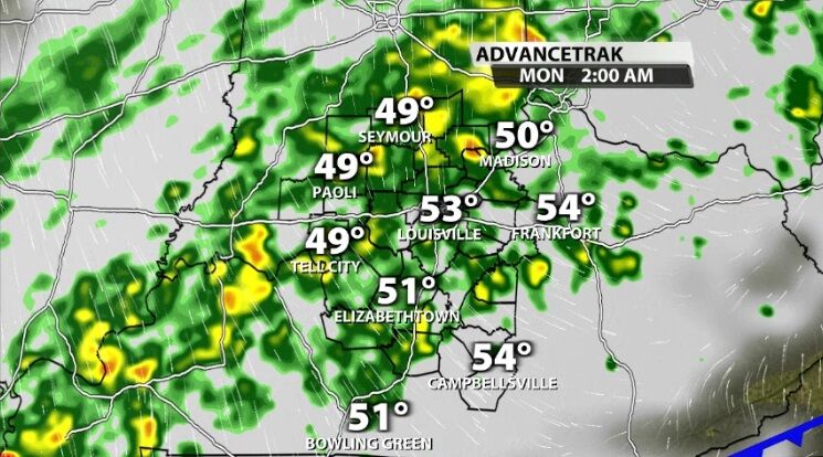
Overnight showers will continue to spread across our communities with mainly light to moderate rain.
By the time most of you are getting up and starting your day Monday, we should start to see some of the rain thinning out and fading from our far northwestern communities.
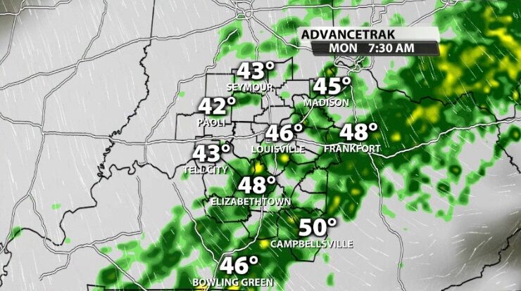
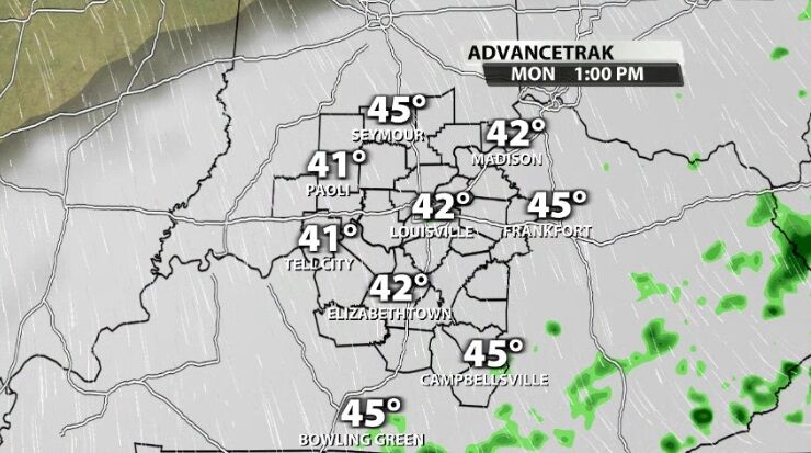
The rain will continue to fade away to the southeast and should be out of our area by the early afternoon.
The clouds will be slower to clear, though. Those should start to break overnight allowing temperatures to drop even lower than they otherwise would have by Tuesday morning.
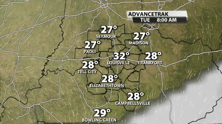
Temperatures will be in the low 30s around Louisville and the middle and upper 20s outside the city which should end the growing season. Remember our area is under a Freeze Watch for Tuesday morning.

Temperatures heading into Monday evening and Tuesday morning will start to trickle on down a…


