
Temperatures continue to climb back near 80 for many of us today again as we continue to remain very dry across Kentuckiana. We're over 2.5" short this month on rainfall and even more than that over the past 40 days across our area, with less than 1/4" of rain.
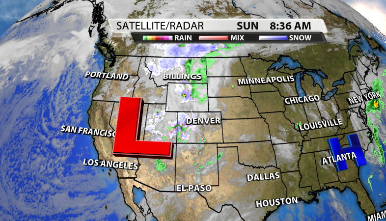
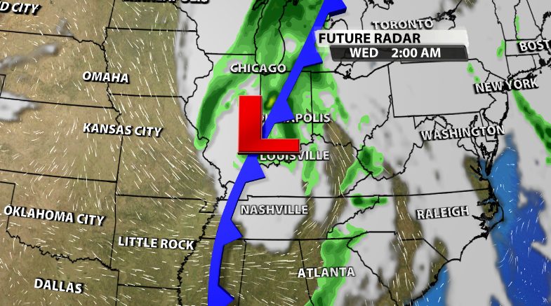
Our next system is on the way though, which is good news because it looks like it will bring at least some measurable rainfall for a good portion of us later this week. The low pressure helping to bring our next, much needed, and only rain chance this week is now in the continental US and will make it's way toward our area over the next 48 hours.
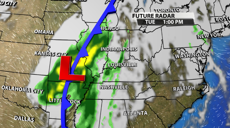
We'll start to see the effects of this system on Tuesday. As it approaches us, a few light showers are possible during the afternoon on Tuesday. However, that rain chance grows as we head into the evening and definitely the overnight hours Tuesday night.
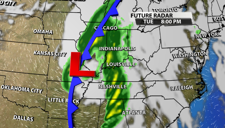
As the low moves across and out of our area by Wednesday morning, a few lingering showers will probably be left behind it as well for some of the day on Wednesday.
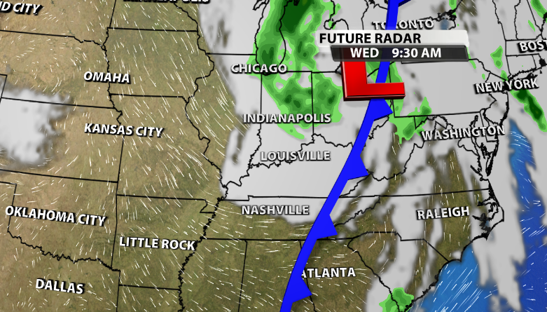
We aren't expected severe weather with this system, as that is most likely in the deep South. While this system has a good amount of energy with it, it will be weakening as it approaches our communities as of now, not strengthening. That means that rain totals will be favoring the higher amounts West of I-65.
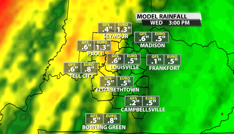
While this won't completely fix our drought that we're currently in, at this point we will take what we can get as we are just so short in terms of rainfall.


