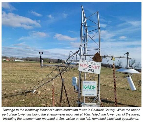

December 10th is a day Kentuckians won't soon forget after a destructive, long-track tornado crossed through our state. Experts met recently to discuss a measured wind gust that occurred that night and how it measures up against state records. The night of December 10th, two Kentucky Mesonet weather stations were in the path of a tornado. That means wind speed around that tornado was measured instead of estimated, an important distinction when keeping official records. Very often during severe weather, trained spotters send in reports of estimated wind speed. That's why storm spotter training through the National Weather Service is so important because it tells us the estimation from the spotter is close to accurate and helps the spotter estimate correctly.
But let's get back to the story - the old record for strongest wind gust in Kentucky was 100.8 mph, also measured by a Kentucky Mesonet station in Calloway county. That happened on April 26, 2011. Fast forward to December 10, 2021 and, "the storm struck at least two Kentucky Mesonet sites, producing measured wind gust speeds higher than any previously known in Kentucky," according to the report release from this meeting of experts.
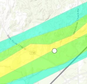
The first Mesonet station is in Graves county, 5.7 miles southwest of Mayfield. The white dot above represents that station, the color shading is the track of the tornado and intensity of winds. Blue is EF-0 magnitude winds, green is EF-1, and yellow is EF-2. That station measured a wind gust of 107.1 mph at 9:24 PM Central time the night of December 10. That wind sensor is 10 meters above the ground which is almost 33 feet. You can see that data in the graph below, but keep in mind, wind speed is measured in meters per second then converted to miles per hour. The station actually recorded a gust of 47.89 m/s for at least three seconds.
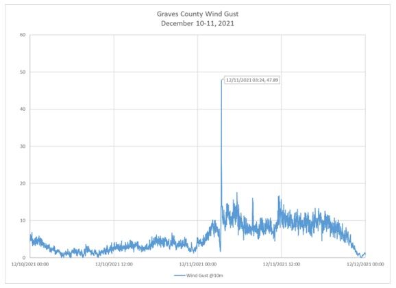
The report adds that this wind gust could have been from the tornado itself or "possibly a rear flank downdraft, according to analysis by NWS Paducah." That gust was strong enough to break the old record, but the storm was still going.
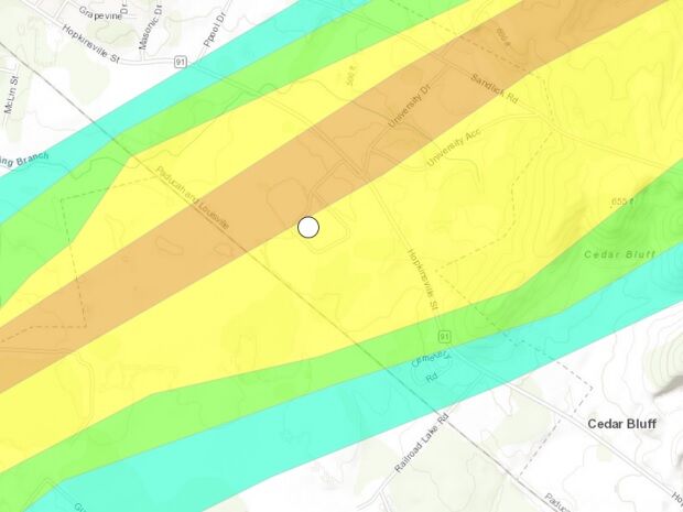
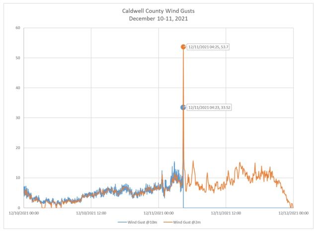
The next station in the path of the tornado was in Caldwell county, 1.5 miles southeast of Princeton. The storm arrived there at 10:25 PM Central, about an hour later. This station gives even more interesting data because there was a wind sensor at 10 meters (like the first one), but there was a second wind sensor only 2 meters off the ground (closer to 6 feet) where we actually feel the wind down here on the ground. The top sensor recorded a wind gust of 75 mph before it stopped reporting. The lower anemometer kept reporting and measured a wind gust of 120.1 mph as the storm passed.

Since this was such a strong gust, the equipment was all checked out after the storm passed and seemed to be working properly. In fact the tower holding this equipment was damaged during the storm, prompting the need for additional accuracy checks of the sensor that continued reporting. Again, this measurement was actually taken in meters per second, so the official measurement is 53.7 m/s. This data demonstrates how important the Kentucky Mesonet program is and the importance of placing the measuring sites across the Commonwealth.
It's pretty hard to argue with the data when it was recorded so well, but there is a question about the difference between wind gusts and tornadic wind. During this meeting, "the team discussed the question of whether a wind speed measured in a tornadic circulation was appropriate to be counted as a record wind gust. While the phrase 'wind gust' may initially evoke the thought of straight-line winds, it was felt that a measured wind speed, regardless of the meteorological cause, was fitting for this category of record wind." All of that to say, we have a new record for strongest wind gust in Kentucky: 120.1 mph on December 10, 2021; a day (or night) we will not soon forget.
Image Credits: State Climate Extremes Committee and National Oceanic and Atmospheric Administration


