
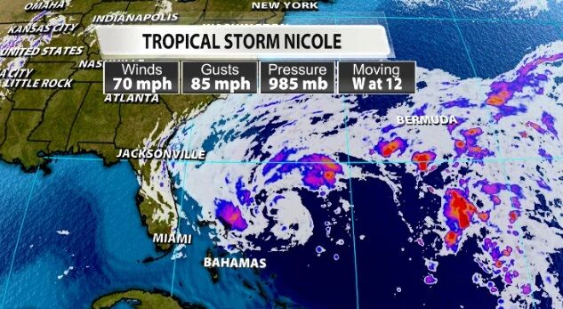
Tropical Storm Nicole made its first landfall on Great Abaco Island just before Noon Eastern Wednesday with an estimated intensity of 70 mph winds.
Flooding has already begun in parts of Florida as you can see in the time-lapse video below from St. Augustine.
Heres a time-lapse of the high tide / #stormsurge flooding from the Saint Augustine, #Florida livecam today from #TropicalStormNicole. This was recorded for about a little over an hour and its now actually starting to recede as the tide goes down. #flwx #Hurricane #Nicole pic.twitter.com/aPijBxsND2
— BirdingPeepWx (@BirdingPeepWx) November 9, 2022
In fact, do you remember NASA's Artemis mission that was supposed to launch in September and has been delayed a few times? It was scheduled to launch early Monday morning, November 14, but that has now been delayed until at least Wednesday, November 16, because of this storm.
As teams continue to monitor Tropical Storm Nicole, we've decided to re-target the launch for the #Artemis I mission to Wednesday, Nov. 16, pending safe conditions for employees to return to work. https://t.co/08yHOd2a17 pic.twitter.com/QfWhjyTlE7
— NASA (@NASA) November 8, 2022
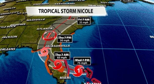
Nicole is forecast to briefly become a hurricane before making landfall on the east coast of Florida overnight between Wednesday and Thursday. It should quickly weaken to a tropical storm after making landfall, then curve north and weaken further.
That's where the remnants of Nicole will start to impact us. A cold front will slide across the central United States; remember, a cold front is like a wall between two different kinds of air. So this "wall" will keep the tropical moisture in front of it.
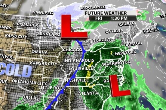
The placement of this front at the time the moisture arrives will dictate who gets rain and who gets nothing. Forecast models don't agree on how much rain is possible here because we are on the extreme edge of the rain. Heavier bands of rain are always possible with tropical moisture, but if we are on the outer edge, it's less likely we would see those heavier bands.
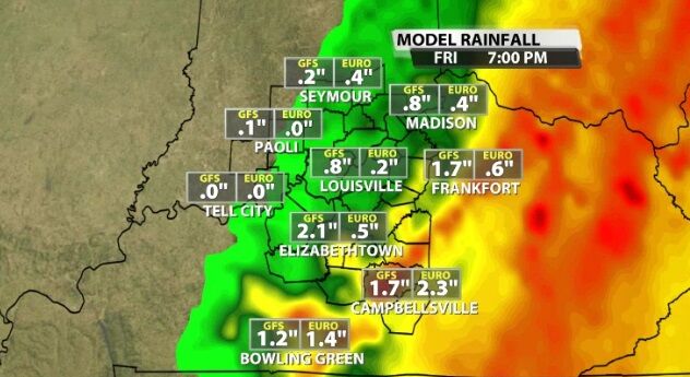
Tune into WDRB News tonight between 4 and 7 PM and again 10 PM to see updates from the National Hurricane Center on Nicole and hear our thoughts on how far west this rain will reach.


