
Do you remember the historic and major winter storm that affected much of the Ohio Valley 21 years ago today? Two bursts of heavy snow, separated by a few hours, brought over two feet of snow across several counties north of the Ohio River in southern Indiana.
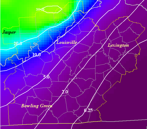
Credit: NWS This map shows an approximate analysis of snow and/or ice accumulations, in inches, across the NWS Louisville area of responsibility.
Interstates 64 and 65 across southern Indiana were closed for a number of hours during this storm. Snow totals of 30 inches or more were measured across portions of Washington, Jefferson, and Scott counties. Further south, an amazing 6 inches of sleet fell in one location across Henry County.

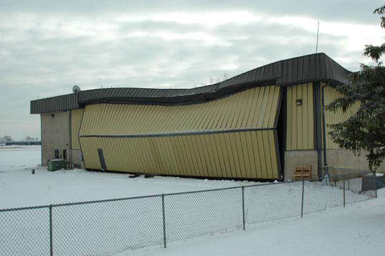
Credit: Damaged Elizabethtown airport hanger, due to heavy ice accumulations during 22-23 December 2004 winter storm. Steve Townsend, Elizabethtown
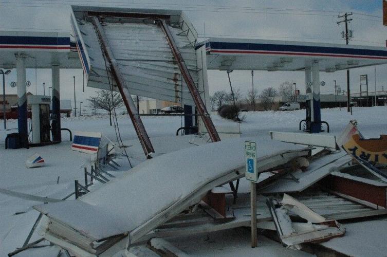
Significant sleet accumulations also fell on the Louisville metro area. Thundersnow and thundersleet were observed during this event, with snowfall rates approaching 4 inches per hour in some southern Indiana locations. Across central Kentucky, freezing rain brought up to an inch and a half of ice across an area from Bowling Green through Nelson County. Ice accumulations caused considerable tree and some structural roof damage in Hardin and Nelson counties.

Credit: A collapsed gas station roof in Elizabethtown due to ice accumulations (Dec. 2004) Tom Williams, Elizabethtown


