
Well folks...it wouldn't be the week leading up to Derby (or the week of Derby at that matter) without increasing rain and storm chances. We've got some KDF events coming up in a few days and then of course all the days at the track next week. Let's first dive into what we know about the events for the end of the week, and then take a sneak peak at what Derby week could throw at us.
Balloon Glow 1(Thursday) & 2 (Friday)
There are two "Great Balloon Glows" this year. The first is on Thursday night and the second on the normally scheduled Friday night. If you want to go to one and avoid any rain completely, Thursday is your option. Here's why...
Tomorrow (Thursday) will likely be the warmest day of the week. Highs are set to reach the low-mid 80s, and....we don't have a rain chance. The glow begins at 9pm, and by then we'll be dry with temperatures in low-mid 70s.
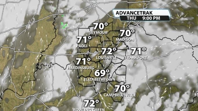
Balloon Glow 2 on Friday is typically the more popular one, but you're going to be flirting with rain and storms rolling in. A dying front will be approaching our area on Friday evening.
These storms won't have much wind energy to work with but will have some instability to use, so thunderstorms are likely and a rogue strong one can't be ruled out. These are likely to move in sometime after around 8PM. That time will change a bit between now & then.
Mini/Marathon
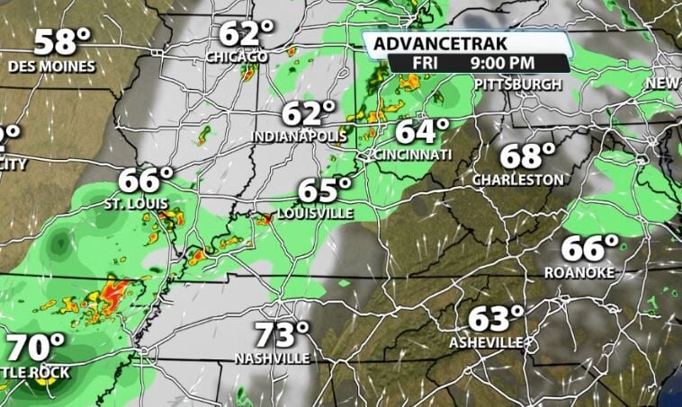
The Mini & Marathon are big events for locals every year with thousands of runners participating. Saturday isn't completely clear in terms of confidence in the forecast, but there is a chance lingering showers/storms could impact the races.
As that dying front on Friday goes by, it lays down a boundary in our area. Some data is showing another low pressure rolling in behind it, which could lead to more rain/storms for the morning and perhaps linger it into the afternoon as well.
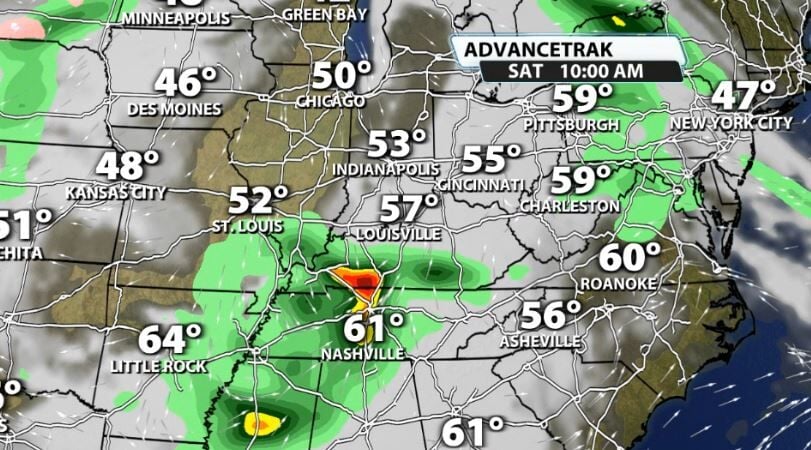
Not all data is showing this, so confidence is lower at when we'll get rid of the rain Saturday, but know that it is a potential to see some of those showers/storms linger for the morning.
Monday
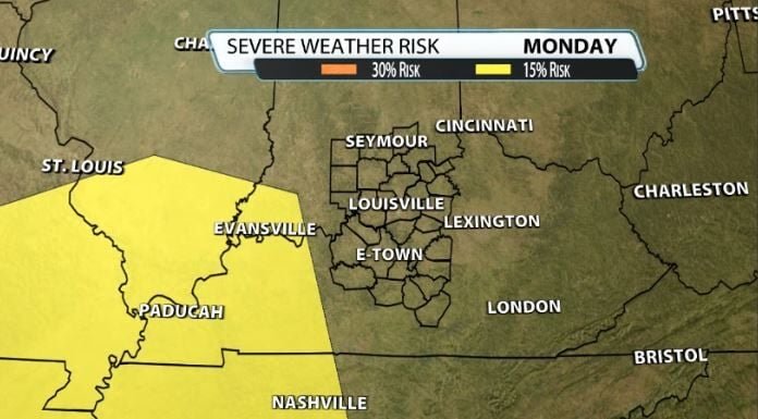
Monday brings yet another chance of storms, this time perhaps some strong storms to our area. We're still far away from this, so there are a lot of details to be determined, but a strong system will be rolling into our area Monday evening that could produce strong to severe storms.
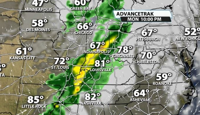
The SPC previously had us under a severe risk already for Monday, but that has since been pulled further west. We will need to keep an eye on this one as it rolls in Monday.
Derby Week
Past Monday, things are a lot more blurry. That, naturally because of how far away it is, but we can still get somewhat of an idea of what's to come. With closed low pressures moving toward our area Derby week, it makes it very complex when dialing in rain chances.
Here's what the trends are leaning towards; scattered rain chances and cooler weather, especially for Derby day.
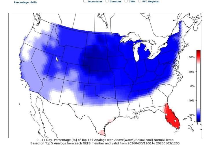
There will likely be a couple or few days during Derby week that will have rain chances with it. Which will be the highest, is still TBD. However, a lot of data continues to show below-normal temperatures being likely leading up to Derby Day. You can see the 9-11 Day Temperature outlook from CIPS analogs shows a strong signal of cooler than normal temperatures in our area, around an 84% chance. That is valid for the dates of 4/30 to 5/3.

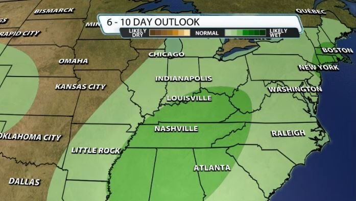
We can look at the CPC's 6-10 Day Precipitation Outlook (valid for dates 4/27-5/1) and see the likelihood for above normal rainfall in our area as well.
So while rain chances are not known for specific days just yet next week, it's likely some of them will have rain.


