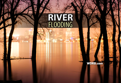

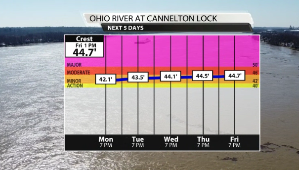
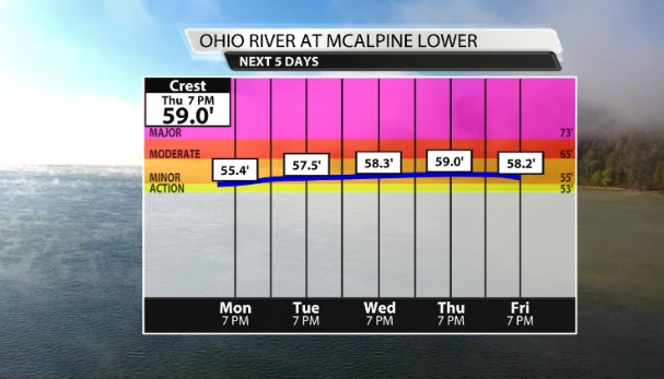
What an insane turn of events this weekend! We dealt with life-threatening flooding, strong thunderstorms, and heavy snow all within 24 hours. Even before this storm, the rivers, streams, and creeks were already running high and the ground was saturated. It's no surprise that we now have minor flooding up and down the Ohio. These are the areas impacted and closed along the McAlpine Upper, McAlpine Lower, and Cannelton Lock as of this Monday evening forecast...
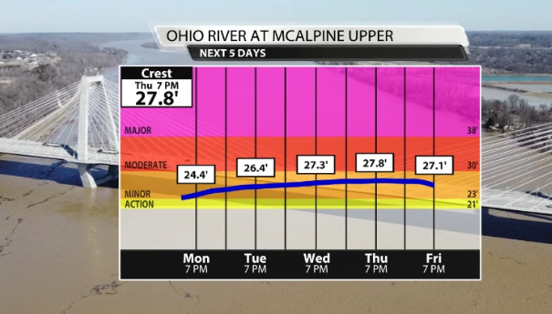
27' - River Road floods at many locations from 3rd St. to Glenview. Blankenbaker Lane closes south of River Road. River Dell Rd. floods at Mellwood Ave. Riverside Dr. floods at many locations.
59' - Overbrook Rd. floods south of Lake Dreamland Rd.
42' - Agricultural flooding begins near Cloverport and Cannelton. Highway 66 floods near Derby and Dexter. Rocky Point Girl Scout camp is affected.
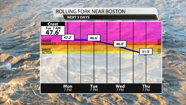
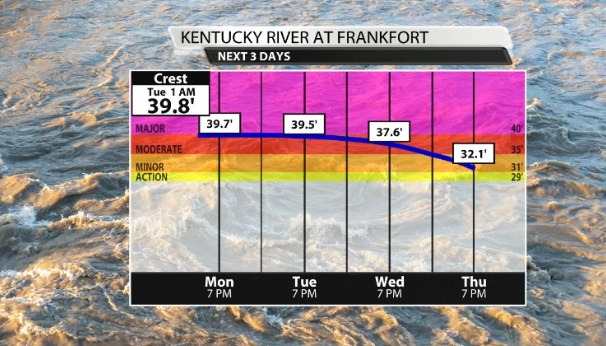
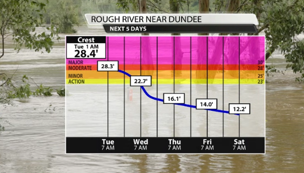
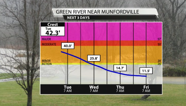
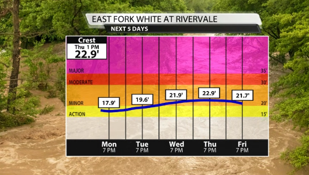
The Rolling Fork near Boston, the Kentucky River at Frankfort, Rough River near Dundee, the Green River near Mundordville, and the East Fork White at Rivervale are all dealing with some degree of flooding. Pick out which one you live or drive by and the hydrographs below display when the crest is forecat to happen, plus how high the water will get. Please avoid flooded roads at all cost!


