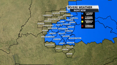
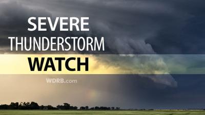
The Storm Prediction Center and National Weather Service have expanded the Severe Thunderstorm Watch to include more of our WDRB communities. This will remain in effect until 7 PM.

Below is the text issued by the SPC with this Watch:
  The NWS Storm Prediction Center has issued a

   * Severe Thunderstorm Watch for portions of
     Far southeast Indiana
     Central to eastern Kentucky

   * Effective this Wednesday afternoon and evening from 310 PM
     until 700 PM EDT.

   * Primary threats include...
     Scattered damaging wind gusts to 65 mph possible

   SUMMARY...Trailing thunderstorms along the Ohio River may form into
   a cluster as it spreads eastward across parts of central to eastern
   Kentucky into early evening.

   The severe thunderstorm watch area is approximately along and 30
   statute miles north and south of a line from 30 miles west southwest
   of Louisville KY to 105 miles east of Lexington KY. For a complete
   depiction of the watch see the associated watch outline update
   (WOUS64 KWNS WOU3).

   PRECAUTIONARY/PREPAREDNESS ACTIONS...

   REMEMBER...A Severe Thunderstorm Watch means conditions are
   favorable for severe thunderstorms in and close to the watch area.
   Persons in these areas should be on the lookout for threatening
   weather conditions and listen for later statements and possible
   warnings. Severe thunderstorms can and occasionally do produce
   tornadoes.


