
Ahead of afternoon and evening storms, the Storm Prediction Center has issued a Severe Thunderstorm watch for part of our area. This is in effect until 8PM. Here's who it includes:
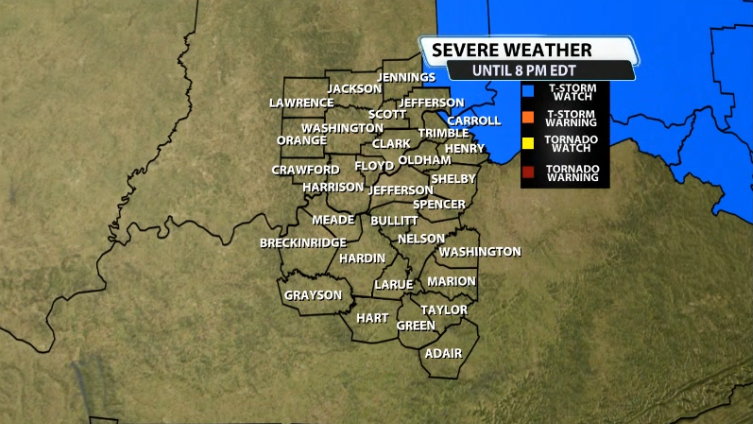
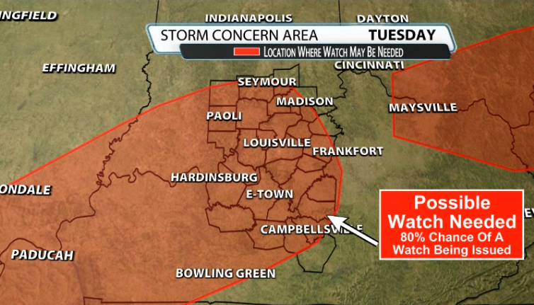
For now, it's only Carroll county, but we will very likely see a separate watch for the rest of us very soon. The SPC has noted that this other highlighted area has an 80% chance of seeing a watch soon as well. Be on the lookout for that to be issued.
Here's more specifics from the SPC & the NWS on the watch for Carroll county included in it:
The NWS Storm Prediction Center has issued a
* Severe Thunderstorm Watch for portions of
Far Southeast Indiana
Far Northern Kentucky
Central and Southern Ohio
Southwest Pennsylvania
West Virginia
* Effective this Tuesday afternoon and evening from 110 PM until
800 PM EDT.
* Primary threats include...
Scattered damaging wind gusts to 70 mph likely
Scattered large hail events to 1.5 inches in diameter possible
A tornado or two possible
SUMMARY...Thunderstorm coverage is expected to increase this
afternoon as a pre-frontal trough and associated cold front moves
through the region. Overall environmental conditions favor strong to
severe thunderstorms, with a linear convective mode favoring
damaging gusts as the primary risk. Low-level shear is also strong
enough to support a low-probability risk for a few brief,
line-embedded tornadoes as well.


