

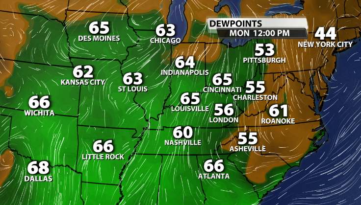
A big change from our Sunday. Winds have shifted out of the direct South, and at a good speed, gusting to around 25mph at times. This wind direction is causing an influx of much more moist and muggy air into our area. So before you even see storms, you'll feel the difference with dewpoints in the mid to upper 60s today.
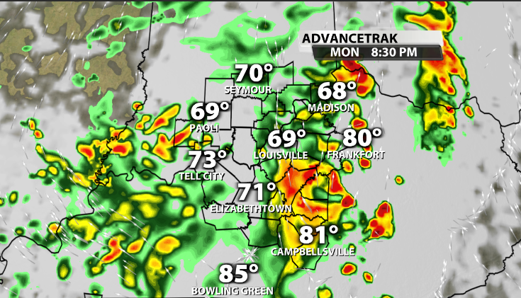
Storms will use this low level moisture to help feed into making them a bit stronger later this afternoon and into this evening. We continue to see more pop-up like thunderstorms.
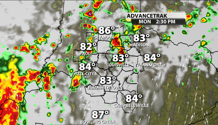
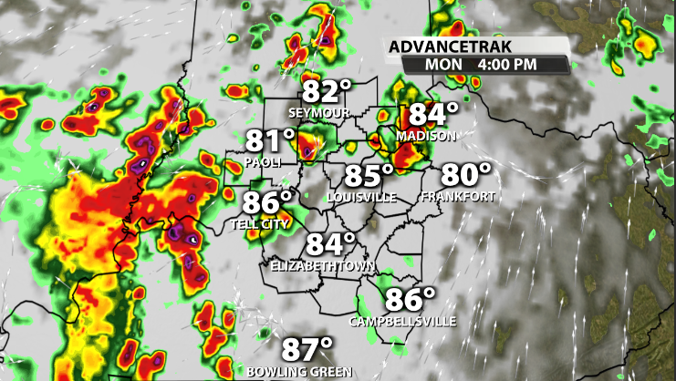
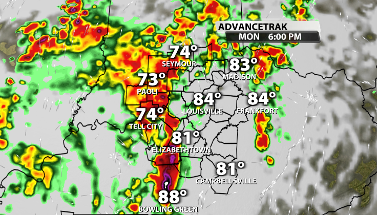
Heading into the late afternoon and evening time that becomes more widespread. This is when we could see more stronger storms across the area.
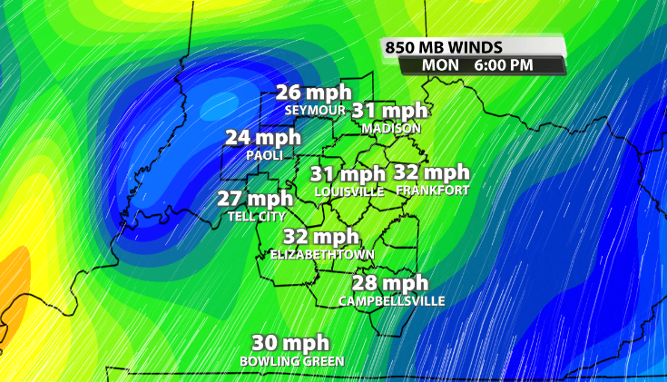
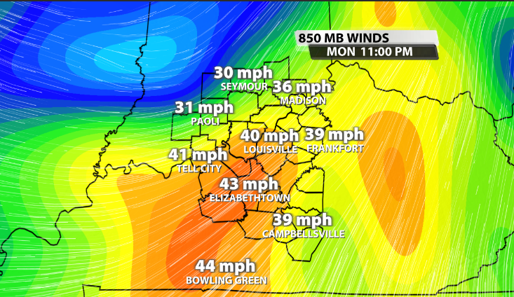
We've got a few things working in favor of stronger storms later today. The main influence we have for these storms to become stronger is wind shear, or wind energy. We typically need around 40mph or greater at the 850mb level of the atmosphere (what this graphic is showing). We will have sufficient wind energy for parts of the area heading into this evening.
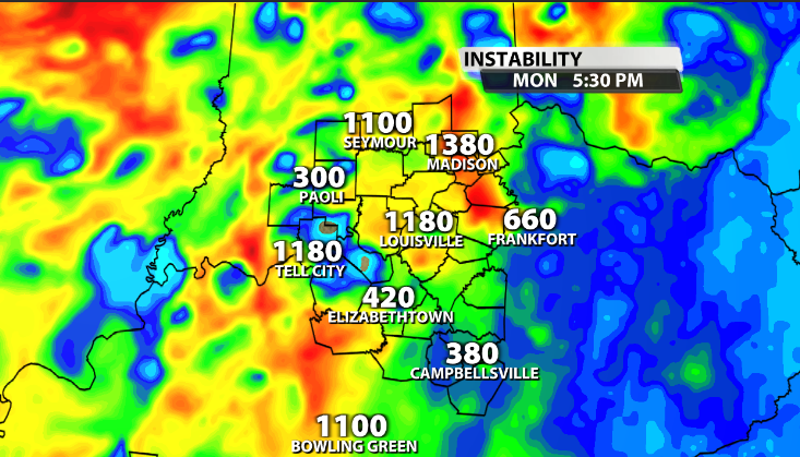
We also need storm energy or fuel, scientifically known as CAPE. While we will have some in place, a lot of what CAPE will be available will depend on where storms move through before the main line. Areas that stay dry until the widespread storms arrive this evening, will have more storm fuel available.
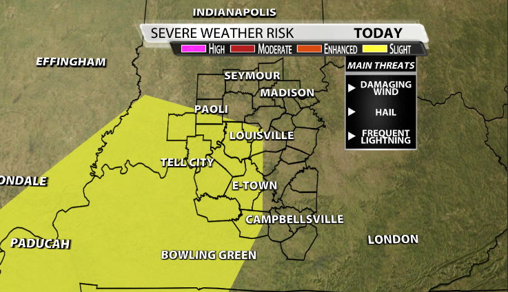
With all of this being considered the SPC has locations along and West of I-65 in the Slight (2/5) category for severe storms this evening, with the main impacts being damaging wind gusts, frequent thunder and lightning, and small hail.


