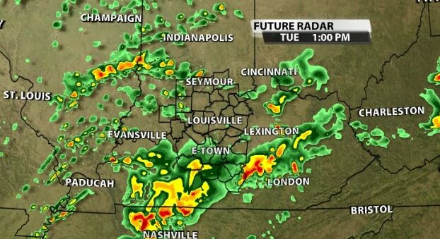
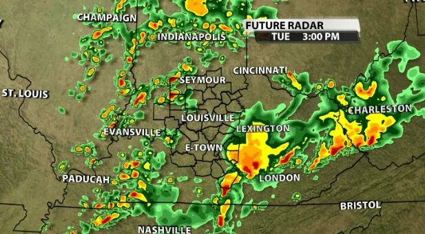
A level 4 out of 5 risk of severe storms covers a large part of our area now as additional rounds of storms will move through this afternoon and tonight.
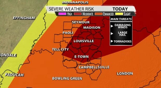
All threats are still on the table as a cold front sweeps through our area tonight. The atmosphere is destabilizing this afternoon, meaning storm energy is building. The strongest storms will bring hail, tornadoes, and damaging wind gusts in addition to the heavy rain and thunder/lightning all thunderstorms will bring us today.
TIMING
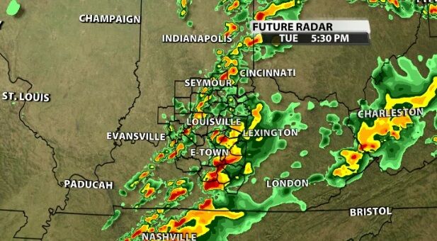
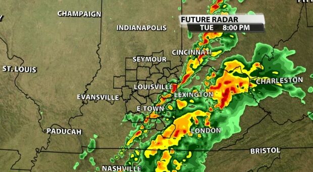
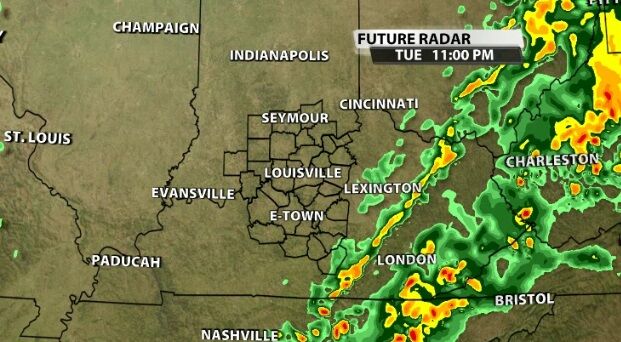
The risk of the strongest severe storms is highest in southern and central Kentucky, but that may shift as we watch conditions develop this afternoon. Tune into WDRB News this afternoon to see the latest data and hear live analysis from our meteorologists.


