A level 4 out of 5 risk of severe storms covers a large part of our area now as additional rounds of storms will move through this afternoon and tonight.
From
To

Highway 36 will remain closed to all traffic except residents and emergency responders

Top Story
Strong storms moved through parts of southern Indiana on Thursday afternoon.

The Storm Prediction Center has issued a Severe Thunderstorm Watch for most of our area Saturday until 11 PM.
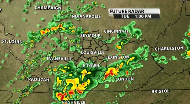
Severe storms are moving through our area this morning and rounds of strong storms will plague our area for the next few days.

We just finished a conference call with the National Weather Service to their local partners to discuss more about the threat of severe storms tonight. Here's a summary of what we talked about in that call:

Sunday continues to look like a good candidate for some strong thunderstorms in our area.

The Storm Prediction Center has issued a Severe Thunderstorm Watch for part of our area until 10 PM Central (11 PM Eastern).

Top Story
Some areas saw baseball-sized hail.

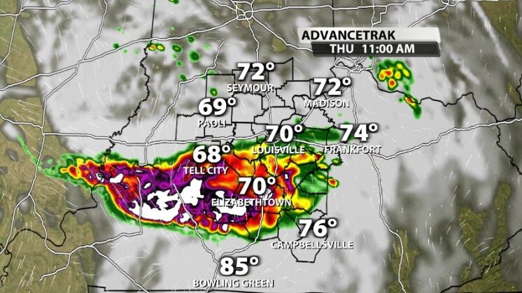
We saw strong storms move through our area Sunday, and there are more on the way for Monday. The storms Monday look like they will be stronger than Sunday, so let's break down why and when to expect them in your community.