


A cold front just rolled across Kentuckiana today, but its impacts won't be felt for very long. Let's talk about when temperatures could soar into the 90s!

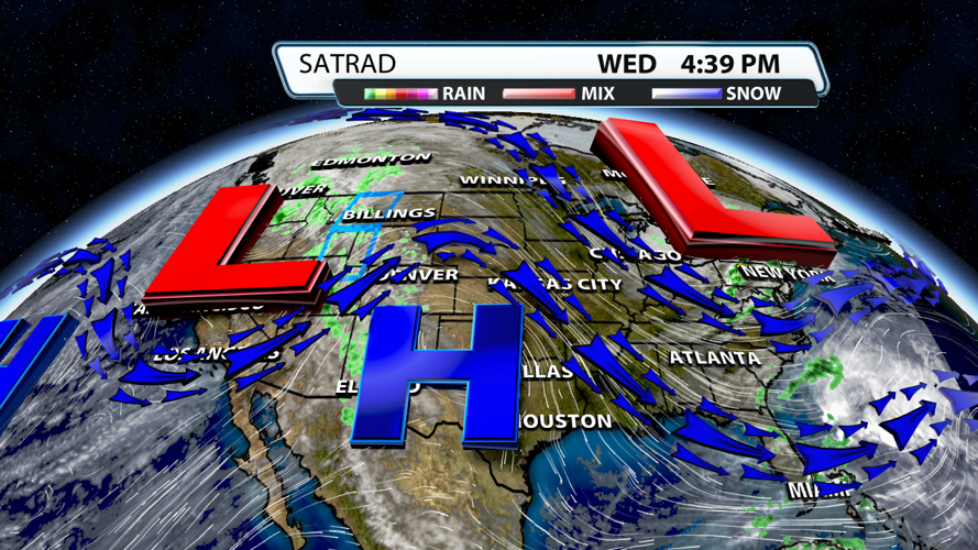
The trough (red L) currently sitting over the Great Lakes, the Ohio River Valley, and the Northeastern U.S. will usher in much cooler air for tonight and tomorrow. Temperatures could end up in the upper 30s in our coldest spots on Thursday morning. It's the ridge of high pressure over the Southern Plains that will move east and bring us much warmer air for the weekend and early next week.

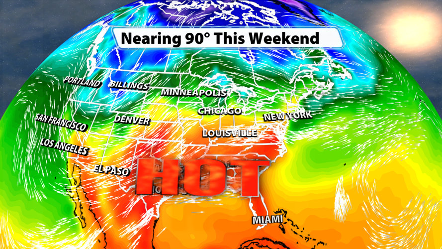
It's not hard to determine where the warmest temperatures should be this weekend when you look at the above graphic. The orange and red colors across our region and across the Southeastern U.S. are associated with the incoming ridge and indicate surface temperatures in the middle 80s to low 90s on Saturday. Southwesterly and southerly flow will aid in ushering in the significantly warmer air this weekend and early next week.

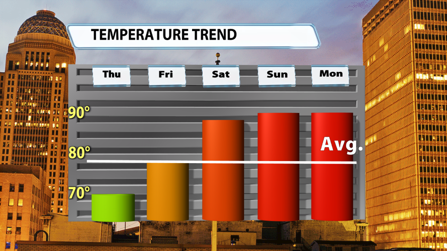
As mentioned before, the trough does have influence, but only for a day or two. Temperatures on Thursday will struggle to move out of the 60s. This is almost 10 degrees below seasonal norms. Friday will quickly warm back to where our highs should be this time of year. Saturday, Sunday, Monday, and even Tuesday will likely be 5 - 10+ degrees warmer than what we expect to see at this point in May.


