The Storm Prediction Center has expanded the "Slight Risk" for severe weather for today again. A slight risk is a level 2 out of 5 and means severe storms are not widespread with varying levels of intensity. This threat of severe weather is based on how much instability is able to develop by the afternoon and evening. At this point, instability is not very high, but has been slowly building. This means there could still be a few storms with damaging wind gusts and hail, but the atmosphere has to overcome this current lack of instability. We also need some dry time between our current round of storms and the wave later today in order to do that.
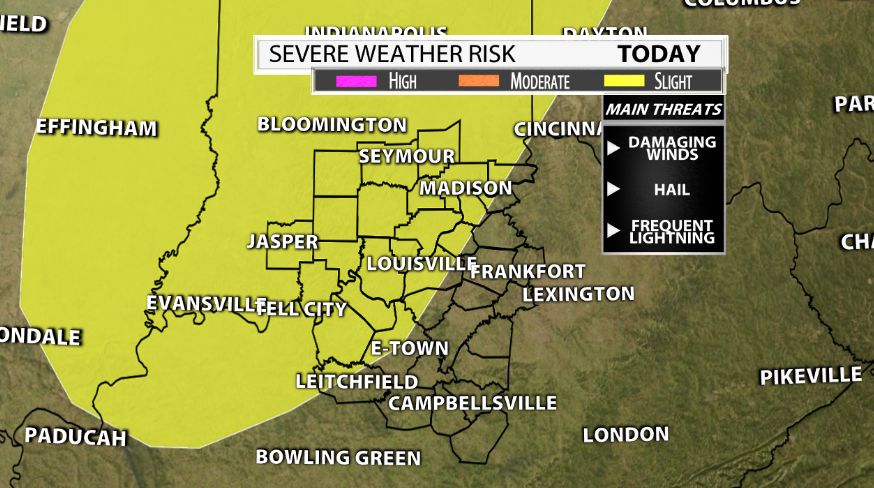
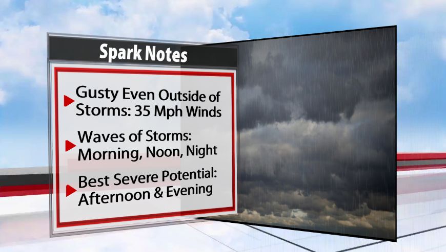
There is plenty of wind energy today. Winds will be gusty regardless of storms. Expect wind gusts of about 25-35 mph. There is a wind advisory for one county in the WDRB viewing area: Carroll County until 8 pm, where winds could gust faster. If instability increases to the level models are projecting (at least 1000 J/kg of CAPE) a few strong to severe storms are certainly possible with the wind energy present. The main threat to prepare for is damaging straight line winds. Secondary threats are frequent lightning, hail, and localized heavy rain. While the tornado threat is never completely off the table, it is a lower threat and would be very isolated.
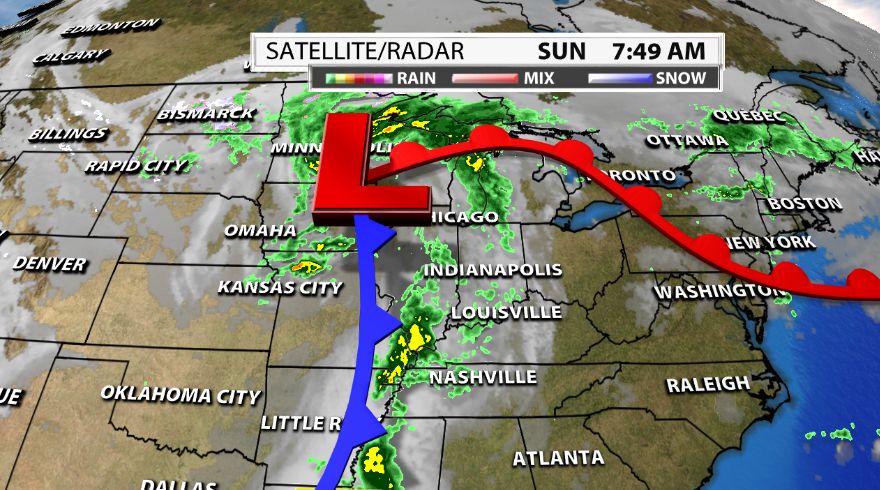
A cold front is the catalyst for storms. It will slide through tonight whether we get severe weather or not. It will drop our temperatures by tonight. It is already cooler today, thanks to extra clouds and showers around. However, once the front moves through, it will be even cooler. Highs tomorrow will be in the mid 70s! Lows by Monday night and into Tuesday will drop into the 50s. The cool down is brief though. We have more 90s in our near future.
Timing:
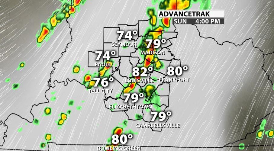
We have already seen a few light showers this morning. That was round one. That brought extra cloud cover with it and traveled from the plains in the last 24 hours. It weakened considerably during that time. The second round is moving into our western counties now (late morning and early afternoon). It came from AK/MO. This has some moderate rainfall and lightning. It is progressing NNE and there could be heavy rain with periods of reduced visibility and some lightning.
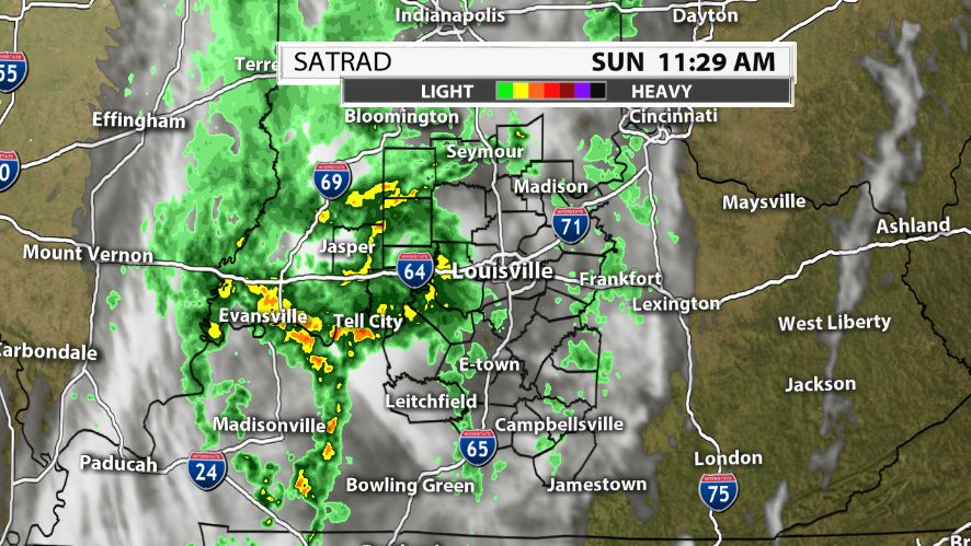
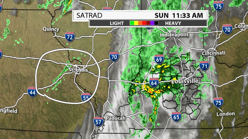
The idea for the afternoon and evening is for storms to develop ahead of the cold front. It is starting now. It is the showers near St. Louis, circled below and more should develop ahead of those showers as well. How these two lines (the one over us now and the one out west) progress will have an impact on the severity of storms later today.
There is a narrow window for the best severe potential. It is when CAPE (or instability) is the highest and we still have sufficient wind energy. That is late afternoon through this evening.

It becomes more showery with the loss of daytime heating later tonight with storms eventually ending. Hannah and I will be monitoring this all day. If and when storms become strong or severe, we will be sure to let you know in a variety of ways. One of those is on social media. The links to my pages are below!