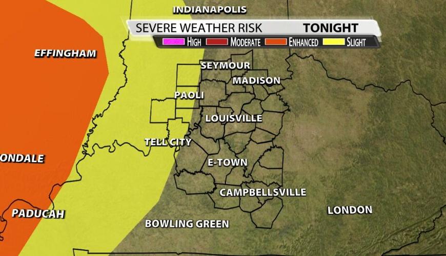
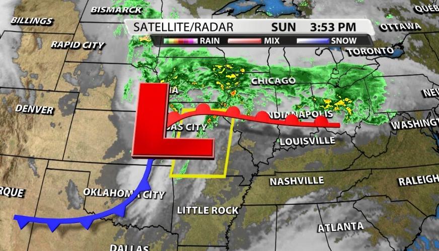
Now that the warm front has passed through our area, we are in the "warm sector" of this system. That's the best place for storms before the cold front moves through. We will see a line of storms overnight, so let's talk about when and how strong those could be when they arrive.
SETUP

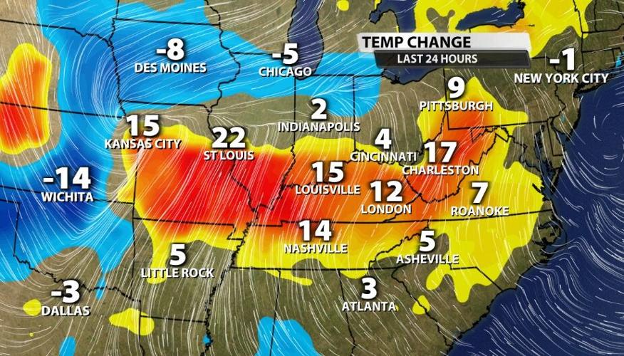
When discussing the potential to get strong or severe storms, we look for four main ingredients: Shear, Instability, Lift, and Moisture. Heat contributes to instability, and we definitely got that heat today. After the warm front crossed to our north, it opened us up to that strong southerly breeze bringing in much warmer air. The high temperature in Louisville hit 80!

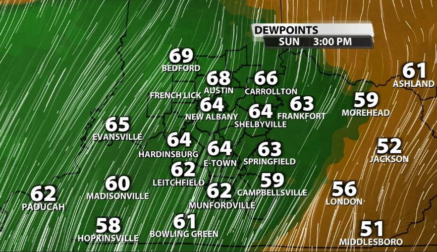
We have moisture. Dew points also climbed about as much as the temperature did since that south breeze is bringing us air that is also more humid.

Lift is mainly provided by the cold front as the forcing mechanism, but the timing of that front will lead to minimal lift. More on that in the TIMING section below

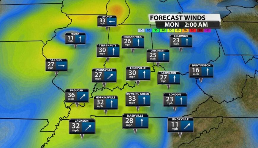
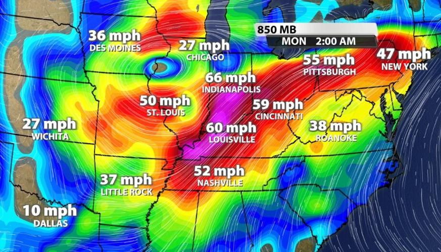
The last ingredient is shear which describes the wind moving in different directions and at different speeds through the different levels of the atmosphere. We have a strong low level jet with wind moving in from the southwest.

You probably noticed the wind started to pick up this afternoon, so it's also moving at a pretty good pace down here near the ground. The surface wind ahead of the front is moving in from the south, so we do have a bit of wind shear.

Considering all of these factors, strong wind gusts will be the main concern in the storms that come through tonight regardless of how strong they are when they arrive. That element does not depend on how much sunshine we saw during the day or how warm we are when the storms arrive. The tornado threat is very low and so is the threat of large hail since CAPE values are so low.
TIMING
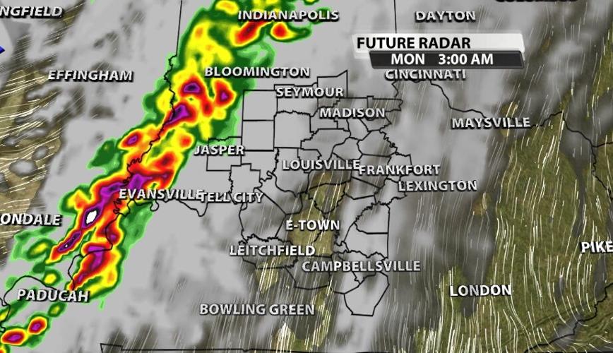
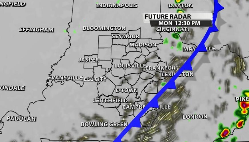
The general window for these storms to cross through our area is 2 AM - 9 AM. The leading edge should arrive in our western communities around 2-3 AM.

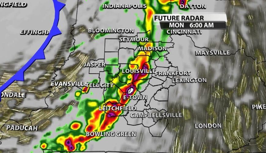
The storms will move from west toward east with the strongest storms arriving in our communities west of I-65. By the time they cross over the interstate, they should be weakening.

The line should be in the Louisville metro toward the early end of the morning commute - somewhere around 4-6 AM.

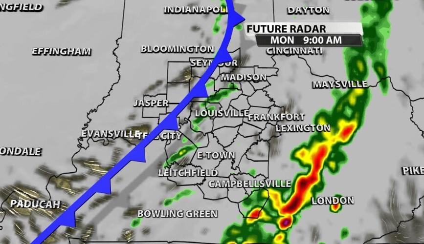
The storms continue to march through our communities, exiting toward the Bluegrass region around 8-9 AM.

Light showers and drizzle follow up behind the front and hang around into the afternoon. This won't be like our last cold front where the sky clears out within a few hours. Plan on seeing clouds and cold drizzle for most of the day.


