Have you heard your favorite WDRB meteorologist say "outflow boundary" (or just outflow or just boundary) when talking about storms? This post will help clear up what that is and what it is not.
Inside a thunderstorm air is moving up (updraft) and air is moving down (downdraft). When a strong downdraft develops in a thunderstorm it can lead to an outflow boundary. Imagine quickly dumping a bucket of water out onto pavement. The water falls down until it hits the pavement and is then forced to spread out because it has nowhere else to go. It can't go down any farther, and it can't go back up. The downdraft does the same thing. Wind flows down quickly until it hits the surface of the Earth and is then forced to spread out. It mainly spreads in the direction the wind is already flowing at the surface.

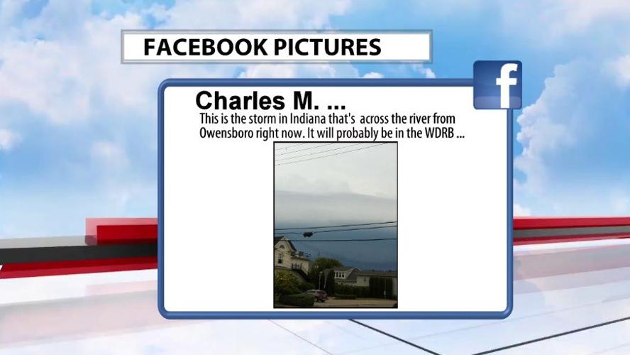
The air from the downdraft is colder than the air around it in the environment, which can lead to clouds developing on the leading edge of the outflow. That cloud on the leading edge of an outflow boundary is sometimes called a shelf cloud. It looks like a shelf spreading out from the parent thunderstorm that created it. A roll cloud is similar to a shelf cloud, but is separated from its parent thunderstorm. The shelf cloud is still connected to the storm, but the roll cloud is a separate cloud feature in the sky. Charles sent this picture in Sunday of the storms approaching our area from Owensboro.

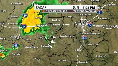
The outflow boundary can also create new storms. The difference between cooler and warmer air and convergence along the boundary can spark thunderstorms similar to how storms pop up along a cold front but on a much smaller scale.


