
It's been over a week now with snow & ice on the ground across the Louisville area with many neighborhood roads still covered with both. While some melting has already taken place, trying to melt over 14" of snow that fell within 6 days is going to take some time. So, when can we expect more of it to melt?
The answer is a little complicated, but there are a few days over the next week where we could speed up that process.
The next couple of days any melting will be tough to come by due to temperatures returning to below freezing. A few snow showers on Tuesday aren't expected to cause many issues around our area, but they will help keep temperatures in the 20s for the afternoon at their highest.


Wednesday morning is expected to be the coldest of the week with single digit air temperatures and possibly even a few sub-zero being possible. Due to the cold start, we once again only reach the 20s.

While we stay below freezing we should still see a lot of sun on Wednesday. Even at below freezing temperatures, the sun's energy can help the onset of some melting of snow & ice.
The real melting should start Thursday through Saturday. Temperatures climb back above freezing Thursday afternoon and even reach as far as the mid to upper 40s on Friday! Those two days should see more melting than what we have seen so far.

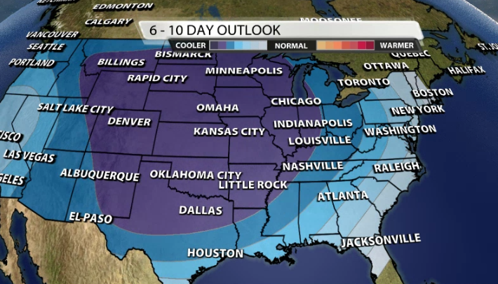
Showers are expected to start the weekend which can also help melt more snow! However, it's what happens after the rain Saturday that could be concerning. Temperatures fall pretty quickly to the point where a few more snow showers are possible for Sunday, but with more arctic air on the way for early next week, a bunch of what has melted and what has fallen as rain could refreeze on the roadways.


That re-freeze potential will need to be watched closely as temperatures fall right back down way below freezing this time next week!


