
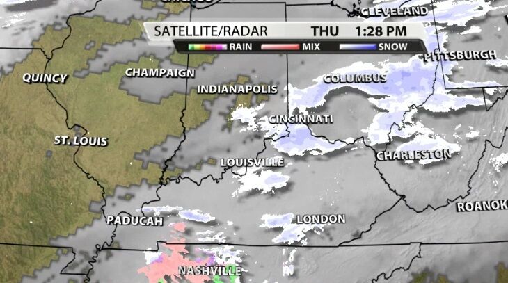
A wintry mix of freezing rain and snow is moving our direction from the southwest. This mix will move into our area this afternoon, and we will see snow spread across more of the area tonight.
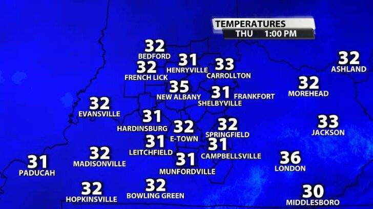
As those mixed showers arrive, temperatures in all of our communities hover near freezing. That makes the precipitation-type a challenging part of this forecast. Snowflakes are forming in clouds thousands of feet above our heads and falling down to earth. What happens to them before they reach you depends entirely on the temperature of the air through which they are falling and the temperature down here at the ground.
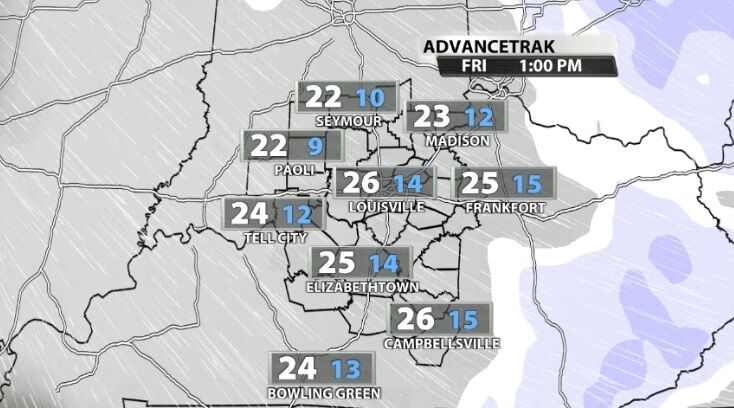
TIMING
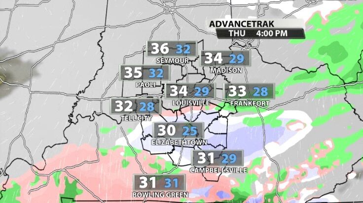
Wintry mix is moving into our southern communities now as a freezing rain/snow combo and will continue to spread through the areas around and south of the KY and BG parkways for the next few hours.
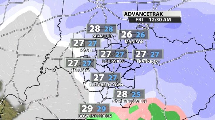
Tonight that moisture drifts farther north and meets up with a second batch of moisture positioned north of us that is drifting south. That northern batch will bring snow to southern Indiana.
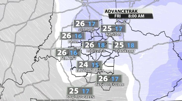
Those two pieces meet in the middle bringing scattered, light snow showers to our communities overnight and through Friday morning. Then all that snow pulls east away from our community by Friday afternoon.
Bitterly cold air rolls in behind this snow so whatever is still left on the road Friday night will likely freeze.
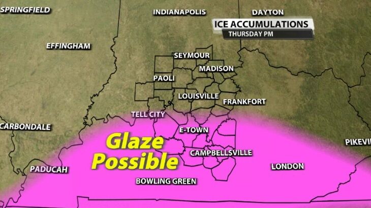
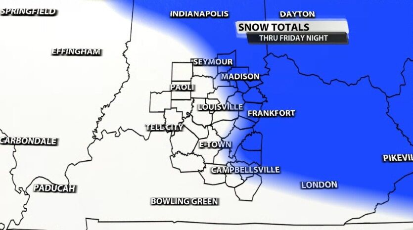
TOTALS
A glaze of ice will be possible in communities generally south of I-64. By "glaze" we mean a light coating less than 0.10". That ice would form this evening. Then we change over to snow, and the snow totals map below goes through Friday afternoon when those snow showers exit our area. A few flurries will be left over Saturday morning but shouldn't give us additional accumulation.
The higher snow totals will be east of our area, specifically east of I-75. In our western communities, accumulations should generally stay under one inch. But keep in mind this will be a heavier, wetter snow than what we saw earlier this week. In our eastern communities, you may see 1"-2" of snow stack up by Friday afternoon.
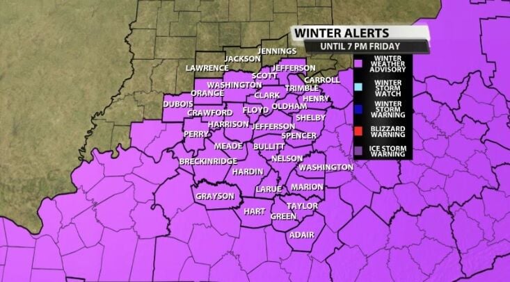
Remember there is a Winter Weather Advisory in place for our area until Friday evening for the expected impacts from this winter weather.
Tune into WDRB News tonight to get an updated look at our forecast. We are on from 4-7 PM and again 10-11:30, so we will be with you as these mixed showers arrive and while more of these showers change over to snow. You can watch us on TV, online at wdrb.com, or in the WDRB+ app for smart phones and smart TVs.


