
Let me start by giving a huge shout-out to the National Weather Service in Louisville for all of their hard work. They confirmed an EF-3 tornado with 145 mph winds in Jeffersontown around the Ampere Dr area. It began in Jeffersontown near Watterson Trail near Rivanna Dr with 85 mph winds as an EF-0 before riding just north of Watterson Trail south of Sky View Park, doing EF-1 damage with 100 mph winds. This is where the tornado began to strengthen.
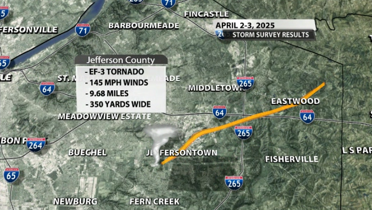
From here it intensified and did EF-3 level damage along the Ampere Dr area. EF-2 damage continued as it passed over Blankenbaker Rd with 130 mph winds, down Plantside Dr through Campus Pl. The tornado continued to wreak havoc on the ground and did EF-1 damage from there all the way across the 265/64 Interchange, crossing Shelbyville Rd, and eventually lifting south of Long Run Park near Pope Dale Road.
As mentioned, the peak winds of this EF-3 tornado reached 145mph. It ended up being on the ground for 9.68 miles and was approximately 350 yards wide. It was on the ground for 10 minutes.
Other Tornadoes From April 2nd
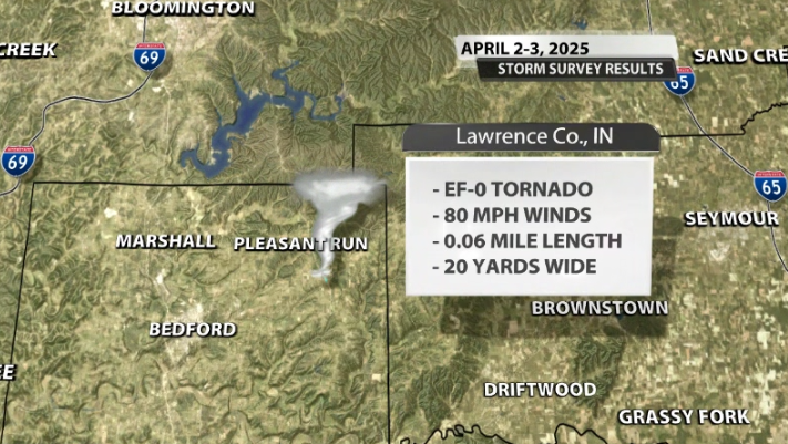
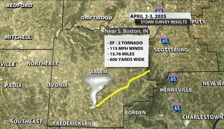
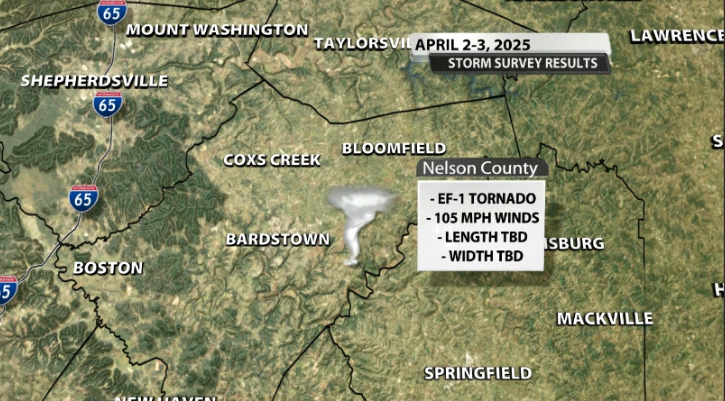
Here are the other paths of tornadoes confirmed by the NWS. Some have been completed, and some are still ongoing. A 4th tornado was confirmed in eastern Nelson county, Southeast of Bardstown as an EF-1 with 105 mph winds.


