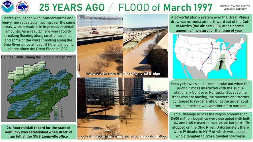

Overview
Copious amounts of rain fell on central Kentucky, southern Ohio, southern Indiana and into West Virginia as the calendar turned from February to March back in 1997. As thunderstorms and large areas of heavy rain repeatedly moved over the same areas, impressive rainfall totals were recorded, with rainfall records being broken in some areas.

Image Credit: NWS
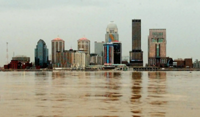
The deluge resulted in record flooding along smaller streams and some of the worst flooding along the Ohio River since at least 1964, and in some places since the Great Flood of 1937. Several tributaries of the Ohio River set all-time record river crests that still stand today.
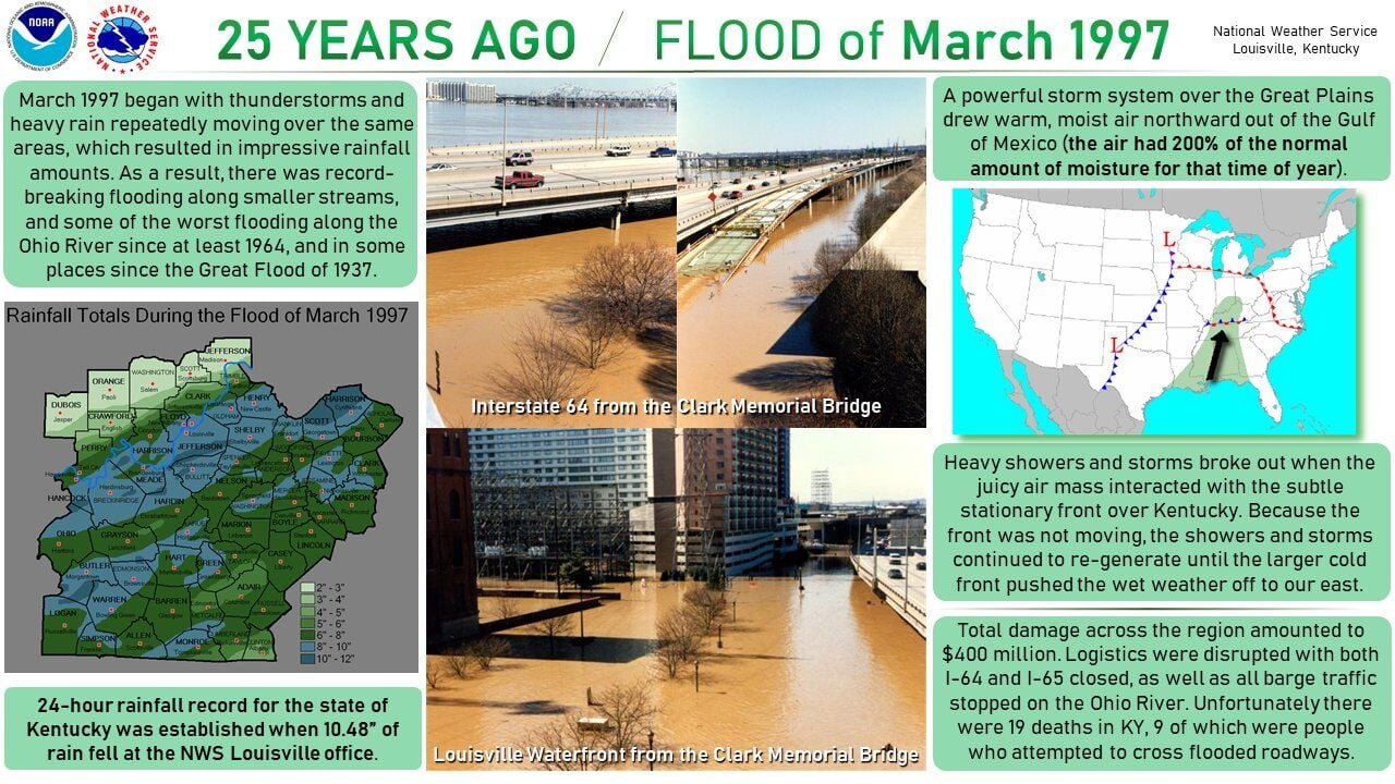
Image Credit: NWS
Quick Facts
- Approximately 83% of deaths from the 1997 Flood were from either driving or walking into flooded roadways/areas.
- Water reached the rooftops in the Kentucky communities of Boston (Nelson County), Falmouth (Pendleton) and Butler (Pendleton).
- River flow in Falmouth was so rapid, homes were swept from their foundations. Nearly 80% of the structures in this town of 2800 people were severely damaged/destroyed.
- In the Louisville metro area about $200 million in damage was attributed to the flooding, with 50,000 dwellings affected. Interstates 64 and 65 were closed.
- Near Cincinnati, the Ohio River rose over 20 feet in just over 24 hours, a rare rate of rise, resulting in hundreds of evacuations along the river from New Richmond, OH to Aurora, IN.
- 90 counties in Kentucky, 17 in Ohio, 16 in West Virginia and 14 in Indiana were declared federal disaster areas.
- Tens of thousands of people were evacuated from their homes, many housed in temporary shelters.
- Total damage across the region (KY, OH, IN, WV) was approximately $700 Million ($1.2 Billion in 2022 dollars)
- Virtually the entire town of Rumsey, KY was evacuated before it was inundated by the Green River.
- The Executive Inn, a major hotel and retail complex in Paducah, KY was closed for the first time in its 15-year history due to flooding on the Ohio River.
- The town of Smithland, KY about 20 miles east of Paducah, was saved by a massive sandbagging effort that lasted over two weeks.
- The Ohio River rose to the highest levels since March of 1964, with navigation on the river stopped completely from Cincinnati to Smithland due to the locks being flooded.

Image Credit: NWS
River Stages
Due to backwater from the Ohio River, the flooding was very prolonged. In the Licking River basin, flooding continued until the 7th, Kentucky River basin the 8th, Salt River basin until the 11th, and the Green River basin until the 18th. The middle of the Ohio River stayed above flood stage until the 16th. Thousands were evacuated along the Ohio River alone, with record flooding on some of the tributaries causing more devastation.

Image Credit: NWS
While many streams and rivers reached flood levels, these Ohio River sites reached "Top 10" crests, with some Ohio River cities having historic river records extending over 160 years.
Fatalities
24 total fatalities in Kentucky, Ohio, West Virginia and Indiana.


