
Last night was a perfect example of how tough forecasting the Northern Lights can be. WHile they were visible in parts of Michigan and Northern Indiana, we could not really see them over our area last night. Why?
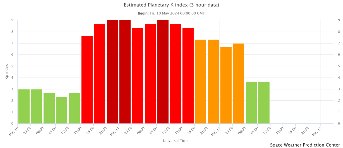
You can see that while NOAA was expecting a potential rise in activity from the next Coronal Mass Ejection from the sun to impact Earth, but levels remained fairly low overnight, at least to what concerns our area. You can also see that the Planetary K-Index, which we normally need around a 9 to see Aurora here, dropped overnight to around a 7 and even down to a 3 this morning as levels fell.

(valid 9am Sunday)
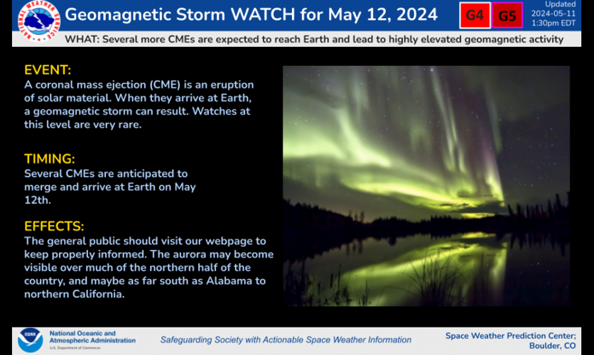
NOAA has issued another Geomagnetic Storm Watch for G4(severe) or greater for today into tonight.

Courtesy of NOAA
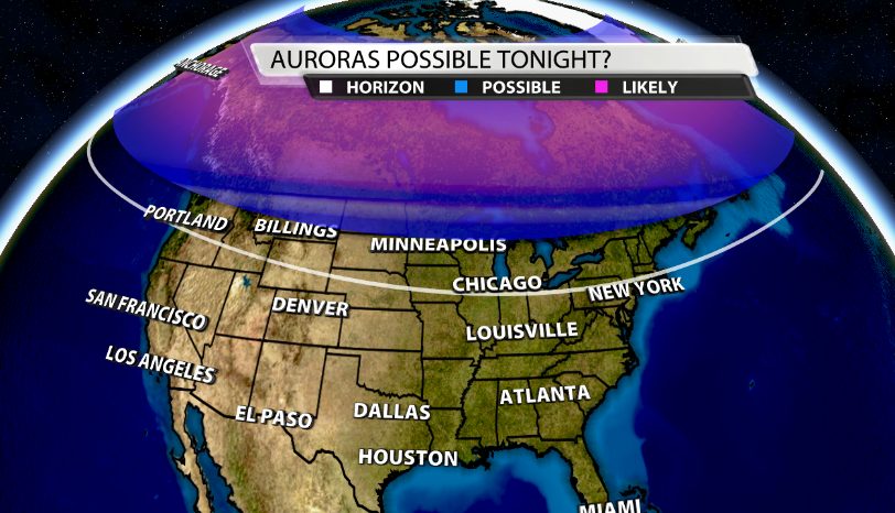
When we look at the possibility of seeing Aurora tonight, it's still much more likely to our North. NOAA's Aurora Forecast as of 9am this morning for tonight has the visibility line as far South as Northern Indiana.
While that's the forecast as of this morning, that can obviously change. These forecasts are updated constantly and with constant CEM's impacting Earth, it's incredibly tough to predict when those levels will rise, so be sure to check for updates here for the latest Aurora view line forecast from NOAA, and here for the newest timing of possible rises in levels.
As of this morning, the forecasted KP-Index from NOAA for tonight is below. Remember, Friday night we had a KP index of 9 and will probably need to reach that or at least an 8 to have a decent chance of seeing Aurora tonight.
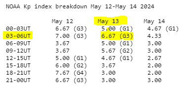
For now, the KP is forecasted to reach around a 6-7 overnight between 03-06 UTC (11pm - 2am). Again, this may have changed by the time you're reading this, so you can check that chart here. The highest KP within the next day is during 2pm-5pm today, but we won't be able to see it due to it still being daytime.
Rain Chances This Week
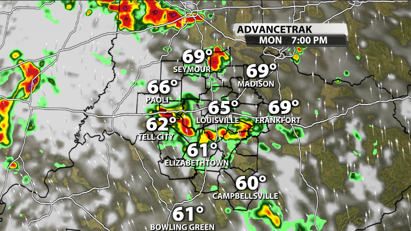
Rain chances begin to increase around our area tomorrow. Monday isn't an all day rain, but by the mid-late afternoon, scattered showers start to roll through our area heading into the evening and nighttime.
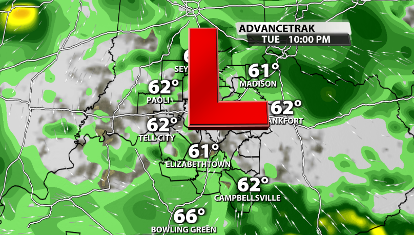
Tuesday still looks to be the best chance of rain this week. An upper-level Low pressure is expected to roll right overtop of our area, which means our rain chances will likely be pretty high with on & off rain through the day.
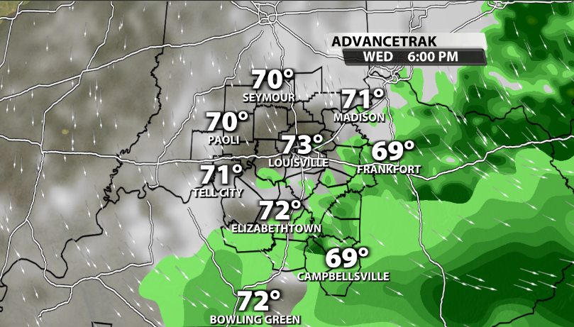
Data is also suggesting that showres could linger through at least the morning time on Wednesday as well.


