

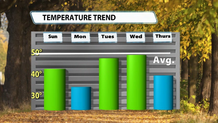
I know, I know, many of us are already sick of the cold air, even though it's early December. To be fair, we should still be around 50 for our high temperatures this time of the year, but needless to say we have been very far from that the last week or so with highs only in the 30s.
Here's the good news...we will see some improvements this work week. It won't be warm, but we should climb back into the mid-upper 40s with a few rain/mix chances this week. Warm? No. Improvement? Sorta? :)
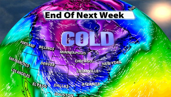
Now that you know some "warmer" air is coming, data is showing the complete opposite to end the week and heading into next weekend. This is still about a week away, so this could definitely change, but it's worth watching heading into next week!
You'll see a surge of cold air coming out of the arctic and out of Canada. Data is beginning to show that air surging into the Ohio Valley for a couple of days heading into this weekend and early next work week.
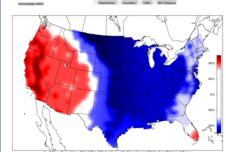
We can look at extended analog data, which is a historical instance of a given meteorological scenario or feature that is used for comparison with another scenario or feature. In a nutshell, this is a complicated way of saying history “can” repeat itself. Those analogs show a 90% chance of colder than normal temperatures being in our area within the next 6-8 days.

Image: CIPS Extended Analogs
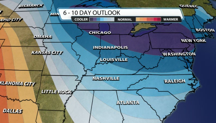
The Climate Prediction Center's 6-10 Day outlook is also starting to pick up on this, showing us having a good likelihood of below-normal temperatures remaining in our area.
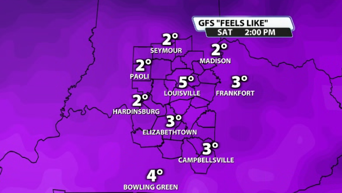
Temperatures in the teens in the afternoons are possible next weekend and wind chill values near 0 or in the single digits are also possible. Again, it's still far out so it can change, but we'll be watching this time next week for another surge of really cold air to return.


