

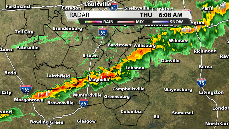
Radar scan of the line of storm in Central KY this morning
Storms rolled across Kentuckiana last night and early this morning. The severe weather stayed along and south of the Western Kentucky and Bluegrass Parkways just as we talked about yesterday.

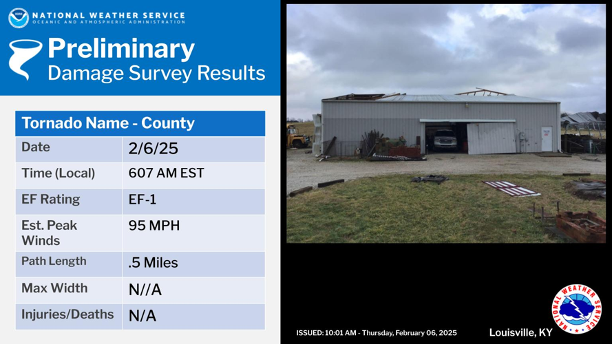
Preliminary info about the tornado in Hart Co. given by the NWS in Louisville
And as we mentioned, the tornado threat was low but not zero. The National Weather Service in Louisville has surveyed storm damage in Hart County and determined that an EF-1 tornado with 95 mph winds did touch down around 5 AM CST this morning.

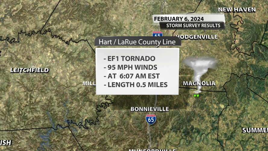
The track of the tornado

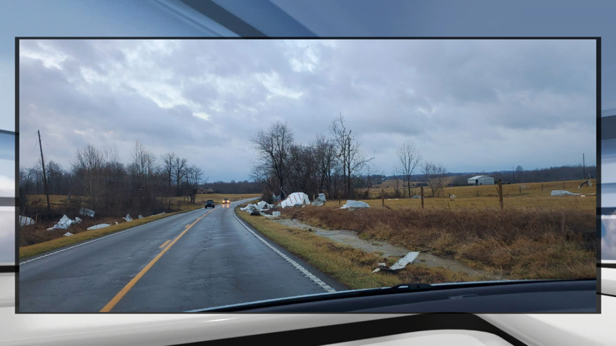
Tornado damage south of Magnolia, KY - Chris Milby
The damage from the tornado seems limited to a small area near US 31E in Northeastern Hart Co.
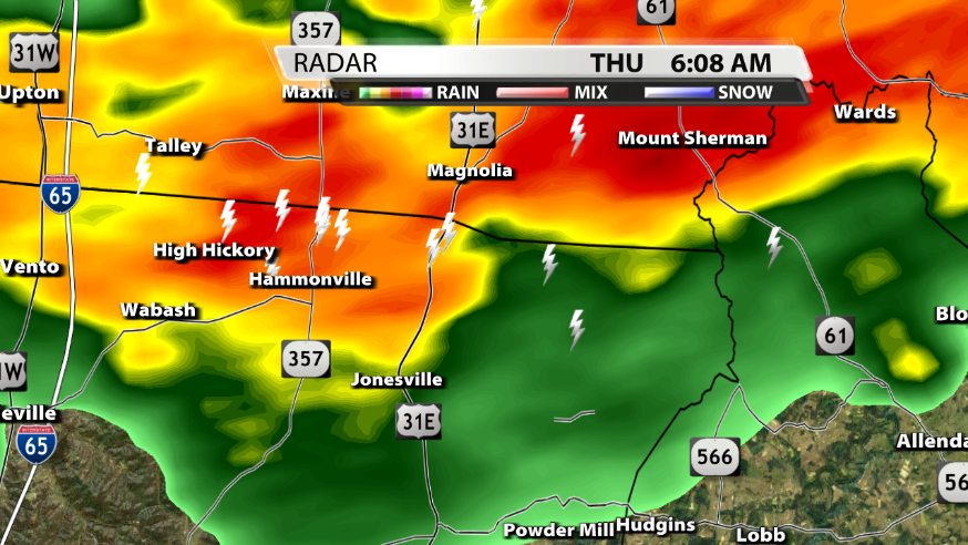
Reflectivity scan of the tornado
We usually look for a well-defined hook within a storm to determine where a tornado may be located, but this was not the case this morning. Tornadoes in lines of storms can often be embedded and have only a subtle inflow notch while likely being rain-wrapped. That makes it hard to see on radar and extremely difficult for storm spotters or EMA personnel to report on the ground.
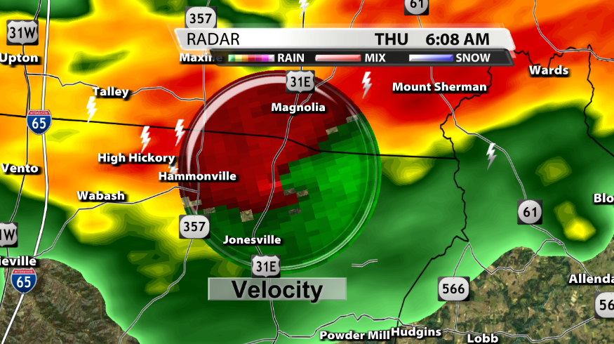
Base velocity scan of the tornado
The game-changer this morning was the very evident velocity couplet of red and green pixels touching each other along US 31E. A velocity product is used every time a tornado warning is issued, but this instance just highlights how important different radar products are during severe weather coverage.


