
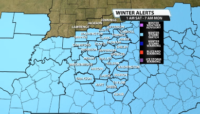
Over the last 12-18 hours, there have been significant shifts in the data for this weekends winter storm that is likely to impact our area in some way or another. Either way, there's a Winter Storm Watch for our area that goes from Saturday morning through Monday morning.
Weather Forecast | Live Cams | Radar | Share Photos & Videos
What's Changed?
I'm (Bryce) not going to hold up your time here. Let's get into it. If you remember in our previous blog from Monday about this weekends system, we talked about needing to watch the path of this storm system because that could dictate 1.) how much or how little snow people get and 2.) what kind of precipitation falls.
That path has shifted since yesterday. We're starting to get better data in now that we are creeping closer to this system being here. Data has now started to shift this system much farther north that what it was showing even on Tuesday.
So what does this mean for us?
With the 100+ mile shift to the north, that means that we are bringing in the sleet and perhaps a little bit of freezing rain further to the north as well. It will start as onset snow because we will be plenty cold from the ground to the cloud.
Then we start seeing the sleet creep in.
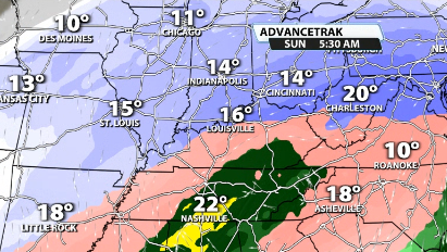
See how close that sleet is to our area now? That is highly important!!
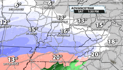
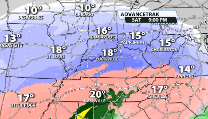
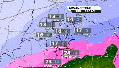
Data is starting to show that sleet being more of a likelihood for a lot of our Kentucky counties and it creeps very close to the Louisville area. Another reason that pinpointing where that sleet line ends up is because just north of it, will be where the heaviest snow totals end up as well.
Right now, a lot of data has that sleet line setting up just south of Louisville, putting the heaviest snow totals along the Ohio River.
Pump the brakes!
Just because data right now is showing the heaviest band of snow along the Ohio River does not mean it is going to stay that way. We just saw a 100-150+ mile shift to the north essentially overnight. Who's to say that sleet line can't move further north/south? Sleet infiltrating snow will cut down on snow totals majorly wherever that sleet ends up.
So what's next?
Simple. What's next is watching the trends in the data over the next 24-48 hours to figure out where exactly that sleet line, and how far north or south it goes. That could end up being the key in dictating who gets a lot of snow and who gets bummed out with a ton of sleet instead.
You can see when we look at this atmospheric sounding from the data for Louisville on Saturday evening, the wind direction about a mile above the ground is southerly, and at a good speed. That is often indicative of warm air aloft infiltrating our atmosphere.
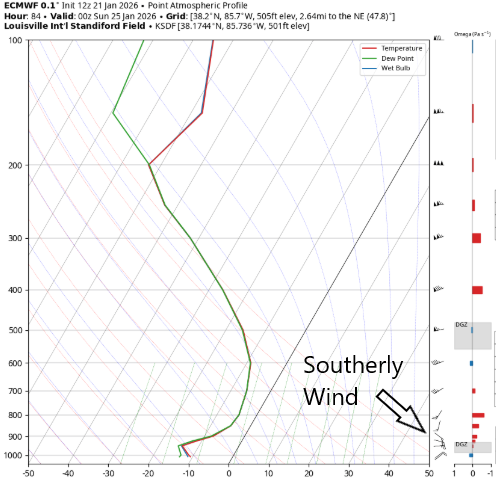
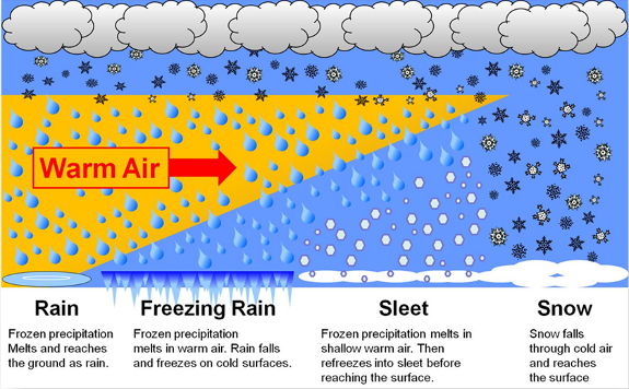
If we warm above freezing at that level, we will end up with sleet. That happens where the snowflake briefly melts and then refreezes on the way to the ground. This is a potential for Louisville. If warm air or a "warm nose" gets into the atmosphere and it turns to sleet, that can eat up snow totals a lot.
That is where this boom vs. bust scenario comes into play. Just north of that sleet line will likely have very high snow totals, but the question is where does it end up? That's what we will be watching the next couple of days before we come out with snow totals.
More coverage:
'Millions of Americans prepare for potentially catastrophic ice storm. Here’s what the numbers show
JCPS cancels all weekend events as forecast promises significant winter storm
INDOT preparing for weekend winter storm as timing, temperatures become key factors
Kentuckiana shoppers stock up on salt, supplies ahead of winter storm


