

Showers & storms will be very likely as we end out the weekend, and there's a solid chance that severe weather accompanies these storms. But don't fret just yet if you have Father's Day plans. There will be quite a bit of dry time on Sunday. Let's break down the details on the incoming severe weather potential.

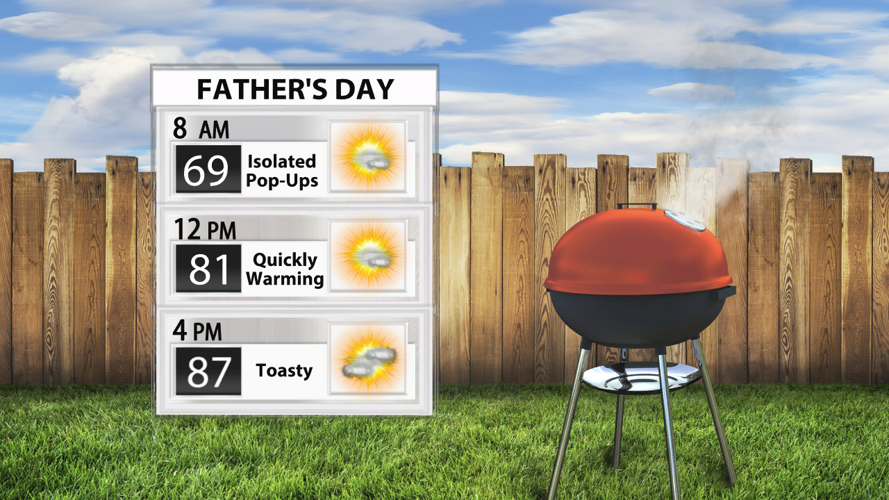
Sunday could start off with a few pop-up showers, but it will be dry for much of the area for most of the day through the morning and afternoon. Temperatures will be at or just above average despite some decent cloud cover during the peak heating hours.

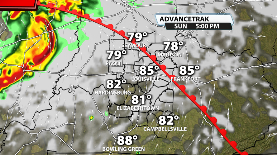
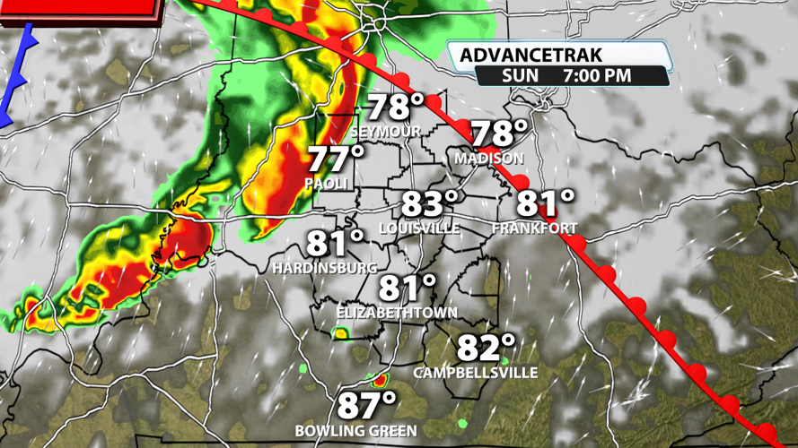
A warm front will move across the area from southwest to northeast throughout the day. A mesoscale convection vortex could form out in the Plains during the morning hours and zoom over our direction throughout the day. You can see the bowing segment in the above graphic, which indicates potential for very strong winds. Add in some faster moving winds aloft, and you have the chance for some tornadoes as well.

If the storm complex from the Plains holds together, it could be in our area during or just after the dinnertime hours. Damaging wind gusts and a tornado or two are the main threats. Some hail is also possible.

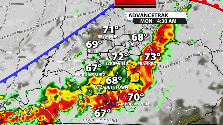
Storms could be present throughout the evening and overnight hours with the original severe threat diminishing before dawn on Monday. Storms could reinitiate on Monday along the boundary, so a low end severe weather threat exists during the day Monday as well.

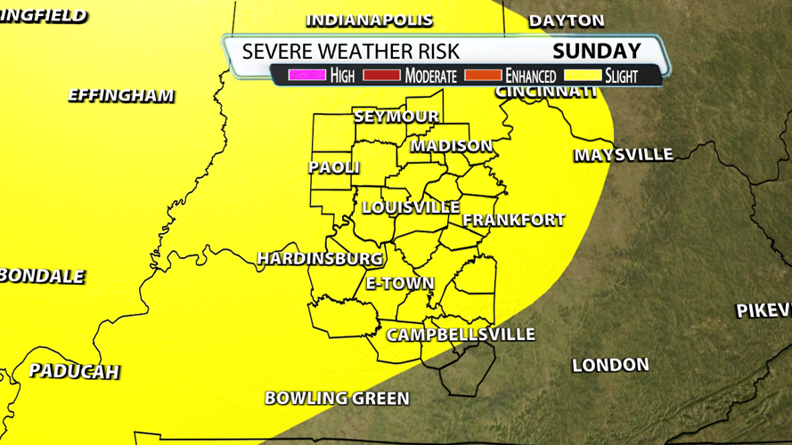
The storm Prediction Center has extended the Slight Risk (level 2 of 5) across all of Kentuckiana except for our communities in far south central KY. As mentioned before, damaging wind gusts and a couple of tornadoes are possible. Tornadoes could be on the stronger side with EF-2+ tornadoes possible. Some hail will be present, but it isn't a primary concern with this setup.

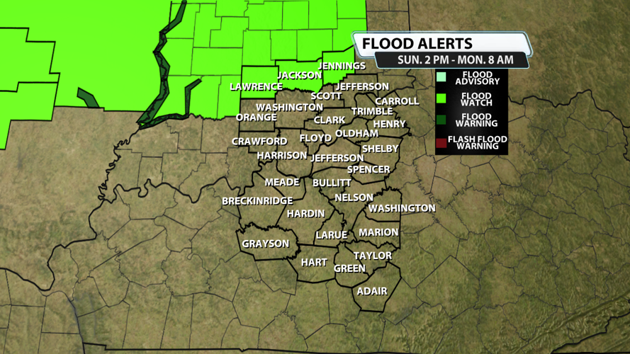
The is also a chance that heavy rain will fall on already saturated ground and lead to move flooding issues. While only our northernmost counties (Lawrence, Jackson, and Jennings) are included in the Flood Watch for Sunday to Monday right now, don't be surprised if the watch is extended to the south as more data comes in over the next 12 hours.
Be safe and celebrate your dads and father figures as best you can! The earlier you can get out there to celebrate, the more likely it is that you won't have to worry about severe weather causing problems for you Father's Day plans!


