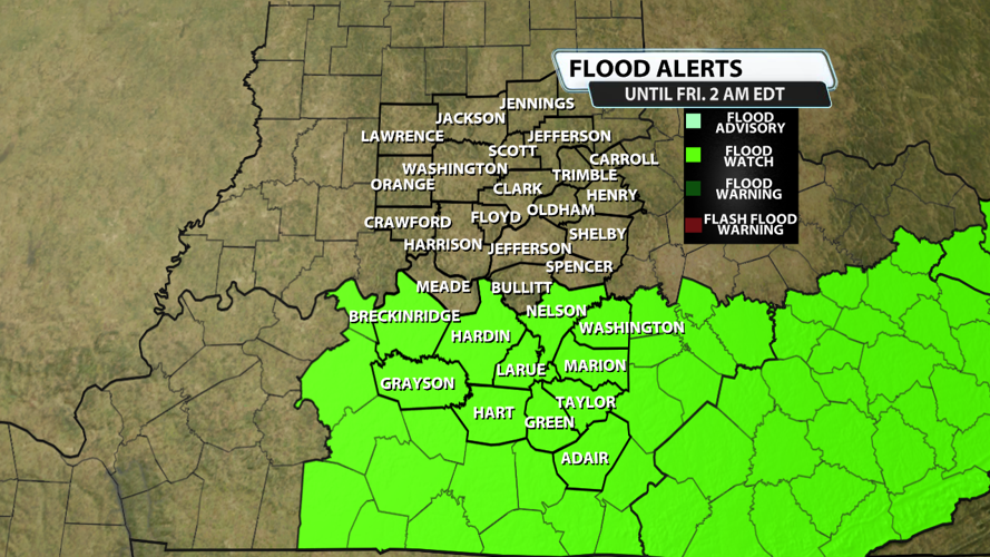


...FLOOD WATCH REMAINS IN EFFECT THROUGH LATE TONIGHT...
* WHAT...Flash flooding caused by excessive rainfall continues to be
possible.
* WHERE...Portions of east central, north central, northwest, and
south central Kentucky, including the following areas, in east
central Kentucky, Boyle, Garrard, Jessamine, Madison and Mercer.
In north central Kentucky, Breckinridge, Hardin, Larue, Nelson and
Washington KY. In northwest Kentucky, Hancock and Ohio. In south
central Kentucky, Adair, Allen, Barren, Butler, Casey, Clinton,
Cumberland, Edmonson, Grayson, Green, Hart, Lincoln, Logan,
Marion, Metcalfe, Monroe, Russell, Simpson, Taylor and Warren.
* WHEN...Through late tonight.
* IMPACTS...Excessive runoff may result in flooding of rivers,
creeks, streams, and other low-lying and flood-prone locations.
Creeks and streams may rise out of their banks.

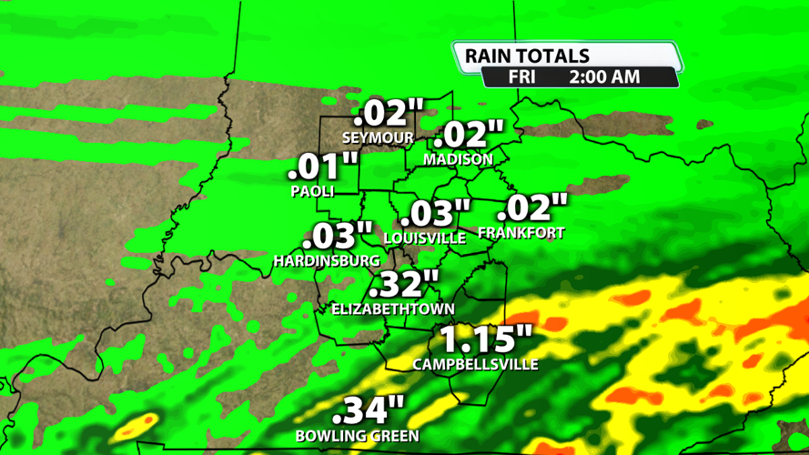
Additional rainfall amounts of .5" to 1.5" are very likely along and south of the Kentucky Parkways this afternoon and evening. Higher totals won't be ruled out.


