The National Weather Service has issued a Flood Watch for nearly our entire area until 11 PM Monday.
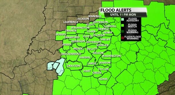
Below is the text issued by the National Weather Service office in Louisville with this Watch:
* WHAT...FLASH FLOODING CAUSED BY EXCESSIVE RAINFALL IS POSSIBLE.

* WHERE...PORTIONS OF SOUTHERN INDIANA AND CENTRAL KENTUCKY.

* WHEN...FROM 8 AM EDT /7 AM CDT/ THIS MORNING THROUGH MONDAY
  EVENING.

* IMPACTS...EXCESSIVE RUNOFF MAY RESULT IN FLOODING OF RIVERS,
  CREEKS, STREAMS, AND OTHER LOW-LYING AND FLOOD-PRONE LOCATIONS.
  CREEKS AND STREAMS MAY RISE OUT OF THEIR BANKS.

* ADDITIONAL DETAILS...
  - SHOWERS AND THUNDERSTORMS COULD PRODUCE LOCALIZED RAINFALL
    AMOUNTS EXCEEDING 2 INCHES IN AN HOUR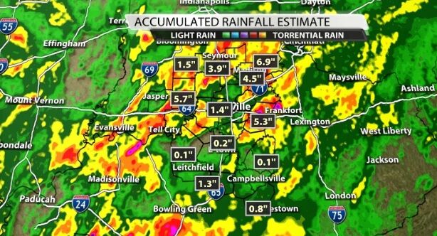
Many of our communities saw more than an inch of rain Saturday as storms dumped rain over the same areas for longer periods of time. The map above shows the radar estimated rain totals from Saturday with the brightest colors showing the highest totals.
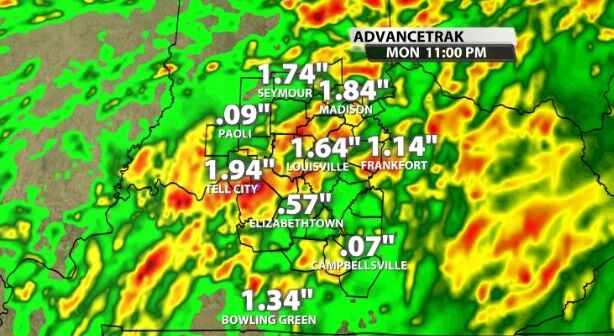
This second map shows estimated rainfall in the next 36(ish) hours. Through Sunday afternoon and Monday more heavy rain will fall from scattered storms. While some of you won't get much rain at all in that window, those of you who get the heavy rain could pick up another easy 1"-2".


