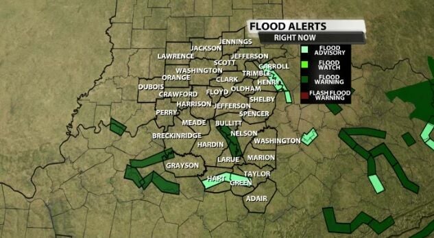
After the heavy rain that fell across our area Thursday, there are a few flood alerts to be aware of in our communities. The dark green in the map below represents active Flood Warnings, the lighter green are Flood Advisories which are broken down in more detail here.
FLOOD WARNINGS
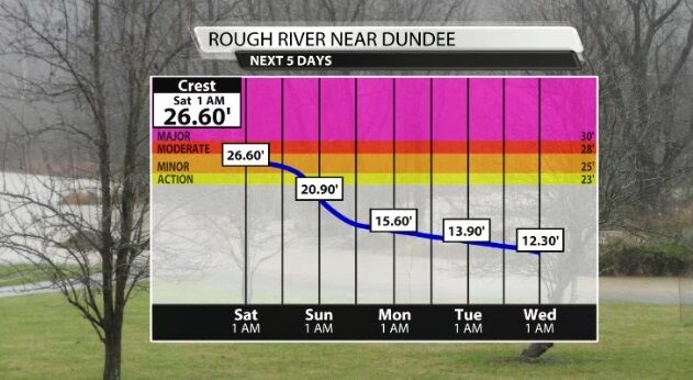
The Rough River near Dundee is under a Flood Warning through tonight. It peaks today in Minor flood stage before starting to drop, and falls below Action stage Saturday.
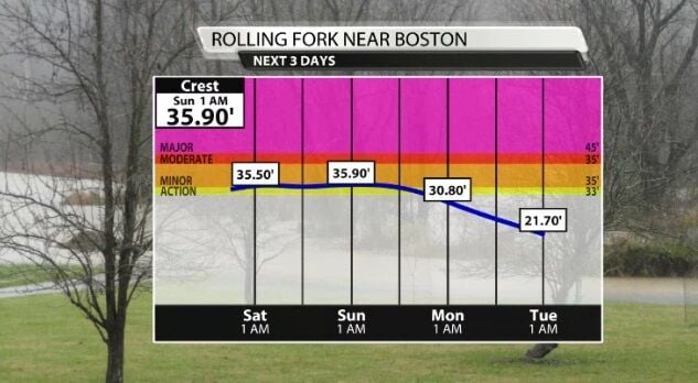
The Rolling Fork near Boston will stay in Minor flood stage through Sunday, so this Flood Warning lasts through Sunday evening. This stretch of river will fall below Action stage Monday.
Remember a Flood Warning means your part of the river is currently flooded.
FLOOD ADVISORIES
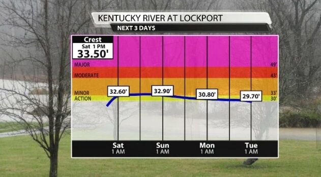
The Kentucky River at Lockport is under a Flood Advisory through Sunday morning. This stretch of river gets closer to Minor flood stage, but at this point is not forecast to actually break that threshold at 33 feet. It is expect to stay in Action stage until it slowly starts dropping early next week.
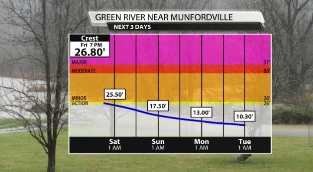
The Green River at Munfordville is currently in Action stage but will quickly fall out of it by Saturday.
LOUISVILLE
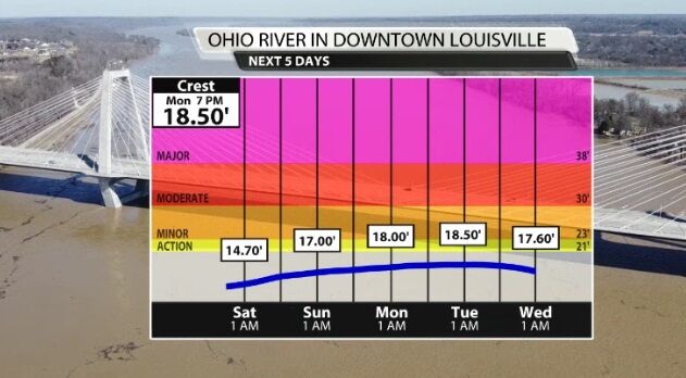
The Ohio River gauge in downtown Louisville does show the river rising slightly in the next few days as all the tributaries feed into it after the heavy rain. However, it is not even expected to reach action stage, so a Flood Advisory or Warning for this stretch of the river is not expected.


