

After the heavy rain that fell across our area Thursday, there are a few flood alerts to be aware of in our communities.

I was on a walk recently when I came across this sign with some information I hadn't heard before

The National Weather Service office in Louisville has used drones on some of their wind and tornado damage surveys before, but they recently expanded that use to include hydrology surveys.

The rain has left our area, but area rivers will continue to rise this week.

Renewable energy like hydro, solar, geothermal and wind power generation facilities

Do you remember in February when the Ohio River flooded in Kentuckiana? We weren't the only ones experiencing river flooding. Many stretches of the Mississippi River also flooded during this time, but some spots are just now coming out of flood stage

Our recent river flooding was captured by satellites orbiting the earth. That means our river flooding was seen from space!
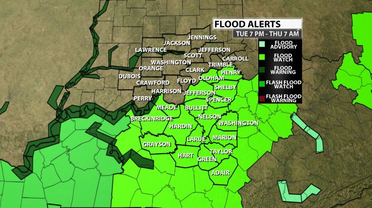
The National Weather Service in Louisville has issued a Flood Watch Tuesday evening through Thursday morning when several inches of rain will be possible.

Even though the rain has stopped falling, river levels will continue to rise. Be on your guard through Thursday and Friday as rivers remain high.