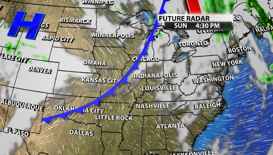
A few showers and patches of drizzle are still holding up in our area Saturday evening, but those should clear out and dry up overnight. The clouds may not be so easy to get rid of. In the big picture below, you can see those clouds lingering into the afternoon on Sunday.

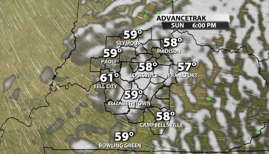
As we zoom in on AdvanceTrak, the clouds still show up here, too, into prime trick-or-treating hours. Some of you may say that as long as the rain leaves, you don't care so much about the clouds. But the clouds have a big impact on the temperature through the morning and early afternoon.

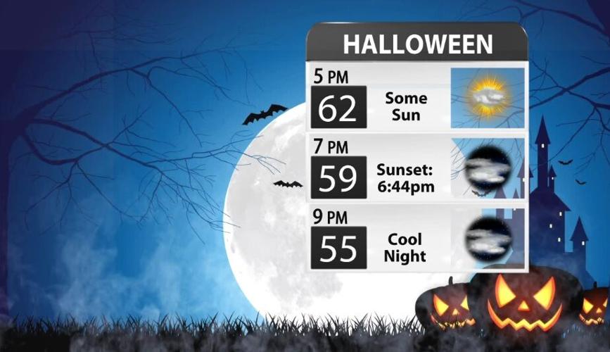
We should start the day "mostly cloudy" meaning more clouds than clear sky. Through the afternoon we will transition to "partly cloudy" which is closer to a half and half mix of sun and clouds. That's about the best we will be able to do, though, which means temperatures will be in the 50s for most of the day.

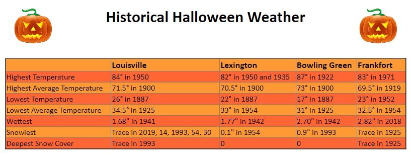
The good news in this forecast (aside from the rain clearing out in time) is that it won't be the hottest or the coldest Halloween in our area. In fact temperatures will be pretty normal for this time of year. Average high temperatures are in the middle 60s right now, and we should see the lower to middle 60s across our area Sunday afternoon. The image below is from the Louisville National Weather Service office showing some of the most extreme weather our area has ever seen on Halloween. Can we all remember just a few years ago when it snowed Halloween night?


